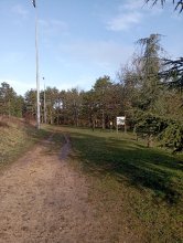
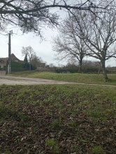
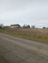
Ground level

slug
groundlevel

Measurement_fff186df-d061-4239-a430-601667636155

Measured radiation

0.332 µSv/h
geolocalisation :

49.239081666667, -0.035433333333333

Ground level
Fanche
ATYPICAL MEASURE
Measurement date :
Latitude :
49.239081666667
Longitude :
-0.035433333333333
Altitude (M) :
15.0
Measurement time :
1 minutes
Distance travelled :
1867.48m
Measurement speed :
Measurement Environment :
Sur la route ontheroad
Weather :
rainy day Pluie
Tags :
Description :
Temperature :
Hits number :
111
Mesure UUID :
fff186df-d061-4239-a430-601667636155
Manual Reporting :
No
Sensor / ID :
safecast_id 1225
Sensor / Firmware version :
$BNRDD
Sensor / Type :
Sensor / Tube type :
Smartphone / UUID :
Smartphone / Platform :
Smartphone / Model :
Smartphone / OS Version :
Position acurracy :
8.0
Measurement height above the ground (in meters) :
1.00
Altitude accuracy :
8.0
Mean qualification :
Ground level
Software version :
openradiation.net/upload v0.9
Measured value :
0.332 µSv/h

Measurement_0c4b6874-d85e-42ec-a03a-2a5ab5f44b44

Measured radiation

0.162 µSv/h
geolocalisation :

43.5814415, 3.9233809

Ground level
Measurement date :
Latitude :
43.5814415
Longitude :
3.9233809
Altitude (M) :
79.0
Measurement time :
2 minutes 6 secondes
Distance travelled :
0.00m
Measurement speed :
Measurement Environment :
En ville city
Weather :
rainy day Pluie
Tags :
Description :
Temperature :
19.0°C
Hits number :
50
Mesure UUID :
0c4b6874-d85e-42ec-a03a-2a5ab5f44b44
Manual Reporting :
No
Sensor / ID :
5213de31
Sensor / Firmware version :
RiumGM BLE -b
Sensor / Type :
Sensor / Tube type :
J305γβ
Smartphone / UUID :
cf6ec3d3e81aee71
Smartphone / Platform :
android
Smartphone / Model :
Core-X4
Smartphone / OS Version :
10
Position acurracy :
7.5
Measurement height above the ground (in meters) :
1.00
Altitude accuracy :
7.5
Mean qualification :
Ground level
Software version :
OpenRadiation app 3.0
Measured value :
0.162 µSv/h

Measurement_635190bd-313f-4c0e-9842-9fea935f2244

Measured radiation

0.075 µSv/h
geolocalisation :

49.858121905902, 0.6927462962665

Ground level
Hobert
Measurement date :
Latitude :
49.858121905902
Longitude :
0.6927462962665
Altitude (M) :
70.0
Measurement time :
3 minutes 53 secondes
Distance travelled :
2170.02m
Measurement speed :
Measurement Environment :
Sur la route ontheroad
Weather :
Tags :
Description :
Temperature :
22.0°C
Hits number :
51
Mesure UUID :
635190bd-313f-4c0e-9842-9fea935f2244
Manual Reporting :
No
Sensor / ID :
57063ce3
Sensor / Firmware version :
RiumGM BLE -b
Sensor / Type :
Sensor / Tube type :
J305γβ
Smartphone / UUID :
099DFCB7-1478-4415-9D8B-B22AC1148A94
Smartphone / Platform :
iOS
Smartphone / Model :
iPhone9,3
Smartphone / OS Version :
15.8.2
Position acurracy :
12.0
Measurement height above the ground (in meters) :
1.00
Altitude accuracy :
12.0
Mean qualification :
Ground level
Software version :
OpenRadiation app 2.3.4
Measured value :
0.075 µSv/h

Measurement_b78562e7-ead3-4d19-b74d-f9383f961211

Measured radiation

0.094 µSv/h
geolocalisation :

49.86305018054, 0.70781943043036

Ground level
Hobert
Measurement date :
Latitude :
49.86305018054
Longitude :
0.70781943043036
Altitude (M) :
21.0
Measurement time :
3 minutes 18 secondes
Distance travelled :
3685.00m
Measurement speed :
Measurement Environment :
Sur la route ontheroad
Weather :
rainy day Pluie
Tags :
Description :
Temperature :
28.0°C
Hits number :
51
Mesure UUID :
b78562e7-ead3-4d19-b74d-f9383f961211
Manual Reporting :
No
Sensor / ID :
57063ce3
Sensor / Firmware version :
RiumGM BLE -b
Sensor / Type :
Sensor / Tube type :
J305γβ
Smartphone / UUID :
099DFCB7-1478-4415-9D8B-B22AC1148A94
Smartphone / Platform :
iOS
Smartphone / Model :
iPhone9,3
Smartphone / OS Version :
15.8.2
Position acurracy :
16.0
Measurement height above the ground (in meters) :
1.00
Altitude accuracy :
16.0
Mean qualification :
Ground level
Software version :
OpenRadiation app 2.3.4
Measured value :
0.094 µSv/h

Measurement_5cbb3adf-c65f-4cdc-9840-fa13687e8fbc

Measured radiation

2.712 µSv/h
geolocalisation :

48.6238957, -34.8958483

Ground level
Fanche
ATYPICAL MEASURE
Measurement date :
Latitude :
48.6238957
Longitude :
-34.8958483
Altitude (M) :
10857.0
Measurement time :
58 minutes 28 secondes
Distance travelled :
Measurement speed :
Measurement Environment :
Weather :
Tags :
Description :
Temperature :
Hits number :
23879
Mesure UUID :
5cbb3adf-c65f-4cdc-9840-fa13687e8fbc
Manual Reporting :
No
Sensor / ID :
000115
Sensor / Firmware version :
OG-KIT1
Sensor / Type :
Sensor / Tube type :
SBM-20
Smartphone / UUID :
00D109DE-DB4A-4F5D-BD30-99D5A8896796
Smartphone / Platform :
iOS
Smartphone / Model :
iPhone8,4
Smartphone / OS Version :
11.3.1
Position acurracy :
50.0
Measurement height above the ground (in meters) :
Altitude accuracy :
50.0
Mean qualification :
Ground level
Software version :
OpenRadiation app 1.0.0
Measured value :
2.712 µSv/h

Measurement_33ffb424-4ec6-49aa-a989-fc3e01ac6ba0

Measured radiation

0.068 µSv/h
geolocalisation :

46.802974157588, 7.1822809207018

Ground level
Measurement date :
Latitude :
46.802974157588
Longitude :
7.1822809207018
Altitude (M) :
562.0
Measurement time :
5 minutes 27 secondes
Distance travelled :
10.22m
Measurement speed :
Measurement Environment :
À l'intérieur inside
Weather :
Tags :
Description :
Temperature :
22.0°C
Hits number :
67
Mesure UUID :
33ffb424-4ec6-49aa-a989-fc3e01ac6ba0
Manual Reporting :
No
Sensor / ID :
9293c581
Sensor / Firmware version :
RiumGM BLE -b
Sensor / Type :
Sensor / Tube type :
J305γβ
Smartphone / UUID :
6250B254-4273-4B7C-BEC5-B9A8B5D79931
Smartphone / Platform :
ios
Smartphone / Model :
iPhone13,1
Smartphone / OS Version :
18.0.1
Position acurracy :
26.0
Measurement height above the ground (in meters) :
1.00
Altitude accuracy :
26.0
Mean qualification :
Ground level
Software version :
OpenRadiation app 3.0
Measured value :
0.068 µSv/h

Measurement_454115a2-3847-4c1c-8a76-7151cfbb923d

Measured radiation

0.091 µSv/h
geolocalisation :

50.8155736, 20.4679424

Ground level
anwoj
Measurement date :
Latitude :
50.8155736
Longitude :
20.4679424
Altitude (M) :
360.0
Measurement time :
3 minutes 32 secondes
Distance travelled :
118.71m
Measurement speed :
Measurement Environment :
Weather :
Tags :
Description :
zelejowa
Temperature :
13.0°C
Hits number :
53
Mesure UUID :
454115a2-3847-4c1c-8a76-7151cfbb923d
Manual Reporting :
No
Sensor / ID :
Sensor / Firmware version :
RiumGM BLE -b
Sensor / Type :
Sensor / Tube type :
J305γβ
Smartphone / UUID :
0b9843b29fcf8d15
Smartphone / Platform :
android
Smartphone / Model :
XQ-CT54
Smartphone / OS Version :
14
Position acurracy :
6.4
Measurement height above the ground (in meters) :
Altitude accuracy :
6.4
Mean qualification :
Ground level
Software version :
OpenRadiation app 3.0
Measured value :
0.091 µSv/h

Measurement_7213ceb0-4fd6-43fe-a3e9-669047c87755

Measured radiation

0.077 µSv/h
geolocalisation :

47.4425947, -0.5297517

Ground level
Measurement date :
Latitude :
47.4425947
Longitude :
-0.5297517
Altitude (M) :
75.0
Measurement time :
5 minutes 46 secondes
Distance travelled :
20.24m
Measurement speed :
Measurement Environment :
À l'intérieur inside
Weather :
Tags :
Description :
Temperature :
19.0°C
Hits number :
92
Mesure UUID :
7213ceb0-4fd6-43fe-a3e9-669047c87755
Manual Reporting :
No
Sensor / ID :
00080
Sensor / Firmware version :
OpengKIT72
Sensor / Type :
Sensor / Tube type :
Smartphone / UUID :
7cbca3d651dd0c6a
Smartphone / Platform :
android
Smartphone / Model :
SM-M225FV
Smartphone / OS Version :
13
Position acurracy :
11.5
Measurement height above the ground (in meters) :
0.00
Altitude accuracy :
11.5
Mean qualification :
Ground level
Software version :
OpenRadiation app 3.0
Measured value :
0.077 µSv/h

Measurement_d7466b25-4117-46b4-aa94-58753149caa8

Measured radiation

0.185 µSv/h
geolocalisation :

42.6619512, 9.4303965

Ground level
giocante_1
Measurement date :
Latitude :
42.6619512
Longitude :
9.4303965
Altitude (M) :
150.0
Measurement time :
5 minutes 1 secondes
Distance travelled :
109.81m
Measurement speed :
Measurement Environment :
À l'intérieur inside
Weather :
Tags :
Description :
Temperature :
22.0°C
Hits number :
133
Mesure UUID :
d7466b25-4117-46b4-aa94-58753149caa8
Manual Reporting :
No
Sensor / ID :
e4e9c4df
Sensor / Firmware version :
RiumGM BLE -b
Sensor / Type :
Sensor / Tube type :
J305γβ
Smartphone / UUID :
25eac9e9f708ad66
Smartphone / Platform :
android
Smartphone / Model :
SM-S901B
Smartphone / OS Version :
14
Position acurracy :
40.4
Measurement height above the ground (in meters) :
1.00
Altitude accuracy :
40.4
Mean qualification :
Ground level
Software version :
OpenRadiation app 3.0
Measured value :
0.185 µSv/h

Measurement_0726ec19-9483-4726-aa8c-0c33c2987f96

Measured radiation

0.158 µSv/h
geolocalisation :

20.9282518, 83.4114765

Ground level
PKM046
Measurement date :
Latitude :
20.9282518
Longitude :
83.4114765
Altitude (M) :
116.0
Measurement time :
2 minutes 12 secondes
Distance travelled :
2212.69m
Measurement speed :
Measurement Environment :
Sur la route ontheroad
Weather :
Tags :
Description :
Village Agalpur (767022) to Balangir (767001) on road travel. Odisha, India.
Temperature :
28.0°C
Hits number :
51
Mesure UUID :
0726ec19-9483-4726-aa8c-0c33c2987f96
Manual Reporting :
No
Sensor / ID :
4200c47a
Sensor / Firmware version :
RiumGM BLE -b
Sensor / Type :
Sensor / Tube type :
J305γβ
Smartphone / UUID :
75f53b99c49005ab
Smartphone / Platform :
Android
Smartphone / Model :
SM-A515F
Smartphone / OS Version :
13
Position acurracy :
3.6
Measurement height above the ground (in meters) :
1.00
Altitude accuracy :
3.6
Mean qualification :
Ground level
Software version :
OpenRadiation app 2.3.4
Measured value :
0.158 µSv/h