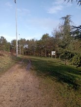
Ground level

slug
groundlevel

Measurement_816628f5-df62-4568-81c5-a149824fff81

Measured radiation

0.327 µSv/h
geolocalisation :

44.565108453282, 6.0951265340371

Ground level
Yann29
ATYPICAL MEASURE
Date de la mesure :
Latitude :
44.565108453282
Longitude :
6.0951265340371
Altitude (M) :
743.0
Measurement time :
3 minutes 19 secondes
Distance travelled :
0.00m
Measurement speed :
Measurement Environment :
À l'intérieur inside
Weather :
Tags :
Description :
s le de Trebezy
Temperature :
21.0°C
Hits number :
160
Mesure UUID :
816628f5-df62-4568-81c5-a149824fff81
Manual Reporting :
No
Sensor / ID :
Sensor / Firmware version :
OpengKIT72
Sensor / Type :
Sensor / Tube type :
Smartphone / UUID :
BD2C896C-CF53-4C23-B10A-A484AFB22EE2
Smartphone / Platform :
ios
Smartphone / Model :
iPhone14,4
Smartphone / OS Version :
18.6.2
Position acurracy :
20.6
Measurement height above the ground (in meters) :
1.00
Altitude accuracy :
20.6
Mean qualification :
Ground level
Software version :
OpenRadiation app 3.1.1
Measured value :
0.327 µSv/h

Measurement_ff411c17-01ab-4e1c-a5fc-0c1756627734

Measured radiation

0.144 µSv/h
geolocalisation :

48.864713333333, 15.120225

Ground level
Fanche
Date de la mesure :
Latitude :
48.864713333333
Longitude :
15.120225
Altitude (M) :
552.0
Measurement time :
2 heures 34 minutes 4 secondes
Distance travelled :
6061.02m
Measurement speed :
Measurement Environment :
En campagne countryside
Weather :
Tags :
Description :
Temperature :
Hits number :
48
Mesure UUID :
ff411c17-01ab-4e1c-a5fc-0c1756627734
Manual Reporting :
No
Sensor / ID :
safecast_id 0297
Sensor / Firmware version :
$CZRDD
Sensor / Type :
Sensor / Tube type :
Smartphone / UUID :
Smartphone / Platform :
Smartphone / Model :
Smartphone / OS Version :
Position acurracy :
19.0
Measurement height above the ground (in meters) :
1.00
Altitude accuracy :
19.0
Mean qualification :
Ground level
Software version :
openradiation.net/upload v0.9
Measured value :
0.144 µSv/h

Measurement_ffbf5dfd-771b-42dd-a75a-da1725616385

Measured radiation

0.117 µSv/h
geolocalisation :

46.481031666667, 1.5399266666667

Ground level
Fanche
Date de la mesure :
Latitude :
46.481031666667
Longitude :
1.5399266666667
Altitude (M) :
398.0
Measurement time :
1 minutes 20 secondes
Distance travelled :
2835.65m
Measurement speed :
Measurement Environment :
Sur la route ontheroad
Weather :
Tags :
Description :
Temperature :
Hits number :
39
Mesure UUID :
ffbf5dfd-771b-42dd-a75a-da1725616385
Manual Reporting :
No
Sensor / ID :
safecast_id 3228
Sensor / Firmware version :
$BNRDD
Sensor / Type :
Sensor / Tube type :
Smartphone / UUID :
Smartphone / Platform :
Smartphone / Model :
Smartphone / OS Version :
Position acurracy :
9.0
Measurement height above the ground (in meters) :
1.00
Altitude accuracy :
9.0
Mean qualification :
Ground level
Software version :
openradiation.net/upload v0.9
Measured value :
0.117 µSv/h

Measurement_ca877f06-8d6d-4cd1-93a6-b6fa4c6c2c7d

Measured radiation

0.183 µSv/h
geolocalisation :

44.1866396, 6.5862973

Ground level
CA13
Date de la mesure :
Latitude :
44.1866396
Longitude :
6.5862973
Altitude (M) :
1473.0
Measurement time :
1 minutes 55 secondes
Distance travelled :
0.00m
Measurement speed :
Measurement Environment :
En campagne countryside
Weather :
Tags :
Description :
Temperature :
19.0°C
Hits number :
50
Mesure UUID :
ca877f06-8d6d-4cd1-93a6-b6fa4c6c2c7d
Manual Reporting :
No
Sensor / ID :
a34aab60
Sensor / Firmware version :
RiumGM BLE -b
Sensor / Type :
Sensor / Tube type :
J305γβ
Smartphone / UUID :
a3ac68fe18ceb46d
Smartphone / Platform :
android
Smartphone / Model :
SM-A520F
Smartphone / OS Version :
8.0.0
Position acurracy :
30.0
Measurement height above the ground (in meters) :
1.00
Altitude accuracy :
30.0
Mean qualification :
Ground level
Software version :
OpenRadiation app 3.1
Measured value :
0.183 µSv/h

Measurement_b8e022d0-ba78-43a2-aa38-c6bc60646e39

Measured radiation

0.253 µSv/h
geolocalisation :

47.702469819345, -3.2612571889909

Ground level
domlo
ATYPICAL MEASURE
Date de la mesure :
Latitude :
47.702469819345
Longitude :
-3.2612571889909
Altitude (M) :
21.0
Measurement time :
1 minutes 39 secondes
Distance travelled :
10.65m
Measurement speed :
Measurement Environment :
En campagne countryside
Weather :
Tags :
Description :
measurment image
Temperature :
24.0°C
Hits number :
57
Mesure UUID :
b8e022d0-ba78-43a2-aa38-c6bc60646e39
Manual Reporting :
No
Sensor / ID :
751f70e7
Sensor / Firmware version :
RiumGM BLE -b
Sensor / Type :
Sensor / Tube type :
J305γβ
Smartphone / UUID :
37C525FD-5749-4F9D-AC22-87318DD67A00
Smartphone / Platform :
iOS
Smartphone / Model :
iPhone12,1
Smartphone / OS Version :
17.5.1
Position acurracy :
84.6
Measurement height above the ground (in meters) :
0.00
Altitude accuracy :
84.6
Mean qualification :
Ground level
Software version :
OpenRadiation app 2.3.4
Measured value :
0.253 µSv/h

Measurement_01be40b1-1a40-4141-afb6-8c22736fb41b

Measured radiation

0.096 µSv/h
geolocalisation :

48.794715771748, 2.2742732341213

Ground level
riantec
Date de la mesure :
Latitude :
48.794715771748
Longitude :
2.2742732341213
Altitude (M) :
165.0
Measurement time :
3 minutes 11 secondes
Distance travelled :
2.39m
Measurement speed :
Measurement Environment :
À l'intérieur inside
Weather :
Tags :
Description :
rencontre Ryoko Ando
Temperature :
21.0°C
Hits number :
50
Mesure UUID :
01be40b1-1a40-4141-afb6-8c22736fb41b
Manual Reporting :
No
Sensor / ID :
4e233779
Sensor / Firmware version :
RiumGM BLE -b
Sensor / Type :
Sensor / Tube type :
J305γβ
Smartphone / UUID :
89D52BEC-0498-43FD-BB2D-36F2DCE62661
Smartphone / Platform :
ios
Smartphone / Model :
iPhone14,7
Smartphone / OS Version :
18.6.2
Position acurracy :
27.2
Measurement height above the ground (in meters) :
1.00
Altitude accuracy :
27.2
Mean qualification :
Ground level
Software version :
OpenRadiation app 3.1.1
Measured value :
0.096 µSv/h

Measurement_095f72fa-8dff-455f-b122-bda3552ca07f

Measured radiation

0.079 µSv/h
geolocalisation :

47.2973396, -1.5040034

Ground level
Date de la mesure :
Latitude :
47.2973396
Longitude :
-1.5040034
Altitude (M) :
70.0
Measurement time :
2 minutes 29 secondes
Distance travelled :
9.32m
Measurement speed :
Measurement Environment :
En ville city
Weather :
Tags :
Description :
Temperature :
29.0°C
Hits number :
51
Mesure UUID :
095f72fa-8dff-455f-b122-bda3552ca07f
Manual Reporting :
No
Sensor / ID :
00226
Sensor / Firmware version :
OpengKIT71
Sensor / Type :
Sensor / Tube type :
SBM-20
Smartphone / UUID :
650846b799e9ca28
Smartphone / Platform :
Android
Smartphone / Model :
COL-L29
Smartphone / OS Version :
10
Position acurracy :
6.9
Measurement height above the ground (in meters) :
1.00
Altitude accuracy :
6.9
Mean qualification :
Ground level
Software version :
OpenRadiation app 2.3.4
Measured value :
0.079 µSv/h

Measurement_0a3d6f2e-d939-4f9d-9453-c45426ed0ed0

Measured radiation

0.053 µSv/h
geolocalisation :

43.609091770825, 3.8825038820021

Ground level
Yann29
Date de la mesure :
Latitude :
43.609091770825
Longitude :
3.8825038820021
Altitude (M) :
32.0
Measurement time :
5 minutes
Distance travelled :
199.30m
Measurement speed :
Measurement Environment :
En ville city
Weather :
Tags :
Description :
Temperature :
27.0°C
Hits number :
64
Mesure UUID :
0a3d6f2e-d939-4f9d-9453-c45426ed0ed0
Manual Reporting :
No
Sensor / ID :
Sensor / Firmware version :
OpengKIT72
Sensor / Type :
Sensor / Tube type :
Smartphone / UUID :
BD2C896C-CF53-4C23-B10A-A484AFB22EE2
Smartphone / Platform :
ios
Smartphone / Model :
iPhone14,4
Smartphone / OS Version :
18.6.2
Position acurracy :
8.8
Measurement height above the ground (in meters) :
1.00
Altitude accuracy :
8.8
Mean qualification :
Ground level
Software version :
OpenRadiation app 3.1.1
Measured value :
0.053 µSv/h

Measurement_ff49a218-fb8a-4ffc-a03a-a01754142154

Measured radiation

0.168 µSv/h
geolocalisation :

47.320476666667, 3.89665

Ground level
Fanche
Date de la mesure :
Latitude :
47.320476666667
Longitude :
3.89665
Altitude (M) :
436.0
Measurement time :
1 minutes
Distance travelled :
783.85m
Measurement speed :
Measurement Environment :
Sur la route ontheroad
Weather :
Tags :
Description :
Temperature :
Hits number :
56
Mesure UUID :
ff49a218-fb8a-4ffc-a03a-a01754142154
Manual Reporting :
No
Sensor / ID :
safecast_id 5058
Sensor / Firmware version :
$BNRDD
Sensor / Type :
Sensor / Tube type :
Smartphone / UUID :
Smartphone / Platform :
Smartphone / Model :
Smartphone / OS Version :
Position acurracy :
8.0
Measurement height above the ground (in meters) :
1.00
Altitude accuracy :
8.0
Mean qualification :
Ground level
Software version :
openradiation.net/upload v0.9
Measured value :
0.168 µSv/h

Measurement_b14c201e-a083-4dc5-a0b0-4da4a6035cd0

Measured radiation

0.415 µSv/h
geolocalisation :

43.608361247563, 3.8934749140109

Ground level
Yann29
ATYPICAL MEASURE
Date de la mesure :
Latitude :
43.608361247563
Longitude :
3.8934749140109
Altitude (M) :
18.0
Measurement time :
2 minutes 23 secondes
Distance travelled :
3.66m
Measurement speed :
Measurement Environment :
À l'intérieur inside
Weather :
Tags :
Description :
mesure à proximité d'un sable de la plage de Trebezy
Temperature :
26.0°C
Hits number :
142
Mesure UUID :
b14c201e-a083-4dc5-a0b0-4da4a6035cd0
Manual Reporting :
No
Sensor / ID :
Sensor / Firmware version :
OpengKIT72
Sensor / Type :
Sensor / Tube type :
Smartphone / UUID :
BD2C896C-CF53-4C23-B10A-A484AFB22EE2
Smartphone / Platform :
ios
Smartphone / Model :
iPhone14,4
Smartphone / OS Version :
18.6.2
Position acurracy :
29.4
Measurement height above the ground (in meters) :
1.00
Altitude accuracy :
29.4
Mean qualification :
Ground level
Software version :
OpenRadiation app 3.1.1
Measured value :
0.415 µSv/h