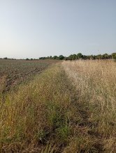
Ground level

slug
groundlevel

Measurement_ff4b6a99-d6dc-4aca-af9a-a41743483522

Measured radiation

0.108 µSv/h
geolocalisation :

48.64081, 2.7353966666667

Ground level
Fanche
Measurement date :
Latitude :
48.64081
Longitude :
2.7353966666667
Altitude (M) :
72.0
Measurement time :
1 minutes
Distance travelled :
4319.19m
Measurement speed :
Measurement Environment :
En campagne countryside
Weather :
Tags :
Description :
Temperature :
Hits number :
36
Mesure UUID :
ff4b6a99-d6dc-4aca-af9a-a41743483522
Manual Reporting :
No
Sensor / ID :
safecast_id 3220
Sensor / Firmware version :
$BNRDD
Sensor / Type :
Sensor / Tube type :
Smartphone / UUID :
Smartphone / Platform :
Smartphone / Model :
Smartphone / OS Version :
Position acurracy :
6.0
Measurement height above the ground (in meters) :
1.00
Altitude accuracy :
6.0
Mean qualification :
Ground level
Software version :
openradiation.net/upload v0.9
Measured value :
0.108 µSv/h

Measurement_857c3af0-41f4-4eb8-be2f-1b953711cb03

Measured radiation

0.103 µSv/h
geolocalisation :

45.945989191223, 6.7219047518668

Ground level
raton74
Measurement date :
Latitude :
45.945989191223
Longitude :
6.7219047518668
Altitude (M) :
1318.0
Measurement time :
5 minutes
Distance travelled :
41.61m
Measurement speed :
Measurement Environment :
En campagne countryside
Weather :
Tags :
Description :
Temperature :
17.0°C
Hits number :
83
Mesure UUID :
857c3af0-41f4-4eb8-be2f-1b953711cb03
Manual Reporting :
No
Sensor / ID :
f38d62a9
Sensor / Firmware version :
RiumGM BLE -b
Sensor / Type :
Sensor / Tube type :
J305γβ
Smartphone / UUID :
288C2239-61F2-4006-94D4-D309C357D469
Smartphone / Platform :
iOS
Smartphone / Model :
iPhone9,3
Smartphone / OS Version :
13.6.1
Position acurracy :
48.0
Measurement height above the ground (in meters) :
1.00
Altitude accuracy :
48.0
Mean qualification :
Ground level
Software version :
OpenRadiation app 2.3.3
Measured value :
0.103 µSv/h

Measurement_ffbf5dfd-771b-42dd-a75a-da1725619259

Measured radiation

0.123 µSv/h
geolocalisation :

47.194773333333, 2.0807833333333

Ground level
Fanche
Measurement date :
Latitude :
47.194773333333
Longitude :
2.0807833333333
Altitude (M) :
131.0
Measurement time :
1 minutes
Distance travelled :
1924.19m
Measurement speed :
Measurement Environment :
Sur la route ontheroad
Weather :
Tags :
Description :
Temperature :
Hits number :
41
Mesure UUID :
ffbf5dfd-771b-42dd-a75a-da1725619259
Manual Reporting :
No
Sensor / ID :
safecast_id 3228
Sensor / Firmware version :
$BNRDD
Sensor / Type :
Sensor / Tube type :
Smartphone / UUID :
Smartphone / Platform :
Smartphone / Model :
Smartphone / OS Version :
Position acurracy :
6.0
Measurement height above the ground (in meters) :
1.00
Altitude accuracy :
6.0
Mean qualification :
Ground level
Software version :
openradiation.net/upload v0.9
Measured value :
0.123 µSv/h

Measurement_85f27495-03dd-66d0-1cdd-7b70ebdd9e17

Measured radiation

0.118 µSv/h
geolocalisation :

50.672861, 3.204542

Ground level
renichuss
Measurement date :
Latitude :
50.672861
Longitude :
3.204542
Altitude (M) :
42.0
Measurement time :
10 minutes
Distance travelled :
0.00m
Measurement speed :
Measurement Environment :
À l'intérieur inside
Weather :
Tags :
Description :
Temperature :
Hits number :
265
Mesure UUID :
85f27495-03dd-66d0-1cdd-7b70ebdd9e17
Manual Reporting :
No
Sensor / ID :
b183cbc2-e56f-4308-862a-3fd17716e5b1
Sensor / Firmware version :
RadMon v1.6
Sensor / Type :
Sensor / Tube type :
SBM-20
Smartphone / UUID :
Smartphone / Platform :
Smartphone / Model :
Smartphone / OS Version :
Position acurracy :
20.0
Measurement height above the ground (in meters) :
1.00
Altitude accuracy :
20.0
Mean qualification :
Ground level
Software version :
RadMon v1.6-backport1.8-2025-a38d
Measured value :
0.118 µSv/h

Measurement_aa34bdd8-5d8d-47e0-9e6f-710c3ac5c9ce

Measured radiation

0.064 µSv/h
geolocalisation :

43.518296, 1.3331228

Ground level
MSKMPO
Measurement date :
Latitude :
43.518296
Longitude :
1.3331228
Altitude (M) :
223.0
Measurement time :
4 minutes 19 secondes
Distance travelled :
10.45m
Measurement speed :
Measurement Environment :
En ville city
Weather :
Tags :
Description :
Frouzins (31) école Alain Bertrand 5 rue du Midi cour de recreation
measurment image
Temperature :
21.0°C
Hits number :
51
Mesure UUID :
aa34bdd8-5d8d-47e0-9e6f-710c3ac5c9ce
Manual Reporting :
No
Sensor / ID :
1991002590
Sensor / Firmware version :
RiumGm
Sensor / Type :
Sensor / Tube type :
J305γβ
Smartphone / UUID :
927c1528b6ac9f45
Smartphone / Platform :
android
Smartphone / Model :
SM-S918B
Smartphone / OS Version :
14
Position acurracy :
52.4
Measurement height above the ground (in meters) :
0.00
Altitude accuracy :
52.4
Mean qualification :
Ground level
Software version :
OpenRadiation app 3.0
Measured value :
0.064 µSv/h

Measurement_ffe6a7be-8266-4b26-a0fa-e81720948357

Measured radiation

0.099 µSv/h
geolocalisation :

48.058365, 0.20455666666667

Ground level
Fanche
Measurement date :
Latitude :
48.058365
Longitude :
0.20455666666667
Altitude (M) :
50.0
Measurement time :
1 minutes
Distance travelled :
1945.30m
Measurement speed :
Measurement Environment :
En ville city
Weather :
Tags :
Description :
Temperature :
Hits number :
33
Mesure UUID :
ffe6a7be-8266-4b26-a0fa-e81720948357
Manual Reporting :
No
Sensor / ID :
safecast_id 1083
Sensor / Firmware version :
$BNRDD
Sensor / Type :
Sensor / Tube type :
Smartphone / UUID :
Smartphone / Platform :
Smartphone / Model :
Smartphone / OS Version :
Position acurracy :
8.0
Measurement height above the ground (in meters) :
1.00
Altitude accuracy :
8.0
Mean qualification :
Ground level
Software version :
openradiation.net/upload v0.9
Measured value :
0.099 µSv/h

Measurement_246fb6bc-8ad0-4bd9-bb1a-c5da26f989ce

Measured radiation

0.046 µSv/h
geolocalisation :

50.408013024052, 1.5890926376304

Ground level
Measurement date :
Latitude :
50.408013024052
Longitude :
1.5890926376304
Altitude (M) :
5.0
Measurement time :
5 minutes 32 secondes
Distance travelled :
72.33m
Measurement speed :
Measurement Environment :
Sur la route ontheroad
Weather :
Tags :
Description :
Temperature :
27.0°C
Hits number :
86
Mesure UUID :
246fb6bc-8ad0-4bd9-bb1a-c5da26f989ce
Manual Reporting :
No
Sensor / ID :
00143
Sensor / Firmware version :
OpengKIT71
Sensor / Type :
Sensor / Tube type :
SBM-20
Smartphone / UUID :
38DD155D-1FC5-478C-BBC9-7809CC5488B2
Smartphone / Platform :
iOS
Smartphone / Model :
iPhone9,4
Smartphone / OS Version :
13.5.1
Position acurracy :
65.0
Measurement height above the ground (in meters) :
1.00
Altitude accuracy :
65.0
Mean qualification :
Ground level
Software version :
OpenRadiation app 2.3.1
Measured value :
0.046 µSv/h

Measurement_aec15780-e8fd-4b9e-a7e4-eacfa10cecdb

Measured radiation

0.116 µSv/h
geolocalisation :

49.416570526084, 1.0463642062876

Ground level
Hobert
Measurement date :
Latitude :
49.416570526084
Longitude :
1.0463642062876
Altitude (M) :
20.0
Measurement time :
2 minutes 48 secondes
Distance travelled :
3529.17m
Measurement speed :
Measurement Environment :
Sur la route ontheroad
Weather :
Tags :
Description :
Temperature :
25.0°C
Hits number :
51
Mesure UUID :
aec15780-e8fd-4b9e-a7e4-eacfa10cecdb
Manual Reporting :
No
Sensor / ID :
57063ce3
Sensor / Firmware version :
RiumGM BLE -b
Sensor / Type :
Sensor / Tube type :
J305γβ
Smartphone / UUID :
099DFCB7-1478-4415-9D8B-B22AC1148A94
Smartphone / Platform :
ios
Smartphone / Model :
iPhone9,3
Smartphone / OS Version :
15.8.3
Position acurracy :
8.0
Measurement height above the ground (in meters) :
1.00
Altitude accuracy :
8.0
Mean qualification :
Ground level
Software version :
OpenRadiation app 3.0
Measured value :
0.116 µSv/h

Measurement_fffbcc5d-c812-4f65-a8a1-571706277633

Measured radiation

0.117 µSv/h
geolocalisation :

48.61447, 2.2553966666667

Ground level
Fanche
Measurement date :
Latitude :
48.61447
Longitude :
2.2553966666667
Altitude (M) :
93.0
Measurement time :
1 minutes
Distance travelled :
1308.27m
Measurement speed :
Measurement Environment :
Sur la route ontheroad
Weather :
rainy day Pluie
Tags :
Description :
Temperature :
Hits number :
39
Mesure UUID :
fffbcc5d-c812-4f65-a8a1-571706277633
Manual Reporting :
No
Sensor / ID :
safecast_id 1223
Sensor / Firmware version :
$BNRDD
Sensor / Type :
Sensor / Tube type :
Smartphone / UUID :
Smartphone / Platform :
Smartphone / Model :
Smartphone / OS Version :
Position acurracy :
8.0
Measurement height above the ground (in meters) :
1.00
Altitude accuracy :
8.0
Mean qualification :
Ground level
Software version :
openradiation.net/upload v0.9
Measured value :
0.117 µSv/h

Measurement_cedbd56d-b45d-4a10-a3bf-20661d5ce9fc

Measured radiation

0.490 µSv/h
geolocalisation :

45.9285303, 3.7812676

Ground level
PTFCJB
ATYPICAL MEASURE
Measurement date :
Latitude :
45.9285303
Longitude :
3.7812676
Altitude (M) :
719.0
Measurement time :
3 minutes
Distance travelled :
Measurement speed :
Measurement Environment :
En campagne countryside
Weather :
Tags :
Description :
Temperature :
Hits number :
Mesure UUID :
cedbd56d-b45d-4a10-a3bf-20661d5ce9fc
Manual Reporting :
Yes
Sensor / ID :
Sensor / Firmware version :
Sensor / Type :
Sensor / Tube type :
Smartphone / UUID :
ACA0F7CE-767E-48DA-AAD9-84C5935EDDE9
Smartphone / Platform :
iOS
Smartphone / Model :
iPhone8,4
Smartphone / OS Version :
11.2.5
Position acurracy :
50.0
Measurement height above the ground (in meters) :
0.00
Altitude accuracy :
50.0
Mean qualification :
Ground level
Software version :
OpenRadiation app 1.0.0
Measured value :
0.490 µSv/h