Wrong measurement

slug
wrongmeasurement

Measurement_2abe219d-cfcd-47cc-bd64-305a4fa2cad6

Measured radiation

0.310 µSv/h
geolocalisation :

50.2369362, 3.7405784

Wrong measurement
goldi
ATYPICAL MEASURE
Measurement date :
Latitude :
50.2369362
Longitude :
3.7405784
Altitude (M) :
218.0
Measurement time :
5 minutes
Distance travelled :
607.42m
Measurement speed :
Measurement Environment :
En campagne countryside
Weather :
Tags :
Description :
forêt
Temperature :
33.0°C
Hits number :
280
Mesure UUID :
2abe219d-cfcd-47cc-bd64-305a4fa2cad6
Manual Reporting :
No
Sensor / ID :
000118
Sensor / Firmware version :
OG-KIT1
Sensor / Type :
Sensor / Tube type :
SBM-20
Smartphone / UUID :
235d04ac6ef13675
Smartphone / Platform :
Android
Smartphone / Model :
VTR-L09
Smartphone / OS Version :
9
Position acurracy :
4.0
Measurement height above the ground (in meters) :
1.00
Altitude accuracy :
4.0
Mean qualification :
Wrong measurement
Software version :
OpenRadiation app 2.2.0
Measured value :
0.310 µSv/h

Measurement_b1930cd9-b94c-40c9-b5b7-d646666deefe

Measured radiation

-0.037 µSv/h
geolocalisation :

50.2377021, 3.749025

Wrong measurement
goldi
Measurement date :
Latitude :
50.2377021
Longitude :
3.749025
Altitude (M) :
220.0
Measurement time :
19 minutes 5 secondes
Distance travelled :
55.99m
Measurement speed :
Measurement Environment :
En campagne countryside
Weather :
Tags :
Description :
forêt
Temperature :
34.0°C
Hits number :
51
Mesure UUID :
b1930cd9-b94c-40c9-b5b7-d646666deefe
Manual Reporting :
No
Sensor / ID :
000118
Sensor / Firmware version :
OG-KIT1
Sensor / Type :
Sensor / Tube type :
SBM-20
Smartphone / UUID :
235d04ac6ef13675
Smartphone / Platform :
Android
Smartphone / Model :
VTR-L09
Smartphone / OS Version :
9
Position acurracy :
4.2
Measurement height above the ground (in meters) :
1.00
Altitude accuracy :
4.2
Mean qualification :
Wrong measurement
Software version :
OpenRadiation app 2.2.0
Measured value :
-0.037 µSv/h

Measurement_8ec2def5-b3d0-45d6-93ad-8b47ce82c377

Measured radiation

0.572 µSv/h
geolocalisation :

50.2378082, 3.7497937

Wrong measurement
goldi
ATYPICAL MEASURE
Measurement date :
Latitude :
50.2378082
Longitude :
3.7497937
Altitude (M) :
217.0
Measurement time :
5 minutes 1 secondes
Distance travelled :
1019.10m
Measurement speed :
Measurement Environment :
En campagne countryside
Weather :
Tags :
Description :
forêt
Temperature :
34.0°C
Hits number :
478
Mesure UUID :
8ec2def5-b3d0-45d6-93ad-8b47ce82c377
Manual Reporting :
No
Sensor / ID :
000118
Sensor / Firmware version :
OG-KIT1
Sensor / Type :
Sensor / Tube type :
SBM-20
Smartphone / UUID :
235d04ac6ef13675
Smartphone / Platform :
Android
Smartphone / Model :
VTR-L09
Smartphone / OS Version :
9
Position acurracy :
3.0
Measurement height above the ground (in meters) :
1.00
Altitude accuracy :
3.0
Mean qualification :
Wrong measurement
Software version :
OpenRadiation app 2.2.0
Measured value :
0.572 µSv/h

Measurement_9db12af3-5c7a-4548-83c0-c3d6910bc479

Measured radiation

-0.030 µSv/h
geolocalisation :

50.2391728, 3.7639471

Wrong measurement
goldi
Measurement date :
Latitude :
50.2391728
Longitude :
3.7639471
Altitude (M) :
197.0
Measurement time :
18 minutes 13 secondes
Distance travelled :
209.16m
Measurement speed :
Measurement Environment :
En campagne countryside
Weather :
Tags :
Description :
forêt
Temperature :
34.0°C
Hits number :
68
Mesure UUID :
9db12af3-5c7a-4548-83c0-c3d6910bc479
Manual Reporting :
No
Sensor / ID :
000118
Sensor / Firmware version :
OG-KIT1
Sensor / Type :
Sensor / Tube type :
SBM-20
Smartphone / UUID :
235d04ac6ef13675
Smartphone / Platform :
Android
Smartphone / Model :
VTR-L09
Smartphone / OS Version :
9
Position acurracy :
4.6
Measurement height above the ground (in meters) :
1.00
Altitude accuracy :
4.6
Mean qualification :
Wrong measurement
Software version :
OpenRadiation app 2.2.0
Measured value :
-0.030 µSv/h

Measurement_cf946797-2fbb-45a8-b589-cbd06ecc6794

Measured radiation

1.268 µSv/h
geolocalisation :

50.2394555, 3.7668514

Wrong measurement
goldi
ATYPICAL MEASURE
Measurement date :
Latitude :
50.2394555
Longitude :
3.7668514
Altitude (M) :
203.0
Measurement time :
1 minutes 38 secondes
Distance travelled :
504.36m
Measurement speed :
Measurement Environment :
En campagne countryside
Weather :
Tags :
Description :
forêt
Temperature :
34.0°C
Hits number :
327
Mesure UUID :
cf946797-2fbb-45a8-b589-cbd06ecc6794
Manual Reporting :
No
Sensor / ID :
000118
Sensor / Firmware version :
OG-KIT1
Sensor / Type :
Sensor / Tube type :
SBM-20
Smartphone / UUID :
235d04ac6ef13675
Smartphone / Platform :
Android
Smartphone / Model :
VTR-L09
Smartphone / OS Version :
9
Position acurracy :
3.9
Measurement height above the ground (in meters) :
1.00
Altitude accuracy :
3.9
Mean qualification :
Wrong measurement
Software version :
OpenRadiation app 2.2.0
Measured value :
1.268 µSv/h

Measurement_26b296a9-c028-4ff9-b0ad-698df9f189a5

Measured radiation

2.955 µSv/h
geolocalisation :

47.2387089, -1.5548019

Wrong measurement
Alpharty
ATYPICAL MEASURE
Measurement date :
Latitude :
47.2387089
Longitude :
-1.5548019
Altitude (M) :
62.0
Measurement time :
47 secondes
Distance travelled :
6.29m
Measurement speed :
Measurement Environment :
À l'intérieur inside
Weather :
Tags :
Description :
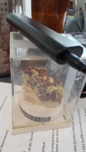
mesure sur de l'uranophane
measurment image
Temperature :
13.0°C
Hits number :
309
Mesure UUID :
26b296a9-c028-4ff9-b0ad-698df9f189a5
Manual Reporting :
No
Sensor / ID :
80:30:DC:4A:BB:9D
Sensor / Firmware version :
AtomTag v.1.0.3
Sensor / Type :
Sensor / Tube type :
SBM-20
Smartphone / UUID :
63eb68845b623e5e
Smartphone / Platform :
Android
Smartphone / Model :
SM-G930F
Smartphone / OS Version :
8.0.0
Position acurracy :
8.0
Measurement height above the ground (in meters) :
1.00
Altitude accuracy :
8.0
Mean qualification :
Wrong measurement
Software version :
OpenRadiation app 2.3.3
Measured value :
2.955 µSv/h