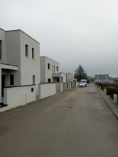
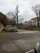
Ground level

slug
groundlevel

Measurement_635fc2e1-4197-d135-74f5-dfd962a62a11

Measured radiation

0.110 µSv/h
geolocalisation :

50.672861, 3.204542

Ground level
renichuss
Measurement date :
Latitude :
50.672861
Longitude :
3.204542
Altitude (M) :
42.0
Measurement time :
10 minutes
Distance travelled :
0.00m
Measurement speed :
Measurement Environment :
À l'intérieur inside
Weather :
Tags :
Description :
Temperature :
Hits number :
253
Mesure UUID :
635fc2e1-4197-d135-74f5-dfd962a62a11
Manual Reporting :
No
Sensor / ID :
b183cbc2-e56f-4308-862a-3fd17716e5b1
Sensor / Firmware version :
RadMon v1.6
Sensor / Type :
Sensor / Tube type :
SBM-20
Smartphone / UUID :
Smartphone / Platform :
Smartphone / Model :
Smartphone / OS Version :
Position acurracy :
20.0
Measurement height above the ground (in meters) :
1.00
Altitude accuracy :
20.0
Mean qualification :
Ground level
Software version :
RadMon v1.6-backport1.8-2025-a38d
Measured value :
0.110 µSv/h

Measurement_fa1954dd-d2c1-4bdb-9b0b-62dce376b916

Measured radiation

0.072 µSv/h
geolocalisation :

48.515209939591, 3.5245049986286

Ground level
Measurement date :
Latitude :
48.515209939591
Longitude :
3.5245049986286
Altitude (M) :
68.0
Measurement time :
3 heures 57 minutes 58 secondes
Distance travelled :
4.99m
Measurement speed :
Measurement Environment :
À l'intérieur inside
Weather :
Tags :
Description :
Temperature :
21.0°C
Hits number :
3455
Mesure UUID :
fa1954dd-d2c1-4bdb-9b0b-62dce376b916
Manual Reporting :
No
Sensor / ID :
53DC9595-D654-D741-3B1D-B27D46502C83
Sensor / Firmware version :
AtomTag v.1.0.3
Sensor / Type :
Sensor / Tube type :
SBM-20
Smartphone / UUID :
C5E1B2B2-0D2C-488F-A560-31370346AD87
Smartphone / Platform :
iOS
Smartphone / Model :
iPhone9,4
Smartphone / OS Version :
15.5
Position acurracy :
68.5
Measurement height above the ground (in meters) :
1.00
Altitude accuracy :
68.5
Mean qualification :
Ground level
Software version :
OpenRadiation app 2.3.4
Measured value :
0.072 µSv/h

Measurement_21a6d4c4-1b24-4a3a-af44-6ab51ebb496d

Measured radiation

0.119 µSv/h
geolocalisation :

43.6314446, 0.86435

Ground level
luc.claustres@kalisio.com
Measurement date :
Latitude :
43.6314446
Longitude :
0.86435
Altitude (M) :
159.0
Measurement time :
45 minutes 16 secondes
Distance travelled :
22938.70m
Measurement speed :
Measurement Environment :
Sur la route ontheroad
Weather :
Tags :
Description :
Temperature :
22.0°C
Hits number :
836
Mesure UUID :
21a6d4c4-1b24-4a3a-af44-6ab51ebb496d
Manual Reporting :
No
Sensor / ID :
2356309787
Sensor / Firmware version :
RiumGm
Sensor / Type :
Sensor / Tube type :
J305γβ
Smartphone / UUID :
ea2ea44e0a690e39
Smartphone / Platform :
Android
Smartphone / Model :
SM-G930U
Smartphone / OS Version :
8.0.0
Position acurracy :
15.0
Measurement height above the ground (in meters) :
0.00
Altitude accuracy :
15.0
Mean qualification :
Ground level
Software version :
OpenRadiation app 2.3.4
Measured value :
0.119 µSv/h

Measurement_ffca513b-1169-44ae-a3e4-541626861366

Measured radiation

0.165 µSv/h
geolocalisation :

45.76967, 2.9610533333333

Ground level
Fanche
Measurement date :
Latitude :
45.76967
Longitude :
2.9610533333333
Altitude (M) :
1389.0
Measurement time :
1 minutes
Distance travelled :
38.05m
Measurement speed :
Measurement Environment :
Sur la route ontheroad
Weather :
Tags :
Description :
Temperature :
Hits number :
55
Mesure UUID :
ffca513b-1169-44ae-a3e4-541626861366
Manual Reporting :
No
Sensor / ID :
safecast_id 3289
Sensor / Firmware version :
$BNRDD
Sensor / Type :
Sensor / Tube type :
Smartphone / UUID :
Smartphone / Platform :
Smartphone / Model :
Smartphone / OS Version :
Position acurracy :
9.0
Measurement height above the ground (in meters) :
1.00
Altitude accuracy :
9.0
Mean qualification :
Ground level
Software version :
openradiation.net/upload v0.9
Measured value :
0.165 µSv/h

Measurement_25388d78-458a-4b30-b8bd-651491458074

Measured radiation

0.081 µSv/h
geolocalisation :

49.537345049949, -1.8848237302172

Ground level
BuChan
Measurement date :
Latitude :
49.537345049949
Longitude :
-1.8848237302172
Altitude (M) :
7.0
Measurement time :
5 minutes 2 secondes
Distance travelled :
32.03m
Measurement speed :
Measurement Environment :
Sur la route ontheroad
Weather :
Tags :
Description :
FLA VES
om 361470
Temperature :
21.0°C
Hits number :
79
Mesure UUID :
25388d78-458a-4b30-b8bd-651491458074
Manual Reporting :
No
Sensor / ID :
36B9B274-1314-A7EB-B432-9C1BE1DE22BB
Sensor / Firmware version :
AtomTag v.1.0.3
Sensor / Type :
Sensor / Tube type :
SBM-20
Smartphone / UUID :
544BD275-F000-4D02-8084-1786ABC41AA1
Smartphone / Platform :
iOS
Smartphone / Model :
iPhone8,1
Smartphone / OS Version :
13.6.1
Position acurracy :
30.0
Measurement height above the ground (in meters) :
1.00
Altitude accuracy :
30.0
Mean qualification :
Ground level
Software version :
OpenRadiation app 2.3.3
Measured value :
0.081 µSv/h

Measurement_ea042b8e-79a5-40a0-aaef-98827a958db1

Measured radiation

0.119 µSv/h
geolocalisation :

45.6962643, 3.1614873

Ground level
Fanche
Measurement date :
Latitude :
45.6962643
Longitude :
3.1614873
Altitude (M) :
458.0
Measurement time :
5 minutes 28 secondes
Distance travelled :
0.00m
Measurement speed :
Measurement Environment :
En campagne countryside
Weather :
Tags :
Description :
Temperature :
23.0°C
Hits number :
101
Mesure UUID :
ea042b8e-79a5-40a0-aaef-98827a958db1
Manual Reporting :
No
Sensor / ID :
4024751690
Sensor / Firmware version :
RiumGm
Sensor / Type :
Sensor / Tube type :
J305γβ
Smartphone / UUID :
8dc28c74a0c35954
Smartphone / Platform :
Android
Smartphone / Model :
SM-G930F
Smartphone / OS Version :
8.0.0
Position acurracy :
10.4
Measurement height above the ground (in meters) :
1.00
Altitude accuracy :
10.4
Mean qualification :
Ground level
Software version :
OpenRadiation app 2.3.4
Measured value :
0.119 µSv/h

Measurement_392a9683-500a-498e-b5a2-c872e06417c3

Measured radiation

0.084 µSv/h
geolocalisation :

42.9733034, -0.1928272

Ground level
Nala
Measurement date :
Latitude :
42.9733034
Longitude :
-0.1928272
Altitude (M) :
920.0
Measurement time :
2 minutes 21 secondes
Distance travelled :
42.57m
Measurement speed :
Measurement Environment :
En ville city
Weather :
Tags :
Description :
measurment image
Temperature :
23.0°C
Hits number :
50
Mesure UUID :
392a9683-500a-498e-b5a2-c872e06417c3
Manual Reporting :
No
Sensor / ID :
00230
Sensor / Firmware version :
OpengKIT71
Sensor / Type :
Sensor / Tube type :
SBM-20
Smartphone / UUID :
963626a73b573742
Smartphone / Platform :
Android
Smartphone / Model :
Redmi Note 6 Pro
Smartphone / OS Version :
9
Position acurracy :
3.0
Measurement height above the ground (in meters) :
0.00
Altitude accuracy :
3.0
Mean qualification :
Ground level
Software version :
OpenRadiation app 2.3.5
Measured value :
0.084 µSv/h

Measurement_ff9568ca-dd8a-4a00-a120-391437475008

Measured radiation

0.081 µSv/h
geolocalisation :

47.716026666667, 7.1380616666667

Ground level
Fanche
Measurement date :
Latitude :
47.716026666667
Longitude :
7.1380616666667
Altitude (M) :
304.0
Measurement time :
1 minutes
Distance travelled :
80.79m
Measurement speed :
Measurement Environment :
Sur la route ontheroad
Weather :
Tags :
Description :
Temperature :
Hits number :
27
Mesure UUID :
ff9568ca-dd8a-4a00-a120-391437475008
Manual Reporting :
No
Sensor / ID :
safecast_id 2340
Sensor / Firmware version :
$BNRDD
Sensor / Type :
Sensor / Tube type :
Smartphone / UUID :
Smartphone / Platform :
Smartphone / Model :
Smartphone / OS Version :
Position acurracy :
7.0
Measurement height above the ground (in meters) :
1.00
Altitude accuracy :
7.0
Mean qualification :
Ground level
Software version :
openradiation.net/upload v0.9
Measured value :
0.081 µSv/h

Measurement_d5ac062f-9392-4082-a521-fb826233a471

Measured radiation

0.073 µSv/h
geolocalisation :

50.05060929786, 1.4026178718096

Ground level
BuChan
Measurement date :
Latitude :
50.05060929786
Longitude :
1.4026178718096
Altitude (M) :
10.0
Measurement time :
5 minutes 2 secondes
Distance travelled :
4411.99m
Measurement speed :
Measurement Environment :
Sur la route ontheroad
Weather :
Tags :
Description :
GRA PEN
OM 361470
Temperature :
21.0°C
Hits number :
74
Mesure UUID :
d5ac062f-9392-4082-a521-fb826233a471
Manual Reporting :
No
Sensor / ID :
36B9B274-1314-A7EB-B432-9C1BE1DE22BB
Sensor / Firmware version :
AtomTag v.1.0.3
Sensor / Type :
Sensor / Tube type :
SBM-20
Smartphone / UUID :
544BD275-F000-4D02-8084-1786ABC41AA1
Smartphone / Platform :
iOS
Smartphone / Model :
iPhone8,1
Smartphone / OS Version :
13.6.1
Position acurracy :
10.0
Measurement height above the ground (in meters) :
1.00
Altitude accuracy :
10.0
Mean qualification :
Ground level
Software version :
OpenRadiation app 2.3.3
Measured value :
0.073 µSv/h

Measurement_ffbf5dfd-771b-42dd-a75a-da1725614188

Measured radiation

0.138 µSv/h
geolocalisation :

45.956346666667, 1.41448

Ground level
Fanche
Measurement date :
Latitude :
45.956346666667
Longitude :
1.41448
Altitude (M) :
582.0
Measurement time :
1 minutes
Distance travelled :
2525.30m
Measurement speed :
Measurement Environment :
Sur la route ontheroad
Weather :
Tags :
Description :
Temperature :
Hits number :
46
Mesure UUID :
ffbf5dfd-771b-42dd-a75a-da1725614188
Manual Reporting :
No
Sensor / ID :
safecast_id 3228
Sensor / Firmware version :
$BNRDD
Sensor / Type :
Sensor / Tube type :
Smartphone / UUID :
Smartphone / Platform :
Smartphone / Model :
Smartphone / OS Version :
Position acurracy :
9.0
Measurement height above the ground (in meters) :
1.00
Altitude accuracy :
9.0
Mean qualification :
Ground level
Software version :
openradiation.net/upload v0.9
Measured value :
0.138 µSv/h