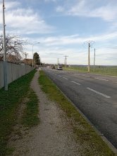
Ground level

slug
groundlevel

Measurement_78dd55ff-25c7-4638-84e9-58e85103e6a0

Measured radiation

0.176 µSv/h
geolocalisation :

48.7950727, 2.2753027

Ground level
Measurement date :
Latitude :
48.7950727
Longitude :
2.2753027
Altitude (M) :
229.0
Measurement time :
4 minutes 59 secondes
Distance travelled :
0.00m
Measurement speed :
Measurement Environment :
À l'intérieur inside
Weather :
Tags :
Description :
Temperature :
28.0°C
Hits number :
143
Mesure UUID :
78dd55ff-25c7-4638-84e9-58e85103e6a0
Manual Reporting :
No
Sensor / ID :
00117
Sensor / Firmware version :
OpengKIT72
Sensor / Type :
Sensor / Tube type :
Smartphone / UUID :
2bf5aae8438a0b9d
Smartphone / Platform :
android
Smartphone / Model :
SM-S921B
Smartphone / OS Version :
15
Position acurracy :
11.1
Measurement height above the ground (in meters) :
1.00
Altitude accuracy :
11.1
Mean qualification :
Ground level
Software version :
OpenRadiation app 3.1
Measured value :
0.176 µSv/h

Measurement_e89dc529-a34c-4fa0-a6a5-a09a06b3599f

Measured radiation

0.142 µSv/h
geolocalisation :

49.175507449644, -0.34884241880195

Ground level
domlo
Measurement date :
Latitude :
49.175507449644
Longitude :
-0.34884241880195
Altitude (M) :
9.0
Measurement time :
2 minutes 43 secondes
Distance travelled :
0.00m
Measurement speed :
Measurement Environment :
En ville city
Weather :
Tags :
Description :
gare caen
Temperature :
21.0°C
Hits number :
58
Mesure UUID :
e89dc529-a34c-4fa0-a6a5-a09a06b3599f
Manual Reporting :
No
Sensor / ID :
41007bbe
Sensor / Firmware version :
RiumGM BLE -b
Sensor / Type :
Sensor / Tube type :
J305γβ
Smartphone / UUID :
F2F0E7EB-7961-450A-A274-5E99CBD951C1
Smartphone / Platform :
ios
Smartphone / Model :
iPhone12,1
Smartphone / OS Version :
18.5
Position acurracy :
20.0
Measurement height above the ground (in meters) :
0.00
Altitude accuracy :
20.0
Mean qualification :
Ground level
Software version :
OpenRadiation app 3.0
Measured value :
0.142 µSv/h

Measurement_fdc77fa4-21a8-4c2d-8c8a-f1213d68c995

Measured radiation

0.106 µSv/h
geolocalisation :

48.670995010988, -1.8512595001294

Ground level
domlo
Measurement date :
Latitude :
48.670995010988
Longitude :
-1.8512595001294
Altitude (M) :
9.0
Measurement time :
5 minutes 51 secondes
Distance travelled :
283.60m
Measurement speed :
Measurement Environment :
En campagne countryside
Weather :
Tags :
Description :
jetée cancale
Temperature :
26.0°C
Hits number :
99
Mesure UUID :
fdc77fa4-21a8-4c2d-8c8a-f1213d68c995
Manual Reporting :
No
Sensor / ID :
41007bbe
Sensor / Firmware version :
RiumGM BLE -b
Sensor / Type :
Sensor / Tube type :
J305γβ
Smartphone / UUID :
F2F0E7EB-7961-450A-A274-5E99CBD951C1
Smartphone / Platform :
ios
Smartphone / Model :
iPhone12,1
Smartphone / OS Version :
18.5
Position acurracy :
4.7
Measurement height above the ground (in meters) :
1.00
Altitude accuracy :
4.7
Mean qualification :
Ground level
Software version :
OpenRadiation app 3.0
Measured value :
0.106 µSv/h

Measurement_989815ee-93dc-45ef-af69-c9b527c2aa17

Measured radiation

0.115 µSv/h
geolocalisation :

43.450012896789, 3.6124206708914

Ground level
Olivier VOLTZ
Measurement date :
Latitude :
43.450012896789
Longitude :
3.6124206708914
Altitude (M) :
28.0
Measurement time :
2 minutes 49 secondes
Distance travelled :
0.00m
Measurement speed :
Measurement Environment :
En campagne countryside
Weather :
Tags :
Description :
Temperature :
24.0°C
Hits number :
51
Mesure UUID :
989815ee-93dc-45ef-af69-c9b527c2aa17
Manual Reporting :
No
Sensor / ID :
7339a980
Sensor / Firmware version :
RiumGM BLE -b
Sensor / Type :
Sensor / Tube type :
J305γβ
Smartphone / UUID :
6A2BCC37-D2A9-4CB6-924B-95846E4FE1D6
Smartphone / Platform :
ios
Smartphone / Model :
iPhone17,3
Smartphone / OS Version :
18.5
Position acurracy :
12.1
Measurement height above the ground (in meters) :
1.00
Altitude accuracy :
12.1
Mean qualification :
Ground level
Software version :
OpenRadiation app 3.0
Measured value :
0.115 µSv/h

Measurement_e827ec79-ec1a-4c30-b253-526a678d6450

Measured radiation

0.040 µSv/h
geolocalisation :

43.454436551425, 5.3051898329001

Ground level
Obspm
Measurement date :
Latitude :
43.454436551425
Longitude :
5.3051898329001
Altitude (M) :
250.0
Measurement time :
4 minutes 55 secondes
Distance travelled :
14910.75m
Measurement speed :
Measurement Environment :
Sur la route ontheroad
Weather :
Tags :
Description :
marseille
Temperature :
19.0°C
Hits number :
51
Mesure UUID :
e827ec79-ec1a-4c30-b253-526a678d6450
Manual Reporting :
No
Sensor / ID :
87084F16-EE46-1B8E-4700-2BD3C5F5EE69
Sensor / Firmware version :
AtomTag
Sensor / Type :
Sensor / Tube type :
SBM-20
Smartphone / UUID :
B2F03F6E-54E2-4338-A3A7-90D398943412
Smartphone / Platform :
ios
Smartphone / Model :
iPhone14,5
Smartphone / OS Version :
18.5
Position acurracy :
14941.7
Measurement height above the ground (in meters) :
1.00
Altitude accuracy :
14941.7
Mean qualification :
Ground level
Software version :
OpenRadiation app 3.0
Measured value :
0.040 µSv/h

Measurement_1bab0c2a-9cff-405a-93be-02fe58d8173f

Measured radiation

3.048 µSv/h
geolocalisation :

49.0058261, 2.5906636

Ground level
Fanche
ATYPICAL MEASURE
Measurement date :
Latitude :
49.0058261
Longitude :
2.5906636
Altitude (M) :
149.0
Measurement time :
32 secondes
Distance travelled :
0.00m
Measurement speed :
Measurement Environment :
Sur la route ontheroad
Weather :
Tags :
Description :
Temperature :
25.0°C
Hits number :
201
Mesure UUID :
1bab0c2a-9cff-405a-93be-02fe58d8173f
Manual Reporting :
No
Sensor / ID :
3a48de08
Sensor / Firmware version :
RiumGM BLE -b
Sensor / Type :
Sensor / Tube type :
J305γβ
Smartphone / UUID :
378ead7f7f72bf9c
Smartphone / Platform :
android
Smartphone / Model :
CPH2211
Smartphone / OS Version :
11
Position acurracy :
100.0
Measurement height above the ground (in meters) :
1.00
Altitude accuracy :
100.0
Mean qualification :
Ground level
Software version :
OpenRadiation app 3.1
Measured value :
3.048 µSv/h

Measurement_0835535e-924d-458e-a865-6b792910cbfa

Measured radiation

0.134 µSv/h
geolocalisation :

44.8845388, 5.0560093

Ground level
Measurement date :
Latitude :
44.8845388
Longitude :
5.0560093
Altitude (M) :
334.0
Measurement time :
2 minutes 19 secondes
Distance travelled :
0.00m
Measurement speed :
Measurement Environment :
En campagne countryside
Weather :
Tags :
Description :
Temperature :
25.0°C
Hits number :
54
Mesure UUID :
0835535e-924d-458e-a865-6b792910cbfa
Manual Reporting :
No
Sensor / ID :
00138
Sensor / Firmware version :
OpengKIT72
Sensor / Type :
Sensor / Tube type :
Smartphone / UUID :
a97d8638a49f002c
Smartphone / Platform :
android
Smartphone / Model :
SM-G996B
Smartphone / OS Version :
15
Position acurracy :
48.9
Measurement height above the ground (in meters) :
1.00
Altitude accuracy :
48.9
Mean qualification :
Ground level
Software version :
OpenRadiation app 3.1
Measured value :
0.134 µSv/h

Measurement_a7cc49c3-5976-45b7-8e57-0e8434f97ea7

Measured radiation

2.833 µSv/h
geolocalisation :

49.0058261, 2.5906636

Ground level
Fanche
ATYPICAL MEASURE
Measurement date :
Latitude :
49.0058261
Longitude :
2.5906636
Altitude (M) :
149.0
Measurement time :
35 secondes
Distance travelled :
0.00m
Measurement speed :
Measurement Environment :
Sur la route ontheroad
Weather :
Tags :
Description :
Temperature :
25.0°C
Hits number :
204
Mesure UUID :
a7cc49c3-5976-45b7-8e57-0e8434f97ea7
Manual Reporting :
No
Sensor / ID :
3a48de08
Sensor / Firmware version :
RiumGM BLE -b
Sensor / Type :
Sensor / Tube type :
J305γβ
Smartphone / UUID :
378ead7f7f72bf9c
Smartphone / Platform :
android
Smartphone / Model :
CPH2211
Smartphone / OS Version :
11
Position acurracy :
100.0
Measurement height above the ground (in meters) :
1.00
Altitude accuracy :
100.0
Mean qualification :
Ground level
Software version :
OpenRadiation app 3.1
Measured value :
2.833 µSv/h

Measurement_088b1d42-34e7-4dc0-96e4-16a10c17c267

Measured radiation

2.931 µSv/h
geolocalisation :

52.5089454, -0.3527322

Ground level
Fanche
ATYPICAL MEASURE
Measurement date :
Latitude :
52.5089454
Longitude :
-0.3527322
Altitude (M) :
11994.0
Measurement time :
29 secondes
Distance travelled :
0.00m
Measurement speed :
Measurement Environment :
Sur la route ontheroad
Weather :
Tags :
Description :
AF082
Temperature :
30.0°C
Hits number :
212
Mesure UUID :
088b1d42-34e7-4dc0-96e4-16a10c17c267
Manual Reporting :
No
Sensor / ID :
000104
Sensor / Firmware version :
OG-KIT1
Sensor / Type :
Sensor / Tube type :
SBM-20
Smartphone / UUID :
f52f9dac520e0335
Smartphone / Platform :
android
Smartphone / Model :
SM-A202F
Smartphone / OS Version :
9
Position acurracy :
18.9
Measurement height above the ground (in meters) :
Altitude accuracy :
18.9
Mean qualification :
Ground level
Software version :
OpenRadiation app 3.1
Measured value :
2.931 µSv/h

Measurement_0e99431f-e1e4-4323-8f2a-c5b056192962

Measured radiation

0.303 µSv/h
geolocalisation :

37.7889632, -122.4080765

Ground level
Fanche
ATYPICAL MEASURE
Measurement date :
Latitude :
37.7889632
Longitude :
-122.4080765
Altitude (M) :
26.0
Measurement time :
1 minutes 10 secondes
Distance travelled :
0.00m
Measurement speed :
Measurement Environment :
À l'intérieur inside
Weather :
Tags :
Description :
Temperature :
13.0°C
Hits number :
52
Mesure UUID :
0e99431f-e1e4-4323-8f2a-c5b056192962
Manual Reporting :
No
Sensor / ID :
0C:1C:57:B5:C3:BB
Sensor / Firmware version :
AtomTag v.1.0.3
Sensor / Type :
Sensor / Tube type :
SBM-20
Smartphone / UUID :
f52f9dac520e0335
Smartphone / Platform :
android
Smartphone / Model :
SM-A202F
Smartphone / OS Version :
9
Position acurracy :
17.3
Measurement height above the ground (in meters) :
Altitude accuracy :
17.3
Mean qualification :
Ground level
Software version :
OpenRadiation app 3.1
Measured value :
0.303 µSv/h