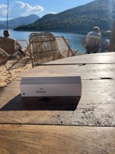


Ground level

slug
groundlevel

Measurement_6188aa67-3af5-4d1d-bf25-4562e5697952

Measured radiation

0.037 µSv/h
geolocalisation :

48.877905652333, 2.129566266644

Ground level
VLE
Date de la mesure :
Latitude :
48.877905652333
Longitude :
2.129566266644
Altitude (M) :
29.0
Measurement time :
3 minutes 32 secondes
Distance travelled :
27.70m
Measurement speed :
Measurement Environment :
À l'intérieur inside
Weather :
Tags :
Description :
Temperature :
26.0°C
Hits number :
50
Mesure UUID :
6188aa67-3af5-4d1d-bf25-4562e5697952
Manual Reporting :
No
Sensor / ID :
Sensor / Firmware version :
OpengKIT71
Sensor / Type :
Sensor / Tube type :
SBM-20
Smartphone / UUID :
DAE2B9A7-C0CD-4363-A09C-D5DEF29BE9CA
Smartphone / Platform :
ios
Smartphone / Model :
iPhone14,7
Smartphone / OS Version :
18.6.2
Position acurracy :
21.2
Measurement height above the ground (in meters) :
1.00
Altitude accuracy :
21.2
Mean qualification :
Ground level
Software version :
OpenRadiation app 3.1.1
Measured value :
0.037 µSv/h

Measurement_a0c4a943-73e8-441b-97b1-9dab233e9b3b

Measured radiation

0.046 µSv/h
geolocalisation :

48.9453968, 2.15229798

Ground level
Germanium
Date de la mesure :
Latitude :
48.9453968
Longitude :
2.15229798
Altitude (M) :
75.0
Measurement time :
5 minutes 1 secondes
Distance travelled :
258.64m
Measurement speed :
Measurement Environment :
Sur la route ontheroad
Weather :
Tags :
Description :
Temperature :
21.0°C
Hits number :
60
Mesure UUID :
a0c4a943-73e8-441b-97b1-9dab233e9b3b
Manual Reporting :
No
Sensor / ID :
00053
Sensor / Firmware version :
OpengKIT72
Sensor / Type :
Sensor / Tube type :
Smartphone / UUID :
96d273508b44d194
Smartphone / Platform :
android
Smartphone / Model :
FP4
Smartphone / OS Version :
14
Position acurracy :
9.9
Measurement height above the ground (in meters) :
1.00
Altitude accuracy :
9.9
Mean qualification :
Ground level
Software version :
OpenRadiation app 3.1
Measured value :
0.046 µSv/h

Measurement_ffb35552-088d-4e86-a1da-621466870246

Measured radiation

0.072 µSv/h
geolocalisation :

48.94483, 2.1463183333333

Ground level
Fanche
Date de la mesure :
Latitude :
48.94483
Longitude :
2.1463183333333
Altitude (M) :
181.0
Measurement time :
1 minutes
Distance travelled :
2203.86m
Measurement speed :
Measurement Environment :
Sur la route ontheroad
Weather :
Tags :
Description :
Temperature :
Hits number :
24
Mesure UUID :
ffb35552-088d-4e86-a1da-621466870246
Manual Reporting :
No
Sensor / ID :
safecast_id 1095
Sensor / Firmware version :
$BNRDD
Sensor / Type :
Sensor / Tube type :
Smartphone / UUID :
Smartphone / Platform :
Smartphone / Model :
Smartphone / OS Version :
Position acurracy :
7.0
Measurement height above the ground (in meters) :
1.00
Altitude accuracy :
7.0
Mean qualification :
Ground level
Software version :
openradiation.net/upload v0.9
Measured value :
0.072 µSv/h

Measurement_ff6b0eab-11e2-4f25-8e5e-11c1a816b9dc

Measured radiation

0.383 µSv/h
geolocalisation :

44.565094709804, 6.0951795465528

Ground level
Yann29
ATYPICAL MEASURE
Date de la mesure :
Latitude :
44.565094709804
Longitude :
6.0951795465528
Altitude (M) :
745.0
Measurement time :
1 minutes 18 secondes
Distance travelled :
8.14m
Measurement speed :
Measurement Environment :
À l'intérieur inside
Weather :
Tags :
Description :
mesure à côté d'un pot de sable de trebezy
Temperature :
24.0°C
Hits number :
72
Mesure UUID :
ff6b0eab-11e2-4f25-8e5e-11c1a816b9dc
Manual Reporting :
No
Sensor / ID :
Sensor / Firmware version :
OpengKIT72
Sensor / Type :
Sensor / Tube type :
Smartphone / UUID :
BD2C896C-CF53-4C23-B10A-A484AFB22EE2
Smartphone / Platform :
ios
Smartphone / Model :
iPhone14,4
Smartphone / OS Version :
18.6.2
Position acurracy :
26.9
Measurement height above the ground (in meters) :
1.00
Altitude accuracy :
26.9
Mean qualification :
Ground level
Software version :
OpenRadiation app 3.1.1
Measured value :
0.383 µSv/h

Measurement_dae927b1-00bf-48a8-a201-18ed80bb4acd

Measured radiation

0.265 µSv/h
geolocalisation :

44.565100198363, 6.0951459037051

Ground level
Yann29
ATYPICAL MEASURE
Date de la mesure :
Latitude :
44.565100198363
Longitude :
6.0951459037051
Altitude (M) :
745.0
Measurement time :
2 minutes 2 secondes
Distance travelled :
0.00m
Measurement speed :
Measurement Environment :
À l'intérieur inside
Weather :
Tags :
Description :
sable de Trebezy pour démonstration que je suis Satis De
Temperature :
22.0°C
Hits number :
74
Mesure UUID :
dae927b1-00bf-48a8-a201-18ed80bb4acd
Manual Reporting :
No
Sensor / ID :
0c1c1940
Sensor / Firmware version :
RiumGM BLE -b
Sensor / Type :
Sensor / Tube type :
J305γβ
Smartphone / UUID :
BD2C896C-CF53-4C23-B10A-A484AFB22EE2
Smartphone / Platform :
ios
Smartphone / Model :
iPhone14,4
Smartphone / OS Version :
18.6.2
Position acurracy :
18.4
Measurement height above the ground (in meters) :
1.00
Altitude accuracy :
18.4
Mean qualification :
Ground level
Software version :
OpenRadiation app 3.1.1
Measured value :
0.265 µSv/h

Measurement_5a6151a4-79ce-4031-a020-e64227c7c57e

Measured radiation

0.684 µSv/h
geolocalisation :

48.877935328406, 2.1285362836617

Ground level
Hobert
ATYPICAL MEASURE
Date de la mesure :
Latitude :
48.877935328406
Longitude :
2.1285362836617
Altitude (M) :
30.0
Measurement time :
1 minutes 12 secondes
Distance travelled :
58.49m
Measurement speed :
Measurement Environment :
À l'intérieur inside
Weather :
Tags :
Description :
measurment image
Temperature :
27.0°C
Hits number :
105
Mesure UUID :
5a6151a4-79ce-4031-a020-e64227c7c57e
Manual Reporting :
No
Sensor / ID :
57063ce3
Sensor / Firmware version :
RiumGM BLE -b
Sensor / Type :
Sensor / Tube type :
J305γβ
Smartphone / UUID :
1A7F9C77-CFAF-4201-AA6C-BA0C76542E37
Smartphone / Platform :
ios
Smartphone / Model :
iPhone10,4
Smartphone / OS Version :
16.7.11
Position acurracy :
40.0
Measurement height above the ground (in meters) :
1.00
Altitude accuracy :
40.0
Mean qualification :
Ground level
Software version :
OpenRadiation app 3.1.1
Measured value :
0.684 µSv/h

Measurement_74bb16ec-4500-4522-9abb-9d6373246fad

Measured radiation

0.406 µSv/h
geolocalisation :

44.56508918187, 6.0951757615263

Ground level
Yann29
ATYPICAL MEASURE
Date de la mesure :
Latitude :
44.56508918187
Longitude :
6.0951757615263
Altitude (M) :
745.0
Measurement time :
1 minutes 15 secondes
Distance travelled :
0.00m
Measurement speed :
Measurement Environment :
À l'intérieur inside
Weather :
Tags :
Description :
mesure du sable de Trebezy pour démonstration
Temperature :
23.0°C
Hits number :
73
Mesure UUID :
74bb16ec-4500-4522-9abb-9d6373246fad
Manual Reporting :
No
Sensor / ID :
Sensor / Firmware version :
OpengKIT72
Sensor / Type :
Sensor / Tube type :
Smartphone / UUID :
BD2C896C-CF53-4C23-B10A-A484AFB22EE2
Smartphone / Platform :
ios
Smartphone / Model :
iPhone14,4
Smartphone / OS Version :
18.6.2
Position acurracy :
27.0
Measurement height above the ground (in meters) :
1.00
Altitude accuracy :
27.0
Mean qualification :
Ground level
Software version :
OpenRadiation app 3.1.1
Measured value :
0.406 µSv/h

Measurement_aebc8dff-fd6a-4434-aa55-5e36da334bf4

Measured radiation

0.455 µSv/h
geolocalisation :

44.565088188583, 6.0951772685593

Ground level
Yann29
ATYPICAL MEASURE
Date de la mesure :
Latitude :
44.565088188583
Longitude :
6.0951772685593
Altitude (M) :
745.0
Measurement time :
2 minutes 19 secondes
Distance travelled :
0.00m
Measurement speed :
Measurement Environment :
À l'intérieur inside
Weather :
Tags :
Description :
sable de Trebezy pour démonstration
Temperature :
22.0°C
Hits number :
150
Mesure UUID :
aebc8dff-fd6a-4434-aa55-5e36da334bf4
Manual Reporting :
No
Sensor / ID :
Sensor / Firmware version :
OpengKIT72
Sensor / Type :
Sensor / Tube type :
Smartphone / UUID :
BD2C896C-CF53-4C23-B10A-A484AFB22EE2
Smartphone / Platform :
ios
Smartphone / Model :
iPhone14,4
Smartphone / OS Version :
18.6.2
Position acurracy :
27.0
Measurement height above the ground (in meters) :
1.00
Altitude accuracy :
27.0
Mean qualification :
Ground level
Software version :
OpenRadiation app 3.1.1
Measured value :
0.455 µSv/h

Measurement_8d1db5f8-9b30-41a9-a702-b6ecae0ede84

Measured radiation

0.192 µSv/h
geolocalisation :

44.511312246364, 6.3088692538499

Ground level
Yann29
Date de la mesure :
Latitude :
44.511312246364
Longitude :
6.3088692538499
Altitude (M) :
784.0
Measurement time :
2 minutes 5 secondes
Distance travelled :
41.13m
Measurement speed :
Measurement Environment :
En campagne countryside
Weather :
Tags :
Description :
Chanteloube
measurment image
Temperature :
25.0°C
Hits number :
57
Mesure UUID :
8d1db5f8-9b30-41a9-a702-b6ecae0ede84
Manual Reporting :
No
Sensor / ID :
Sensor / Firmware version :
Bertin RadConnect v1.0.1969
Sensor / Type :
Sensor / Tube type :
J305γβ
Smartphone / UUID :
BD2C896C-CF53-4C23-B10A-A484AFB22EE2
Smartphone / Platform :
ios
Smartphone / Model :
iPhone14,4
Smartphone / OS Version :
18.6.2
Position acurracy :
7.3
Measurement height above the ground (in meters) :
1.00
Altitude accuracy :
7.3
Mean qualification :
Ground level
Software version :
OpenRadiation app 3.1.1
Measured value :
0.192 µSv/h

Measurement_25f8b0fb-2060-4e28-9b02-2cf291d0c2e3

Measured radiation

0.624 µSv/h
geolocalisation :

48.878149677809, 2.1294769282256

Ground level
Hobert
ATYPICAL MEASURE
Date de la mesure :
Latitude :
48.878149677809
Longitude :
2.1294769282256
Altitude (M) :
29.0
Measurement time :
1 minutes 8 secondes
Distance travelled :
11.74m
Measurement speed :
Measurement Environment :
À l'intérieur inside
Weather :
Tags :
Description :
measurment image
Temperature :
25.0°C
Hits number :
91
Mesure UUID :
25f8b0fb-2060-4e28-9b02-2cf291d0c2e3
Manual Reporting :
No
Sensor / ID :
57063ce3
Sensor / Firmware version :
RiumGM BLE -b
Sensor / Type :
Sensor / Tube type :
J305γβ
Smartphone / UUID :
1A7F9C77-CFAF-4201-AA6C-BA0C76542E37
Smartphone / Platform :
ios
Smartphone / Model :
iPhone10,4
Smartphone / OS Version :
16.7.11
Position acurracy :
8.0
Measurement height above the ground (in meters) :
1.00
Altitude accuracy :
8.0
Mean qualification :
Ground level
Software version :
OpenRadiation app 3.1.1
Measured value :
0.624 µSv/h