


city

icone_mesure
slug
city

Measurement_ca5089d6-a395-4ae1-ab4f-5f1dfbaf67cf

Measured radiation

0.896 µSv/h
geolocalisation :

47.8364551, 1.9435585

Ground level
ATYPICAL MEASURE
Date de la mesure :
Latitude :
47.8364551
Longitude :
1.9435585
Altitude (M) :
160.0
Measurement time :
28 secondes
Distance travelled :
0.25m
Measurement speed :
Measurement Environment :
En ville city
Weather :
Tags :
Description :
Temperature :
23.0°C
Hits number :
53
Mesure UUID :
ca5089d6-a395-4ae1-ab4f-5f1dfbaf67cf
Manual Reporting :
No
Sensor / ID :
8b2254b4
Sensor / Firmware version :
RiumGM BLE -b
Sensor / Type :
Sensor / Tube type :
J305γβ
Smartphone / UUID :
0ce08088d2f2f7fe
Smartphone / Platform :
Android
Smartphone / Model :
Redmi 8
Smartphone / OS Version :
10
Position acurracy :
12.7
Measurement height above the ground (in meters) :
0.00
Altitude accuracy :
12.7
Mean qualification :
Ground level
Software version :
OpenRadiation app 2.3.4
Measured value :
0.896 µSv/h

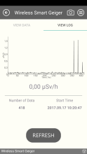
Measurement_b53d8618-85bd-4c47-b89c-6e6d412eba27

Measured radiation

0.413 µSv/h
geolocalisation :

-20.5331441, 47.2432397

Ground level
ghis
ATYPICAL MEASURE
Date de la mesure :
Latitude :
-20.5331441
Longitude :
47.2432397
Altitude (M) :
1327.0
Measurement time :
53 secondes
Distance travelled :
0.00m
Measurement speed :
Measurement Environment :
En ville city
Weather :
Tags :
Description :
Temperature :
19.0°C
Hits number :
53
Mesure UUID :
b53d8618-85bd-4c47-b89c-6e6d412eba27
Manual Reporting :
No
Sensor / ID :
78:A5:04:42:66:85
Sensor / Firmware version :
AtomTag v.1.0.3
Sensor / Type :
Sensor / Tube type :
SBM-20
Smartphone / UUID :
2c849fe673cd8d81
Smartphone / Platform :
Android
Smartphone / Model :
SM-J600FN
Smartphone / OS Version :
10
Position acurracy :
8.0
Measurement height above the ground (in meters) :
1.00
Altitude accuracy :
8.0
Mean qualification :
Ground level
Software version :
OpenRadiation app 2.3.4
Measured value :
0.413 µSv/h

Measurement_b245e6ef-6644-4d76-a89c-376915c0259a

Measured radiation

0.323 µSv/h
geolocalisation :

-20.5331441, 47.2432397

Ground level
ghis
ATYPICAL MEASURE
Date de la mesure :
Latitude :
-20.5331441
Longitude :
47.2432397
Altitude (M) :
1327.0
Measurement time :
1 minutes 7 secondes
Distance travelled :
0.00m
Measurement speed :
Measurement Environment :
En ville city
Weather :
Tags :
Description :
Temperature :
19.0°C
Hits number :
52
Mesure UUID :
b245e6ef-6644-4d76-a89c-376915c0259a
Manual Reporting :
No
Sensor / ID :
78:A5:04:42:66:85
Sensor / Firmware version :
AtomTag v.1.0.3
Sensor / Type :
Sensor / Tube type :
SBM-20
Smartphone / UUID :
2c849fe673cd8d81
Smartphone / Platform :
Android
Smartphone / Model :
SM-J600FN
Smartphone / OS Version :
10
Position acurracy :
8.0
Measurement height above the ground (in meters) :
1.00
Altitude accuracy :
8.0
Mean qualification :
Ground level
Software version :
OpenRadiation app 2.3.4
Measured value :
0.323 µSv/h

Measurement_0214fdc0-f3d9-4eff-9255-a7a4ac182996

Measured radiation

0.070 µSv/h
geolocalisation :

46.2310358, -63.1360025

Ground level
Fanche
Date de la mesure :
Latitude :
46.2310358
Longitude :
-63.1360025
Altitude (M) :
-14.0
Measurement time :
3 minutes 59 secondes
Distance travelled :
87.64m
Measurement speed :
Measurement Environment :
En ville city
Weather :
Tags :
Description :
measurment image
Temperature :
20.0°C
Hits number :
57
Mesure UUID :
0214fdc0-f3d9-4eff-9255-a7a4ac182996
Manual Reporting :
No
Sensor / ID :
0C:1C:57:B5:CA:05
Sensor / Firmware version :
AtomTag v.1.0.3
Sensor / Type :
Sensor / Tube type :
SBM-20
Smartphone / UUID :
2e0896e728021500
Smartphone / Platform :
Android
Smartphone / Model :
SM-A202F
Smartphone / OS Version :
9
Position acurracy :
3.2
Measurement height above the ground (in meters) :
1.00
Altitude accuracy :
3.2
Mean qualification :
Ground level
Software version :
OpenRadiation app 2.3.4
Measured value :
0.070 µSv/h

Measurement_a1a8f95d-e88d-4f88-99e6-aa27195b8aac

Measured radiation

3.649 µSv/h
geolocalisation :

47.9787191, 16.5102409

Ground level
Fanche
ATYPICAL MEASURE
Date de la mesure :
Latitude :
47.9787191
Longitude :
16.5102409
Altitude (M) :
230.0
Measurement time :
12 secondes
Distance travelled :
8.60m
Measurement speed :
Measurement Environment :
En ville city
Weather :
Tags :
Description :
Temperature :
12.0°C
Hits number :
96
Mesure UUID :
a1a8f95d-e88d-4f88-99e6-aa27195b8aac
Manual Reporting :
No
Sensor / ID :
88:4A:EA:7C:0A:69
Sensor / Firmware version :
AtomTag v.1.0.3
Sensor / Type :
Sensor / Tube type :
SBM-20
Smartphone / UUID :
34f3ee373f0909fa
Smartphone / Platform :
Android
Smartphone / Model :
SM-G950F
Smartphone / OS Version :
7.0
Position acurracy :
34.7
Measurement height above the ground (in meters) :
Altitude accuracy :
34.7
Mean qualification :
Ground level
Software version :
OpenRadiation app 2.3.4
Measured value :
3.649 µSv/h

Measurement_1067d3fe-49c9-47b8-ab6a-eac756df3bbe

Measured radiation

1.510 µSv/h
geolocalisation :

48.7868297, 2.2799907

Ground level
pduchemin
ATYPICAL MEASURE
Date de la mesure :
Latitude :
48.7868297
Longitude :
2.2799907
Altitude (M) :
111.0
Measurement time :
1 heures
Distance travelled :
Measurement speed :
Measurement Environment :
En ville city
Weather :
Tags :
Description :
Temperature :
22.0°C
Hits number :
Mesure UUID :
1067d3fe-49c9-47b8-ab6a-eac756df3bbe
Manual Reporting :
Yes
Sensor / ID :
Sensor / Firmware version :
Sensor / Type :
Sensor / Tube type :
FTLAB Bluetooth Smart Geiger BSG-001
Smartphone / UUID :
Smartphone / Platform :
Smartphone / Model :
Smartphone / OS Version :
Position acurracy :
Measurement height above the ground (in meters) :
Altitude accuracy :
Mean qualification :
Ground level
Software version :
openradiation.org v1
Measured value :
1.510 µSv/h

Measurement_fc08b9e6-49b3-4b94-9964-491a6008e026

Measured radiation

0.030 µSv/h
geolocalisation :

48.7868297, 2.2799907

Ground level
pduchemin
Date de la mesure :
Latitude :
48.7868297
Longitude :
2.2799907
Altitude (M) :
111.0
Measurement time :
1 heures
Distance travelled :
Measurement speed :
Measurement Environment :
En ville city
Weather :
Tags :
Description :
Temperature :
22.0°C
Hits number :
Mesure UUID :
fc08b9e6-49b3-4b94-9964-491a6008e026
Manual Reporting :
Yes
Sensor / ID :
Sensor / Firmware version :
Sensor / Type :
Sensor / Tube type :
FTLAB Bluetooth Smart Geiger BSG-001
Smartphone / UUID :
Smartphone / Platform :
Smartphone / Model :
Smartphone / OS Version :
Position acurracy :
Measurement height above the ground (in meters) :
Altitude accuracy :
Mean qualification :
Ground level
Software version :
openradiation.org v1
Measured value :
0.030 µSv/h

Measurement_2c891217-2c53-49a6-8e0f-291850155fe3

Measured radiation

1.550 µSv/h
geolocalisation :

48.7868297, 2.2799907

Ground level
pduchemin
ATYPICAL MEASURE
Date de la mesure :
Latitude :
48.7868297
Longitude :
2.2799907
Altitude (M) :
111.0
Measurement time :
1 heures
Distance travelled :
Measurement speed :
Measurement Environment :
En ville city
Weather :
Tags :
Description :
Temperature :
22.0°C
Hits number :
Mesure UUID :
2c891217-2c53-49a6-8e0f-291850155fe3
Manual Reporting :
Yes
Sensor / ID :
Sensor / Firmware version :
Sensor / Type :
Sensor / Tube type :
FTLAB Bluetooth Smart Geiger BSG-001
Smartphone / UUID :
Smartphone / Platform :
Smartphone / Model :
Smartphone / OS Version :
Position acurracy :
Measurement height above the ground (in meters) :
Altitude accuracy :
Mean qualification :
Ground level
Software version :
openradiation.org v1
Measured value :
1.550 µSv/h

Measurement_e054b851-0895-4b82-991f-6aa732c3732a

Measured radiation

0.060 µSv/h
geolocalisation :

48.7868297, 2.2799907

Ground level
pduchemin
Date de la mesure :
Latitude :
48.7868297
Longitude :
2.2799907
Altitude (M) :
111.0
Measurement time :
1 heures
Distance travelled :
Measurement speed :
Measurement Environment :
En ville city
Weather :
Tags :
Description :
measurment image
Temperature :
22.0°C
Hits number :
Mesure UUID :
e054b851-0895-4b82-991f-6aa732c3732a
Manual Reporting :
Yes
Sensor / ID :
Sensor / Firmware version :
Sensor / Type :
Sensor / Tube type :
FTLAB Bluetooth Smart Geiger BSG-001
Smartphone / UUID :
Smartphone / Platform :
Smartphone / Model :
Smartphone / OS Version :
Position acurracy :
Measurement height above the ground (in meters) :
Altitude accuracy :
Mean qualification :
Ground level
Software version :
openradiation.org v1
Measured value :
0.060 µSv/h