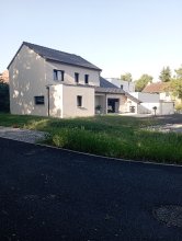
Ground level

slug
groundlevel

Measurement_e1fbaf10-dd37-464e-bfcc-d0eacc55465c

Measured radiation

15.761 µSv/h
geolocalisation :

48.7925984, 2.2732052

Ground level
Fanche
ATYPICAL MEASURE
Measurement date :
Latitude :
48.7925984
Longitude :
2.2732052
Altitude (M) :
208.0
Measurement time :
10 minutes 46 secondes
Distance travelled :
0.00m
Measurement speed :
Measurement Environment :
À l'intérieur inside
Weather :
Tags :
Description :
rium gm Usb x6 L125
Temperature :
26.0°C
Hits number :
20581
Mesure UUID :
e1fbaf10-dd37-464e-bfcc-d0eacc55465c
Manual Reporting :
No
Sensor / ID :
3987296644
Sensor / Firmware version :
RiumGm
Sensor / Type :
Sensor / Tube type :
J305γβ
Smartphone / UUID :
991b74b9d3d5bd6f
Smartphone / Platform :
Android
Smartphone / Model :
SM-A202F
Smartphone / OS Version :
9
Position acurracy :
18.6
Measurement height above the ground (in meters) :
Altitude accuracy :
18.6
Mean qualification :
Ground level
Software version :
OpenRadiation app 2.3.1
Measured value :
15.761 µSv/h

Measurement_e0ab0615-dcbd-44ff-bc25-76c2ff2c0a5b

Measured radiation

15.981 µSv/h
geolocalisation :

48.7925984, 2.2732052

Ground level
Fanche
ATYPICAL MEASURE
Measurement date :
Latitude :
48.7925984
Longitude :
2.2732052
Altitude (M) :
208.0
Measurement time :
10 minutes 46 secondes
Distance travelled :
0.00m
Measurement speed :
Measurement Environment :
À l'intérieur inside
Weather :
Tags :
Description :
rium gm Usb x5 L125
Temperature :
25.0°C
Hits number :
20857
Mesure UUID :
e0ab0615-dcbd-44ff-bc25-76c2ff2c0a5b
Manual Reporting :
No
Sensor / ID :
1701692615
Sensor / Firmware version :
RiumGm
Sensor / Type :
Sensor / Tube type :
J305γβ
Smartphone / UUID :
991b74b9d3d5bd6f
Smartphone / Platform :
Android
Smartphone / Model :
SM-A202F
Smartphone / OS Version :
9
Position acurracy :
18.6
Measurement height above the ground (in meters) :
Altitude accuracy :
18.6
Mean qualification :
Ground level
Software version :
OpenRadiation app 2.3.1
Measured value :
15.981 µSv/h

Measurement_575dfa41-169f-440f-9533-cceecb78cefe

Measured radiation

0.548 µSv/h
geolocalisation :

52.297201375477, 10.46905875206

Ground level
Fanche
ATYPICAL MEASURE
Measurement date :
Latitude :
52.297201375477
Longitude :
10.46905875206
Altitude (M) :
82.0
Measurement time :
17 minutes 42 secondes
Distance travelled :
0.00m
Measurement speed :
Measurement Environment :
En campagne countryside
Weather :
Tags :
Description :
test avec source
Temperature :
32.0°C
Hits number :
1354
Mesure UUID :
575dfa41-169f-440f-9533-cceecb78cefe
Manual Reporting :
No
Sensor / ID :
0C:1C:57:B5:B6:AA
Sensor / Firmware version :
AtomTag v.1.0.3
Sensor / Type :
Sensor / Tube type :
SBM-20
Smartphone / UUID :
991b74b9d3d5bd6f
Smartphone / Platform :
Android
Smartphone / Model :
SM-A202F
Smartphone / OS Version :
9
Position acurracy :
13.0
Measurement height above the ground (in meters) :
1.00
Altitude accuracy :
13.0
Mean qualification :
Ground level
Software version :
OpenRadiation app 2.3.4
Measured value :
0.548 µSv/h

Measurement_b444832b-a71c-4744-850f-5a383fe2754b

Measured radiation

0.552 µSv/h
geolocalisation :

52.297201375477, 10.46905875206

Ground level
Fanche
ATYPICAL MEASURE
Measurement date :
Latitude :
52.297201375477
Longitude :
10.46905875206
Altitude (M) :
82.0
Measurement time :
13 minutes 32 secondes
Distance travelled :
0.00m
Measurement speed :
Measurement Environment :
En campagne countryside
Weather :
Tags :
Description :
test avec source
Temperature :
29.0°C
Hits number :
1043
Mesure UUID :
b444832b-a71c-4744-850f-5a383fe2754b
Manual Reporting :
No
Sensor / ID :
0C:1C:57:B5:B6:AA
Sensor / Firmware version :
AtomTag v.1.0.3
Sensor / Type :
Sensor / Tube type :
SBM-20
Smartphone / UUID :
991b74b9d3d5bd6f
Smartphone / Platform :
Android
Smartphone / Model :
SM-A202F
Smartphone / OS Version :
9
Position acurracy :
13.0
Measurement height above the ground (in meters) :
1.00
Altitude accuracy :
13.0
Mean qualification :
Ground level
Software version :
OpenRadiation app 2.3.4
Measured value :
0.552 µSv/h

Measurement_9069a9b4-4fbd-4ad7-9c24-a8c4e8e51d07

Measured radiation

0.537 µSv/h
geolocalisation :

52.297201375477, 10.46905875206

Ground level
Fanche
ATYPICAL MEASURE
Measurement date :
Latitude :
52.297201375477
Longitude :
10.46905875206
Altitude (M) :
82.0
Measurement time :
13 minutes 20 secondes
Distance travelled :
0.00m
Measurement speed :
Measurement Environment :
En campagne countryside
Weather :
Tags :
Description :
Temperature :
25.0°C
Hits number :
1002
Mesure UUID :
9069a9b4-4fbd-4ad7-9c24-a8c4e8e51d07
Manual Reporting :
No
Sensor / ID :
0C:1C:57:B5:B6:AA
Sensor / Firmware version :
AtomTag v.1.0.3
Sensor / Type :
Sensor / Tube type :
SBM-20
Smartphone / UUID :
991b74b9d3d5bd6f
Smartphone / Platform :
Android
Smartphone / Model :
SM-A202F
Smartphone / OS Version :
9
Position acurracy :
13.0
Measurement height above the ground (in meters) :
1.00
Altitude accuracy :
13.0
Mean qualification :
Ground level
Software version :
OpenRadiation app 2.3.4
Measured value :
0.537 µSv/h