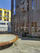


city

icone_mesure
slug
city

Measurement_8328e963-e519-4ca0-9e69-6632223d1b19

Measured radiation

0.063 µSv/h
geolocalisation :

48.69150134, 2.3763635

Ground level
Germanium
Date de la mesure :
Latitude :
48.69150134
Longitude :
2.3763635
Altitude (M) :
72.0
Measurement time :
1 heures 37 minutes 14 secondes
Distance travelled :
0.67m
Measurement speed :
Measurement Environment :
En ville city
Weather :
Tags :
Description :
Temperature :
20.0°C
Hits number :
1369
Mesure UUID :
8328e963-e519-4ca0-9e69-6632223d1b19
Manual Reporting :
No
Sensor / ID :
00053
Sensor / Firmware version :
OpengKIT72
Sensor / Type :
Sensor / Tube type :
Smartphone / UUID :
96d273508b44d194
Smartphone / Platform :
android
Smartphone / Model :
FP4
Smartphone / OS Version :
14
Position acurracy :
4.1
Measurement height above the ground (in meters) :
1.00
Altitude accuracy :
4.1
Mean qualification :
Ground level
Software version :
OpenRadiation app 3.1.1
Measured value :
0.063 µSv/h
Measurement_b7acc22c-5546-4d84-bfa1-3d036b3e658a

Measured radiation

0.070 µSv/h
geolocalisation :

47.3647718, 5.0244967

Ground level
suzon-21
Date de la mesure :
Latitude :
47.3647718
Longitude :
5.0244967
Altitude (M) :
324.0
Measurement time :
5 minutes
Distance travelled :
0.00m
Measurement speed :
Measurement Environment :
En ville city
Weather :
Tags :
Description :
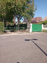
Ahuy, allée des érables.
Radiacode 102 +-20%,
measurment image
Temperature :
21.0°C
Hits number :
Mesure UUID :
b7acc22c-5546-4d84-bfa1-3d036b3e658a
Manual Reporting :
Yes
Sensor / ID :
Sensor / Firmware version :
Sensor / Type :
Sensor / Tube type :
Smartphone / UUID :
40f15d6de1d2300e
Smartphone / Platform :
android
Smartphone / Model :
22011119UY
Smartphone / OS Version :
12
Position acurracy :
2.2
Measurement height above the ground (in meters) :
1.00
Altitude accuracy :
2.2
Mean qualification :
Ground level
Software version :
OpenRadiation app 3.1.1
Measured value :
0.070 µSv/h

Measurement_ed795e73-625c-4201-9418-a08fd7324281

Measured radiation

0.041 µSv/h
geolocalisation :

47.3630056, 5.0279588

Ground level
suzon-21
Date de la mesure :
Latitude :
47.3630056
Longitude :
5.0279588
Altitude (M) :
318.0
Measurement time :
10 minutes
Distance travelled :
0.00m
Measurement speed :
Measurement Environment :
En ville city
Weather :
Tags :
Description :
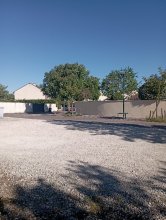
Ahuy, allée des sorbiers.
Radiacode 102. +- 27%.
measurment image
Temperature :
23.0°C
Hits number :
Mesure UUID :
ed795e73-625c-4201-9418-a08fd7324281
Manual Reporting :
Yes
Sensor / ID :
Sensor / Firmware version :
Sensor / Type :
Sensor / Tube type :
Smartphone / UUID :
40f15d6de1d2300e
Smartphone / Platform :
android
Smartphone / Model :
22011119UY
Smartphone / OS Version :
12
Position acurracy :
2.5
Measurement height above the ground (in meters) :
1.00
Altitude accuracy :
2.5
Mean qualification :
Ground level
Software version :
OpenRadiation app 3.1.1
Measured value :
0.041 µSv/h

Measurement_863a20d0-5cf9-48fd-8821-c3b73a6904d4

Measured radiation

0.098 µSv/h
geolocalisation :

47.2056104, -1.5631263

Ground level
labsciren
Date de la mesure :
Latitude :
47.2056104
Longitude :
-1.5631263
Altitude (M) :
56.0
Measurement time :
3 minutes 23 secondes
Distance travelled :
2.88m
Measurement speed :
Measurement Environment :
En ville city
Weather :
Tags :
Description :
devant fibois
measurment image
Temperature :
26.0°C
Hits number :
54
Mesure UUID :
863a20d0-5cf9-48fd-8821-c3b73a6904d4
Manual Reporting :
No
Sensor / ID :
7c805ac0
Sensor / Firmware version :
RiumGM BLE -b
Sensor / Type :
Sensor / Tube type :
J305γβ
Smartphone / UUID :
20735809be10aad8
Smartphone / Platform :
Android
Smartphone / Model :
M2007J20CG
Smartphone / OS Version :
12
Position acurracy :
15.7
Measurement height above the ground (in meters) :
1.00
Altitude accuracy :
15.7
Mean qualification :
Ground level
Software version :
OpenRadiation app 2.3.4
Measured value :
0.098 µSv/h

Measurement_d13d6b2a-262a-4bee-8871-fc67ac834a00

Measured radiation

0.115 µSv/h
geolocalisation :

47.20652892, -1.56455248

Ground level
labsciren
Date de la mesure :
Latitude :
47.20652892
Longitude :
-1.56455248
Altitude (M) :
52.0
Measurement time :
2 minutes 56 secondes
Distance travelled :
206.56m
Measurement speed :
Measurement Environment :
En ville city
Weather :
Tags :
Description :
carousel des mondes marins
measurment image
Temperature :
24.0°C
Hits number :
53
Mesure UUID :
d13d6b2a-262a-4bee-8871-fc67ac834a00
Manual Reporting :
No
Sensor / ID :
7c805ac0
Sensor / Firmware version :
RiumGM BLE -b
Sensor / Type :
Sensor / Tube type :
J305γβ
Smartphone / UUID :
20735809be10aad8
Smartphone / Platform :
Android
Smartphone / Model :
M2007J20CG
Smartphone / OS Version :
12
Position acurracy :
7.3
Measurement height above the ground (in meters) :
1.00
Altitude accuracy :
7.3
Mean qualification :
Ground level
Software version :
OpenRadiation app 2.3.4
Measured value :
0.115 µSv/h

Measurement_a9661427-b72b-4c04-9db9-328e5a1e5e68

Measured radiation

0.317 µSv/h
geolocalisation :

50.49745, 12.13879

Ground level
SunboX
ATYPICAL MEASURE
Date de la mesure :
Latitude :
50.49745
Longitude :
12.13879
Altitude (M) :
361.0
Measurement time :
6 secondes
Distance travelled :
Measurement speed :
Measurement Environment :
En ville city
Weather :
Tags :
Description :
Temperature :
Hits number :
0
Mesure UUID :
a9661427-b72b-4c04-9db9-328e5a1e5e68
Manual Reporting :
No
Sensor / ID :
35002800180000314b433056
Sensor / Firmware version :
Rad Pro 3.1test17
Sensor / Type :
Sensor / Tube type :
Smartphone / UUID :
Smartphone / Platform :
Smartphone / Model :
Smartphone / OS Version :
Position acurracy :
17.5
Measurement height above the ground (in meters) :
5.00
Altitude accuracy :
17.5
Mean qualification :
Ground level
Software version :
radpro-wifi-bridge_1.15.6
Measured value :
0.317 µSv/h

Measurement_ecd6075a-e27d-43d8-ae67-e8729ac80fa9

Measured radiation

0.306 µSv/h
geolocalisation :

50.49745, 12.13879

Ground level
SunboX
ATYPICAL MEASURE
Date de la mesure :
Latitude :
50.49745
Longitude :
12.13879
Altitude (M) :
361.0
Measurement time :
2 secondes
Distance travelled :
Measurement speed :
Measurement Environment :
En ville city
Weather :
Tags :
Description :
Temperature :
Hits number :
0
Mesure UUID :
ecd6075a-e27d-43d8-ae67-e8729ac80fa9
Manual Reporting :
No
Sensor / ID :
35002800180000314b433056
Sensor / Firmware version :
Rad Pro 3.1test17
Sensor / Type :
Sensor / Tube type :
Smartphone / UUID :
Smartphone / Platform :
Smartphone / Model :
Smartphone / OS Version :
Position acurracy :
17.5
Measurement height above the ground (in meters) :
5.00
Altitude accuracy :
17.5
Mean qualification :
Ground level
Software version :
radpro-wifi-bridge_1.15.6
Measured value :
0.306 µSv/h

Measurement_751d00dc-d8af-40f9-b069-772eaef818b7

Measured radiation

0.342 µSv/h
geolocalisation :

50.49745, 12.13879

Ground level
SunboX
ATYPICAL MEASURE
Date de la mesure :
Latitude :
50.49745
Longitude :
12.13879
Altitude (M) :
361.0
Measurement time :
Distance travelled :
Measurement speed :
Measurement Environment :
En ville city
Weather :
Tags :
Description :
Temperature :
Hits number :
0
Mesure UUID :
751d00dc-d8af-40f9-b069-772eaef818b7
Manual Reporting :
No
Sensor / ID :
35002800180000314b433056
Sensor / Firmware version :
Rad Pro 3.1test17
Sensor / Type :
Sensor / Tube type :
Smartphone / UUID :
Smartphone / Platform :
Smartphone / Model :
Smartphone / OS Version :
Position acurracy :
17.5
Measurement height above the ground (in meters) :
5.00
Altitude accuracy :
17.5
Mean qualification :
Ground level
Software version :
radpro-wifi-bridge_1.15.6
Measured value :
0.342 µSv/h

Measurement_da4cb54f-c03a-4b3b-94fb-9ab09aeedb7f

Measured radiation

0.336 µSv/h
geolocalisation :

50.49745, 12.13879

Ground level
SunboX
ATYPICAL MEASURE
Date de la mesure :
Latitude :
50.49745
Longitude :
12.13879
Altitude (M) :
361.0
Measurement time :
4 secondes
Distance travelled :
Measurement speed :
Measurement Environment :
En ville city
Weather :
Tags :
Description :
Temperature :
Hits number :
0
Mesure UUID :
da4cb54f-c03a-4b3b-94fb-9ab09aeedb7f
Manual Reporting :
No
Sensor / ID :
35002800180000314b433056
Sensor / Firmware version :
Rad Pro 3.1test17
Sensor / Type :
Sensor / Tube type :
Smartphone / UUID :
Smartphone / Platform :
Smartphone / Model :
Smartphone / OS Version :
Position acurracy :
17.5
Measurement height above the ground (in meters) :
5.00
Altitude accuracy :
17.5
Mean qualification :
Ground level
Software version :
radpro-wifi-bridge_1.15.6
Measured value :
0.336 µSv/h

Measurement_080300ec-1888-4f6a-83f9-fc8112ecb554

Measured radiation

0.427 µSv/h
geolocalisation :

50.49745, 12.13879

Ground level
SunboX
ATYPICAL MEASURE
Date de la mesure :
Latitude :
50.49745
Longitude :
12.13879
Altitude (M) :
361.0
Measurement time :
Distance travelled :
Measurement speed :
Measurement Environment :
En ville city
Weather :
Tags :
Description :
Temperature :
Hits number :
0
Mesure UUID :
080300ec-1888-4f6a-83f9-fc8112ecb554
Manual Reporting :
No
Sensor / ID :
35002800180000314b433056
Sensor / Firmware version :
Rad Pro 3.1test17
Sensor / Type :
Sensor / Tube type :
Smartphone / UUID :
Smartphone / Platform :
Smartphone / Model :
Smartphone / OS Version :
Position acurracy :
17.5
Measurement height above the ground (in meters) :
5.00
Altitude accuracy :
17.5
Mean qualification :
Ground level
Software version :
radpro-wifi-bridge_1.15.6
Measured value :
0.427 µSv/h