


city

icone_mesure
slug
city

Measurement_89390c6e-51da-490b-bc94-3aedf126e28b

Measured radiation

0.239 µSv/h
geolocalisation :

16.064430100941, 108.23076644624

Ground level
YsaureLjn
ATYPICAL MEASURE
Date de la mesure :
Latitude :
16.064430100941
Longitude :
108.23076644624
Altitude (M) :
1.0
Measurement time :
1 heures 9 minutes 21 secondes
Distance travelled :
25.44m
Measurement speed :
Measurement Environment :
En ville city
Weather :
rainy day Pluie
Tags :
Description :
Temperature :
17.0°C
Hits number :
2518
Mesure UUID :
89390c6e-51da-490b-bc94-3aedf126e28b
Manual Reporting :
No
Sensor / ID :
7A212BAF-3B65-62A0-1D88-99D9D953F25A
Sensor / Firmware version :
AtomTag
Sensor / Type :
Sensor / Tube type :
SBM-20
Smartphone / UUID :
19DDA0DF-E002-43EA-9F34-C1A5C29FB893
Smartphone / Platform :
ios
Smartphone / Model :
iPhone13,3
Smartphone / OS Version :
26.1
Position acurracy :
18.2
Measurement height above the ground (in meters) :
1.00
Altitude accuracy :
18.2
Mean qualification :
Ground level
Software version :
OpenRadiation app 3.1.1
Measured value :
0.239 µSv/h
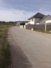
Measurement_ff998048-f637-4531-a58a-b11700156536

Measured radiation

0.096 µSv/h
geolocalisation :

48.787286666667, 2.2828016666667

Ground level
Fanche
Date de la mesure :
Latitude :
48.787286666667
Longitude :
2.2828016666667
Altitude (M) :
123.0
Measurement time :
1 minutes
Distance travelled :
108.23m
Measurement speed :
Measurement Environment :
En ville city
Weather :
rainy day Pluie
Tags :
Description :
Temperature :
Hits number :
32
Mesure UUID :
ff998048-f637-4531-a58a-b11700156536
Manual Reporting :
No
Sensor / ID :
safecast_id 1225
Sensor / Firmware version :
$BNRDD
Sensor / Type :
Sensor / Tube type :
Smartphone / UUID :
Smartphone / Platform :
Smartphone / Model :
Smartphone / OS Version :
Position acurracy :
7.0
Measurement height above the ground (in meters) :
1.00
Altitude accuracy :
7.0
Mean qualification :
Ground level
Software version :
openradiation.net/upload v0.9
Measured value :
0.096 µSv/h

Measurement_fffa67ee-80fe-42d1-aa77-181762264529

Measured radiation

0.084 µSv/h
geolocalisation :

48.793263333333, 2.2734666666667

Ground level
Fanche
Date de la mesure :
Latitude :
48.793263333333
Longitude :
2.2734666666667
Altitude (M) :
192.0
Measurement time :
1 minutes
Distance travelled :
13.56m
Measurement speed :
Measurement Environment :
En ville city
Weather :
Tags :
Description :
Temperature :
Hits number :
28
Mesure UUID :
fffa67ee-80fe-42d1-aa77-181762264529
Manual Reporting :
No
Sensor / ID :
safecast_id 2343
Sensor / Firmware version :
$BNRDD
Sensor / Type :
Sensor / Tube type :
Smartphone / UUID :
Smartphone / Platform :
Smartphone / Model :
Smartphone / OS Version :
Position acurracy :
10.0
Measurement height above the ground (in meters) :
1.00
Altitude accuracy :
10.0
Mean qualification :
Ground level
Software version :
openradiation.net/upload v0.9
Measured value :
0.084 µSv/h

Measurement_ab4a38f5-d470-4b34-8573-34b66d72a86e

Measured radiation

0.062 µSv/h
geolocalisation :

47.362885, 5.0224833

Ground level
suzon-21
Date de la mesure :
Latitude :
47.362885
Longitude :
5.0224833
Altitude (M) :
327.0
Measurement time :
5 minutes 3 secondes
Distance travelled :
0.00m
Measurement speed :
Measurement Environment :
En ville city
Weather :
Tags :
Description :
Ahuy, rue du clos de Beze
measurment image
Temperature :
25.0°C
Hits number :
71
Mesure UUID :
ab4a38f5-d470-4b34-8573-34b66d72a86e
Manual Reporting :
No
Sensor / ID :
00153
Sensor / Firmware version :
OpengKIT72
Sensor / Type :
Sensor / Tube type :
Smartphone / UUID :
40f15d6de1d2300e
Smartphone / Platform :
android
Smartphone / Model :
22011119UY
Smartphone / OS Version :
12
Position acurracy :
6.6
Measurement height above the ground (in meters) :
1.00
Altitude accuracy :
6.6
Mean qualification :
Ground level
Software version :
OpenRadiation app 3.1.1
Measured value :
0.062 µSv/h

Measurement_f7bb4bc9-a11a-47c9-973e-860a4d371314

Measured radiation

0.098 µSv/h
geolocalisation :

48.7951586, 2.28475

Ground level
Fanche
Date de la mesure :
Latitude :
48.7951586
Longitude :
2.28475
Altitude (M) :
171.0
Measurement time :
1 minutes 41 secondes
Distance travelled :
0.00m
Measurement speed :
Measurement Environment :
En ville city
Weather :
Tags :
Description :
Temperature :
Hits number :
55
Mesure UUID :
f7bb4bc9-a11a-47c9-973e-860a4d371314
Manual Reporting :
No
Sensor / ID :
00:07:80:A6:80:8F
Sensor / Firmware version :
bGeigieBLEv201
Sensor / Type :
Sensor / Tube type :
LND 7317 pancake
Smartphone / UUID :
991b74b9d3d5bd6f
Smartphone / Platform :
android
Smartphone / Model :
SM-A202F
Smartphone / OS Version :
9
Position acurracy :
13.6
Measurement height above the ground (in meters) :
1.00
Altitude accuracy :
13.6
Mean qualification :
Ground level
Software version :
OpenRadiation app 3.1.1
Measured value :
0.098 µSv/h

Measurement_6249f9f0-086a-4b74-bc73-b8208d4f9304

Measured radiation

0.108 µSv/h
geolocalisation :

48.7951586, 2.28475

Ground level
Fanche
Date de la mesure :
Latitude :
48.7951586
Longitude :
2.28475
Altitude (M) :
171.0
Measurement time :
1 minutes 25 secondes
Distance travelled :
0.00m
Measurement speed :
Measurement Environment :
En ville city
Weather :
Tags :
Description :
Temperature :
Hits number :
51
Mesure UUID :
6249f9f0-086a-4b74-bc73-b8208d4f9304
Manual Reporting :
No
Sensor / ID :
00:07:80:A6:80:8F
Sensor / Firmware version :
bGeigieBLEv201
Sensor / Type :
Sensor / Tube type :
LND 7317 pancake
Smartphone / UUID :
991b74b9d3d5bd6f
Smartphone / Platform :
android
Smartphone / Model :
SM-A202F
Smartphone / OS Version :
9
Position acurracy :
13.6
Measurement height above the ground (in meters) :
1.00
Altitude accuracy :
13.6
Mean qualification :
Ground level
Software version :
OpenRadiation app 3.1.1
Measured value :
0.108 µSv/h

Measurement_9721131e-cb07-4b2f-a867-e6db2a2ddd53

Measured radiation

0.096 µSv/h
geolocalisation :

48.7951586, 2.28475

Ground level
Fanche
Date de la mesure :
Latitude :
48.7951586
Longitude :
2.28475
Altitude (M) :
171.0
Measurement time :
1 minutes 36 secondes
Distance travelled :
0.00m
Measurement speed :
Measurement Environment :
En ville city
Weather :
Tags :
Description :
Temperature :
Hits number :
51
Mesure UUID :
9721131e-cb07-4b2f-a867-e6db2a2ddd53
Manual Reporting :
No
Sensor / ID :
00:07:80:A6:80:8F
Sensor / Firmware version :
bGeigieBLEv201
Sensor / Type :
Sensor / Tube type :
LND 7317 pancake
Smartphone / UUID :
991b74b9d3d5bd6f
Smartphone / Platform :
android
Smartphone / Model :
SM-A202F
Smartphone / OS Version :
9
Position acurracy :
13.6
Measurement height above the ground (in meters) :
1.00
Altitude accuracy :
13.6
Mean qualification :
Ground level
Software version :
OpenRadiation app 3.1.1
Measured value :
0.096 µSv/h

Measurement_e66cc703-e8c1-4edf-b4e5-7397c887b074

Measured radiation

0.184 µSv/h
geolocalisation :

21.034648471556, 105.85218734808

Ground level
YsaureLjn
Date de la mesure :
Latitude :
21.034648471556
Longitude :
105.85218734808
Altitude (M) :
17.0
Measurement time :
1 heures 7 minutes 54 secondes
Distance travelled :
0.00m
Measurement speed :
Measurement Environment :
En ville city
Weather :
rainy day Pluie
Tags :
Description :
Temperature :
21.0°C
Hits number :
1979
Mesure UUID :
e66cc703-e8c1-4edf-b4e5-7397c887b074
Manual Reporting :
No
Sensor / ID :
7A212BAF-3B65-62A0-1D88-99D9D953F25A
Sensor / Firmware version :
AtomTag
Sensor / Type :
Sensor / Tube type :
SBM-20
Smartphone / UUID :
19DDA0DF-E002-43EA-9F34-C1A5C29FB893
Smartphone / Platform :
ios
Smartphone / Model :
iPhone13,3
Smartphone / OS Version :
26.0.1
Position acurracy :
20.1
Measurement height above the ground (in meters) :
1.00
Altitude accuracy :
20.1
Mean qualification :
Ground level
Software version :
OpenRadiation app 3.1.1
Measured value :
0.184 µSv/h

Measurement_ff3124f6-1a65-4e58-aa70-401748363942

Measured radiation

0.105 µSv/h
geolocalisation :

48.923506666667, 2.12453

Ground level
Fanche
Date de la mesure :
Latitude :
48.923506666667
Longitude :
2.12453
Altitude (M) :
0.0
Measurement time :
2 minutes 40 secondes
Distance travelled :
9460.65m
Measurement speed :
Measurement Environment :
En ville city
Weather :
rainy day Pluie
Tags :
Description :
Temperature :
Hits number :
35
Mesure UUID :
ff3124f6-1a65-4e58-aa70-401748363942
Manual Reporting :
No
Sensor / ID :
safecast_id 5039
Sensor / Firmware version :
$BNRDD
Sensor / Type :
Sensor / Tube type :
Smartphone / UUID :
Smartphone / Platform :
Smartphone / Model :
Smartphone / OS Version :
Position acurracy :
0.0
Measurement height above the ground (in meters) :
1.00
Altitude accuracy :
0.0
Mean qualification :
Ground level
Software version :
openradiation.net/upload v0.9
Measured value :
0.105 µSv/h

Measurement_baf7d62d-595a-4187-900e-26907528231a

Measured radiation

0.056 µSv/h
geolocalisation :

48.945428794295, 2.1354396175613

Ground level
Thierry Labour
Date de la mesure :
Latitude :
48.945428794295
Longitude :
2.1354396175613
Altitude (M) :
52.0
Measurement time :
3 minutes 1 secondes
Distance travelled :
38.71m
Measurement speed :
Measurement Environment :
En ville city
Weather :
Tags :
Description :
Temperature :
24.0°C
Hits number :
51
Mesure UUID :
baf7d62d-595a-4187-900e-26907528231a
Manual Reporting :
No
Sensor / ID :
00194
Sensor / Firmware version :
OpengKIT71
Sensor / Type :
Sensor / Tube type :
SBM-20
Smartphone / UUID :
E7DDB2B1-690F-4ECE-AF75-C1CBC575E77F
Smartphone / Platform :
iOS
Smartphone / Model :
iPhone8,1
Smartphone / OS Version :
13.1.3
Position acurracy :
5.0
Measurement height above the ground (in meters) :
0.00
Altitude accuracy :
5.0
Mean qualification :
Ground level
Software version :
OpenRadiation app 2.3.1
Measured value :
0.056 µSv/h