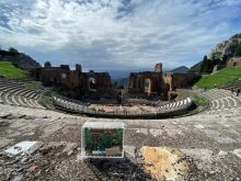
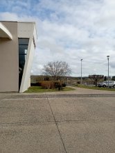
Ground level

slug
groundlevel

Measurement_ff996a87-b7e1-4d89-ad4e-201476517901

Measured radiation

0.458 µSv/h
geolocalisation :

43.297978333333, 5.3702166666667

Ground level
Fanche
ATYPICAL MEASURE
Measurement date :
Latitude :
43.297978333333
Longitude :
5.3702166666667
Altitude (M) :
21.0
Measurement time :
1 minutes 1 secondes
Distance travelled :
21.01m
Measurement speed :
Measurement Environment :
Sur la route ontheroad
Weather :
Tags :
Description :
Temperature :
Hits number :
153
Mesure UUID :
ff996a87-b7e1-4d89-ad4e-201476517901
Manual Reporting :
No
Sensor / ID :
safecast_id 2340
Sensor / Firmware version :
$BNRDD
Sensor / Type :
Sensor / Tube type :
Smartphone / UUID :
Smartphone / Platform :
Smartphone / Model :
Smartphone / OS Version :
Position acurracy :
8.0
Measurement height above the ground (in meters) :
1.00
Altitude accuracy :
8.0
Mean qualification :
Ground level
Software version :
openradiation.net/upload v0.9
Measured value :
0.458 µSv/h

Measurement_ff71e49e-9295-4c5b-ab35-e01496858711

Measured radiation

0.308 µSv/h
geolocalisation :

46.023108333333, 1.441555

Ground level
Fanche
ATYPICAL MEASURE
Measurement date :
Latitude :
46.023108333333
Longitude :
1.441555
Altitude (M) :
548.0
Measurement time :
1 minutes
Distance travelled :
789.74m
Measurement speed :
Measurement Environment :
Sur la route ontheroad
Weather :
Tags :
Description :
Temperature :
Hits number :
103
Mesure UUID :
ff71e49e-9295-4c5b-ab35-e01496858711
Manual Reporting :
No
Sensor / ID :
safecast_id 2340
Sensor / Firmware version :
$BNRDD
Sensor / Type :
Sensor / Tube type :
Smartphone / UUID :
Smartphone / Platform :
Smartphone / Model :
Smartphone / OS Version :
Position acurracy :
9.0
Measurement height above the ground (in meters) :
1.00
Altitude accuracy :
9.0
Mean qualification :
Ground level
Software version :
openradiation.net/upload v0.9
Measured value :
0.308 µSv/h

Measurement_ffdec57a-8aa2-45c3-a219-0d1496901394

Measured radiation

0.323 µSv/h
geolocalisation :

45.998636666667, 1.3948033333333

Ground level
Fanche
ATYPICAL MEASURE
Measurement date :
Latitude :
45.998636666667
Longitude :
1.3948033333333
Altitude (M) :
566.0
Measurement time :
1 minutes
Distance travelled :
230.33m
Measurement speed :
Measurement Environment :
Sur la route ontheroad
Weather :
Tags :
Description :
Temperature :
Hits number :
108
Mesure UUID :
ffdec57a-8aa2-45c3-a219-0d1496901394
Manual Reporting :
No
Sensor / ID :
safecast_id 2340
Sensor / Firmware version :
$BNRDD
Sensor / Type :
Sensor / Tube type :
Smartphone / UUID :
Smartphone / Platform :
Smartphone / Model :
Smartphone / OS Version :
Position acurracy :
9.0
Measurement height above the ground (in meters) :
1.00
Altitude accuracy :
9.0
Mean qualification :
Ground level
Software version :
openradiation.net/upload v0.9
Measured value :
0.323 µSv/h

Measurement_ffdec57a-8aa2-45c3-a219-0d1496902237

Measured radiation

0.332 µSv/h
geolocalisation :

46.055901666667, 1.4176516666667

Ground level
Fanche
ATYPICAL MEASURE
Measurement date :
Latitude :
46.055901666667
Longitude :
1.4176516666667
Altitude (M) :
612.0
Measurement time :
1 minutes
Distance travelled :
212.73m
Measurement speed :
Measurement Environment :
Sur la route ontheroad
Weather :
Tags :
Description :
Temperature :
Hits number :
111
Mesure UUID :
ffdec57a-8aa2-45c3-a219-0d1496902237
Manual Reporting :
No
Sensor / ID :
safecast_id 2340
Sensor / Firmware version :
$BNRDD
Sensor / Type :
Sensor / Tube type :
Smartphone / UUID :
Smartphone / Platform :
Smartphone / Model :
Smartphone / OS Version :
Position acurracy :
7.0
Measurement height above the ground (in meters) :
1.00
Altitude accuracy :
7.0
Mean qualification :
Ground level
Software version :
openradiation.net/upload v0.9
Measured value :
0.332 µSv/h

Measurement_ff2b52aa-5438-4080-a426-2d1526578709

Measured radiation

1.057 µSv/h
geolocalisation :

48.60192, 2.0884533333333

Ground level
Fanche
ATYPICAL MEASURE
Measurement date :
Latitude :
48.60192
Longitude :
2.0884533333333
Altitude (M) :
98.0
Measurement time :
1 minutes
Distance travelled :
1.96m
Measurement speed :
Measurement Environment :
Sur la route ontheroad
Weather :
Tags :
Description :
Temperature :
Hits number :
353
Mesure UUID :
ff2b52aa-5438-4080-a426-2d1526578709
Manual Reporting :
No
Sensor / ID :
safecast_id 2340
Sensor / Firmware version :
$BNRDD
Sensor / Type :
Sensor / Tube type :
Smartphone / UUID :
Smartphone / Platform :
Smartphone / Model :
Smartphone / OS Version :
Position acurracy :
4.0
Measurement height above the ground (in meters) :
1.00
Altitude accuracy :
4.0
Mean qualification :
Ground level
Software version :
openradiation.net/upload v0.9
Measured value :
1.057 µSv/h

Measurement_ff2b52aa-5438-4080-a426-2d1526578769

Measured radiation

1.323 µSv/h
geolocalisation :

48.601908333333, 2.0884733333333

Ground level
Fanche
ATYPICAL MEASURE
Measurement date :
Latitude :
48.601908333333
Longitude :
2.0884733333333
Altitude (M) :
97.0
Measurement time :
1 minutes
Distance travelled :
6.46m
Measurement speed :
Measurement Environment :
Sur la route ontheroad
Weather :
Tags :
Description :
Temperature :
Hits number :
442
Mesure UUID :
ff2b52aa-5438-4080-a426-2d1526578769
Manual Reporting :
No
Sensor / ID :
safecast_id 2340
Sensor / Firmware version :
$BNRDD
Sensor / Type :
Sensor / Tube type :
Smartphone / UUID :
Smartphone / Platform :
Smartphone / Model :
Smartphone / OS Version :
Position acurracy :
4.0
Measurement height above the ground (in meters) :
1.00
Altitude accuracy :
4.0
Mean qualification :
Ground level
Software version :
openradiation.net/upload v0.9
Measured value :
1.323 µSv/h