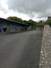
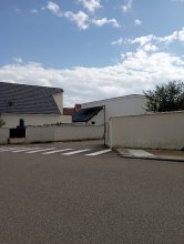
Ground level

slug
groundlevel

Measurement_ffb394b8-3855-41e3-a7d3-2e1725269582

Measured radiation

0.446 µSv/h
geolocalisation :

52.29732, 10.4691

Ground level
Fanche
ATYPICAL MEASURE
Measurement date :
Latitude :
52.29732
Longitude :
10.4691
Altitude (M) :
64.0
Measurement time :
1 minutes
Distance travelled :
0.00m
Measurement speed :
Measurement Environment :
En campagne countryside
Weather :
Tags :
Description :
Temperature :
Hits number :
149
Mesure UUID :
ffb394b8-3855-41e3-a7d3-2e1725269582
Manual Reporting :
No
Sensor / ID :
safecast_id 1225
Sensor / Firmware version :
$BNRDD
Sensor / Type :
Sensor / Tube type :
Smartphone / UUID :
Smartphone / Platform :
Smartphone / Model :
Smartphone / OS Version :
Position acurracy :
9.0
Measurement height above the ground (in meters) :
1.00
Altitude accuracy :
9.0
Mean qualification :
Ground level
Software version :
openradiation.net/upload v0.9
Measured value :
0.446 µSv/h

Measurement_ffb394b8-3855-41e3-a7d3-2e1725269642

Measured radiation

0.413 µSv/h
geolocalisation :

52.29732, 10.4691

Ground level
Fanche
ATYPICAL MEASURE
Measurement date :
Latitude :
52.29732
Longitude :
10.4691
Altitude (M) :
64.0
Measurement time :
1 minutes 1 secondes
Distance travelled :
1.52m
Measurement speed :
Measurement Environment :
En campagne countryside
Weather :
Tags :
Description :
Temperature :
Hits number :
138
Mesure UUID :
ffb394b8-3855-41e3-a7d3-2e1725269642
Manual Reporting :
No
Sensor / ID :
safecast_id 1225
Sensor / Firmware version :
$BNRDD
Sensor / Type :
Sensor / Tube type :
Smartphone / UUID :
Smartphone / Platform :
Smartphone / Model :
Smartphone / OS Version :
Position acurracy :
9.0
Measurement height above the ground (in meters) :
1.00
Altitude accuracy :
9.0
Mean qualification :
Ground level
Software version :
openradiation.net/upload v0.9
Measured value :
0.413 µSv/h

Measurement_ffb394b8-3855-41e3-a7d3-2e1725269703

Measured radiation

0.404 µSv/h
geolocalisation :

52.297308333333, 10.469088333333

Ground level
Fanche
ATYPICAL MEASURE
Measurement date :
Latitude :
52.297308333333
Longitude :
10.469088333333
Altitude (M) :
61.0
Measurement time :
1 minutes
Distance travelled :
0.97m
Measurement speed :
Measurement Environment :
En campagne countryside
Weather :
Tags :
Description :
Temperature :
Hits number :
135
Mesure UUID :
ffb394b8-3855-41e3-a7d3-2e1725269703
Manual Reporting :
No
Sensor / ID :
safecast_id 1225
Sensor / Firmware version :
$BNRDD
Sensor / Type :
Sensor / Tube type :
Smartphone / UUID :
Smartphone / Platform :
Smartphone / Model :
Smartphone / OS Version :
Position acurracy :
9.0
Measurement height above the ground (in meters) :
1.00
Altitude accuracy :
9.0
Mean qualification :
Ground level
Software version :
openradiation.net/upload v0.9
Measured value :
0.404 µSv/h

Measurement_ffb394b8-3855-41e3-a7d3-2e1725269763

Measured radiation

0.395 µSv/h
geolocalisation :

52.297313333333, 10.469076666667

Ground level
Fanche
ATYPICAL MEASURE
Measurement date :
Latitude :
52.297313333333
Longitude :
10.469076666667
Altitude (M) :
62.0
Measurement time :
1 minutes
Distance travelled :
0.75m
Measurement speed :
Measurement Environment :
En campagne countryside
Weather :
Tags :
Description :
Temperature :
Hits number :
132
Mesure UUID :
ffb394b8-3855-41e3-a7d3-2e1725269763
Manual Reporting :
No
Sensor / ID :
safecast_id 1225
Sensor / Firmware version :
$BNRDD
Sensor / Type :
Sensor / Tube type :
Smartphone / UUID :
Smartphone / Platform :
Smartphone / Model :
Smartphone / OS Version :
Position acurracy :
9.0
Measurement height above the ground (in meters) :
1.00
Altitude accuracy :
9.0
Mean qualification :
Ground level
Software version :
openradiation.net/upload v0.9
Measured value :
0.395 µSv/h

Measurement_ffb394b8-3855-41e3-a7d3-2e1725269823

Measured radiation

0.449 µSv/h
geolocalisation :

52.29732, 10.469078333333

Ground level
Fanche
ATYPICAL MEASURE
Measurement date :
Latitude :
52.29732
Longitude :
10.469078333333
Altitude (M) :
59.0
Measurement time :
1 minutes 1 secondes
Distance travelled :
0.72m
Measurement speed :
Measurement Environment :
En campagne countryside
Weather :
Tags :
Description :
Temperature :
Hits number :
150
Mesure UUID :
ffb394b8-3855-41e3-a7d3-2e1725269823
Manual Reporting :
No
Sensor / ID :
safecast_id 1225
Sensor / Firmware version :
$BNRDD
Sensor / Type :
Sensor / Tube type :
Smartphone / UUID :
Smartphone / Platform :
Smartphone / Model :
Smartphone / OS Version :
Position acurracy :
9.0
Measurement height above the ground (in meters) :
1.00
Altitude accuracy :
9.0
Mean qualification :
Ground level
Software version :
openradiation.net/upload v0.9
Measured value :
0.449 µSv/h

Measurement_ffb394b8-3855-41e3-a7d3-2e1725269884

Measured radiation

0.362 µSv/h
geolocalisation :

52.297325, 10.469085

Ground level
Fanche
ATYPICAL MEASURE
Measurement date :
Latitude :
52.297325
Longitude :
10.469085
Altitude (M) :
60.0
Measurement time :
1 minutes
Distance travelled :
0.79m
Measurement speed :
Measurement Environment :
En campagne countryside
Weather :
Tags :
Description :
Temperature :
Hits number :
121
Mesure UUID :
ffb394b8-3855-41e3-a7d3-2e1725269884
Manual Reporting :
No
Sensor / ID :
safecast_id 1225
Sensor / Firmware version :
$BNRDD
Sensor / Type :
Sensor / Tube type :
Smartphone / UUID :
Smartphone / Platform :
Smartphone / Model :
Smartphone / OS Version :
Position acurracy :
9.0
Measurement height above the ground (in meters) :
1.00
Altitude accuracy :
9.0
Mean qualification :
Ground level
Software version :
openradiation.net/upload v0.9
Measured value :
0.362 µSv/h

Measurement_ffb394b8-3855-41e3-a7d3-2e1725269944

Measured radiation

0.377 µSv/h
geolocalisation :

52.29733, 10.469093333333

Ground level
Fanche
ATYPICAL MEASURE
Measurement date :
Latitude :
52.29733
Longitude :
10.469093333333
Altitude (M) :
60.0
Measurement time :
1 minutes
Distance travelled :
2.44m
Measurement speed :
Measurement Environment :
En campagne countryside
Weather :
Tags :
Description :
Temperature :
Hits number :
126
Mesure UUID :
ffb394b8-3855-41e3-a7d3-2e1725269944
Manual Reporting :
No
Sensor / ID :
safecast_id 1225
Sensor / Firmware version :
$BNRDD
Sensor / Type :
Sensor / Tube type :
Smartphone / UUID :
Smartphone / Platform :
Smartphone / Model :
Smartphone / OS Version :
Position acurracy :
9.0
Measurement height above the ground (in meters) :
1.00
Altitude accuracy :
9.0
Mean qualification :
Ground level
Software version :
openradiation.net/upload v0.9
Measured value :
0.377 µSv/h

Measurement_ffb394b8-3855-41e3-a7d3-2e1725270004

Measured radiation

0.389 µSv/h
geolocalisation :

52.297351666667, 10.469098333333

Ground level
Fanche
ATYPICAL MEASURE
Measurement date :
Latitude :
52.297351666667
Longitude :
10.469098333333
Altitude (M) :
59.0
Measurement time :
1 minutes 1 secondes
Distance travelled :
0.96m
Measurement speed :
Measurement Environment :
En campagne countryside
Weather :
Tags :
Description :
Temperature :
Hits number :
130
Mesure UUID :
ffb394b8-3855-41e3-a7d3-2e1725270004
Manual Reporting :
No
Sensor / ID :
safecast_id 1225
Sensor / Firmware version :
$BNRDD
Sensor / Type :
Sensor / Tube type :
Smartphone / UUID :
Smartphone / Platform :
Smartphone / Model :
Smartphone / OS Version :
Position acurracy :
9.0
Measurement height above the ground (in meters) :
1.00
Altitude accuracy :
9.0
Mean qualification :
Ground level
Software version :
openradiation.net/upload v0.9
Measured value :
0.389 µSv/h

Measurement_ffb394b8-3855-41e3-a7d3-2e1725270065

Measured radiation

0.413 µSv/h
geolocalisation :

52.29736, 10.469095

Ground level
Fanche
ATYPICAL MEASURE
Measurement date :
Latitude :
52.29736
Longitude :
10.469095
Altitude (M) :
61.0
Measurement time :
1 minutes
Distance travelled :
1.59m
Measurement speed :
Measurement Environment :
En campagne countryside
Weather :
Tags :
Description :
Temperature :
Hits number :
138
Mesure UUID :
ffb394b8-3855-41e3-a7d3-2e1725270065
Manual Reporting :
No
Sensor / ID :
safecast_id 1225
Sensor / Firmware version :
$BNRDD
Sensor / Type :
Sensor / Tube type :
Smartphone / UUID :
Smartphone / Platform :
Smartphone / Model :
Smartphone / OS Version :
Position acurracy :
10.0
Measurement height above the ground (in meters) :
1.00
Altitude accuracy :
10.0
Mean qualification :
Ground level
Software version :
openradiation.net/upload v0.9
Measured value :
0.413 µSv/h

Measurement_ffb394b8-3855-41e3-a7d3-2e1725282656

Measured radiation

0.530 µSv/h
geolocalisation :

52.29735, 10.469131666667

Ground level
Fanche
ATYPICAL MEASURE
Measurement date :
Latitude :
52.29735
Longitude :
10.469131666667
Altitude (M) :
62.0
Measurement time :
1 minutes
Distance travelled :
2.83m
Measurement speed :
Measurement Environment :
En campagne countryside
Weather :
Tags :
Description :
Temperature :
Hits number :
177
Mesure UUID :
ffb394b8-3855-41e3-a7d3-2e1725282656
Manual Reporting :
No
Sensor / ID :
safecast_id 1225
Sensor / Firmware version :
$BNRDD
Sensor / Type :
Sensor / Tube type :
Smartphone / UUID :
Smartphone / Platform :
Smartphone / Model :
Smartphone / OS Version :
Position acurracy :
11.0
Measurement height above the ground (in meters) :
1.00
Altitude accuracy :
11.0
Mean qualification :
Ground level
Software version :
openradiation.net/upload v0.9
Measured value :
0.530 µSv/h