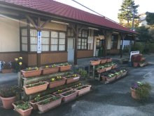


countryside

icone_mesure
slug
countryside

Measurement_a31dfe31-99fa-4130-990e-7d35fa73872d

Measured radiation

0.112 µSv/h
geolocalisation :

36.993112606031, 140.62163575566

Ground level
NPOFD01
Date de la mesure :
Latitude :
36.993112606031
Longitude :
140.62163575566
Altitude (M) :
451.0
Measurement time :
3 minutes 21 secondes
Distance travelled :
63.08m
Measurement speed :
Measurement Environment :
En campagne countryside
Weather :
rainy day Pluie
Tags :
Description :
measurment image
Temperature :
30.0°C
Hits number :
59
Mesure UUID :
a31dfe31-99fa-4130-990e-7d35fa73872d
Manual Reporting :
No
Sensor / ID :
f6112d65
Sensor / Firmware version :
RiumGM BLE -b
Sensor / Type :
Sensor / Tube type :
J305γβ
Smartphone / UUID :
6F50EDF0-C177-4413-9D89-A6FE7E4A7639
Smartphone / Platform :
iOS
Smartphone / Model :
iPhone14,6
Smartphone / OS Version :
17.5.1
Position acurracy :
4.0
Measurement height above the ground (in meters) :
1.00
Altitude accuracy :
4.0
Mean qualification :
Ground level
Software version :
OpenRadiation app 2.3.4
Measured value :
0.112 µSv/h

Measurement_0b747e1b-6ef6-445d-842b-556a03641c32

Measured radiation

0.115 µSv/h
geolocalisation :

49.393570958811, 1.0547157622444

Ground level
REP-Rouen2023
Date de la mesure :
Latitude :
49.393570958811
Longitude :
1.0547157622444
Altitude (M) :
65.0
Measurement time :
2 minutes 54 secondes
Distance travelled :
0.00m
Measurement speed :
Measurement Environment :
En campagne countryside
Weather :
Tags :
Description :
measurment image
Temperature :
22.0°C
Hits number :
52
Mesure UUID :
0b747e1b-6ef6-445d-842b-556a03641c32
Manual Reporting :
No
Sensor / ID :
6b3f95e2
Sensor / Firmware version :
RiumGM BLE -b
Sensor / Type :
Sensor / Tube type :
J305γβ
Smartphone / UUID :
14B67E76-D12D-4011-966B-6476AE1E7EEE
Smartphone / Platform :
iOS
Smartphone / Model :
iPhone9,3
Smartphone / OS Version :
15.7.5
Position acurracy :
35.0
Measurement height above the ground (in meters) :
1.00
Altitude accuracy :
35.0
Mean qualification :
Ground level
Software version :
OpenRadiation app 2.3.4
Measured value :
0.115 µSv/h

Measurement_c4cdd3db-acac-4562-82ad-f87cee2a89b3

Measured radiation

0.061 µSv/h
geolocalisation :

44.626946291492, 4.7492740093009

Ground level
Date de la mesure :
Latitude :
44.626946291492
Longitude :
4.7492740093009
Altitude (M) :
65.0
Measurement time :
3 minutes 1 secondes
Distance travelled :
3.50m
Measurement speed :
Measurement Environment :
En campagne countryside
Weather :
rainy day Pluie
Tags :
Description :
Temperature :
14.0°C
Hits number :
54
Mesure UUID :
c4cdd3db-acac-4562-82ad-f87cee2a89b3
Manual Reporting :
No
Sensor / ID :
00193
Sensor / Firmware version :
OpengKIT71
Sensor / Type :
Sensor / Tube type :
SBM-20
Smartphone / UUID :
78B035B2-14E3-48A1-8F11-841EA591211D
Smartphone / Platform :
iOS
Smartphone / Model :
iPhone9,3
Smartphone / OS Version :
13.3
Position acurracy :
24.0
Measurement height above the ground (in meters) :
0.00
Altitude accuracy :
24.0
Mean qualification :
Ground level
Software version :
OpenRadiation app 2.3.1
Measured value :
0.061 µSv/h

Measurement_21a32df5-68b2-438f-b8ed-d541223d1b89

Measured radiation

0.058 µSv/h
geolocalisation :

48.6112887, -1.5056472

Ground level
Kuistroff
Date de la mesure :
Latitude :
48.6112887
Longitude :
-1.5056472
Altitude (M) :
-14.0
Measurement time :
3 minutes 35 secondes
Distance travelled :
Measurement speed :
Measurement Environment :
En campagne countryside
Weather :
Tags :
Description :
Temperature :
Hits number :
62
Mesure UUID :
21a32df5-68b2-438f-b8ed-d541223d1b89
Manual Reporting :
No
Sensor / ID :
000108
Sensor / Firmware version :
OG-KIT1
Sensor / Type :
Sensor / Tube type :
SBM-20
Smartphone / UUID :
4F7BE08C-C43E-495C-996A-6E4CB91035C8
Smartphone / Platform :
iOS
Smartphone / Model :
iPhone9,3
Smartphone / OS Version :
11.0.1
Position acurracy :
48.0
Measurement height above the ground (in meters) :
1.00
Altitude accuracy :
48.0
Mean qualification :
Ground level
Software version :
OpenRadiation app 1.0.0
Measured value :
0.058 µSv/h

Measurement_67d7617b-feec-42fd-be78-10548d2ee254

Measured radiation

8.448 µSv/h
geolocalisation :

37.413475954625, 140.9853976808

Ground level
sirse31
ATYPICAL MEASURE
Date de la mesure :
Latitude :
37.413475954625
Longitude :
140.9853976808
Altitude (M) :
74.0
Measurement time :
52 secondes
Distance travelled :
12.48m
Measurement speed :
Measurement Environment :
En campagne countryside
Weather :
Tags :
Description :
site G Fukushima comparaison spectro in situ
measurment image
Temperature :
28.0°C
Hits number :
1009
Mesure UUID :
67d7617b-feec-42fd-be78-10548d2ee254
Manual Reporting :
No
Sensor / ID :
00170
Sensor / Firmware version :
OpengKIT71
Sensor / Type :
Sensor / Tube type :
SBM-20
Smartphone / UUID :
383B87B9-BE22-43ED-AEDF-1FAC257116B1
Smartphone / Platform :
iOS
Smartphone / Model :
iPhone10,5
Smartphone / OS Version :
13.1.2
Position acurracy :
64.0
Measurement height above the ground (in meters) :
1.00
Altitude accuracy :
64.0
Mean qualification :
Ground level
Software version :
OpenRadiation app 2.3.1
Measured value :
8.448 µSv/h

Measurement_9a8f835d-65c0-45f9-bd07-08137ae29e32

Measured radiation

0.331 µSv/h
geolocalisation :

48.7184356, -3.8178585

Ground level
FQopenrad
ATYPICAL MEASURE
Date de la mesure :
Latitude :
48.7184356
Longitude :
-3.8178585
Altitude (M) :
39.0
Measurement time :
1 minutes 4 secondes
Distance travelled :
Measurement speed :
Measurement Environment :
En campagne countryside
Weather :
Tags :
Description :
Temperature :
Hits number :
63
Mesure UUID :
9a8f835d-65c0-45f9-bd07-08137ae29e32
Manual Reporting :
No
Sensor / ID :
000113
Sensor / Firmware version :
OG-KIT1
Sensor / Type :
Sensor / Tube type :
SBM-20
Smartphone / UUID :
e588d7b88ff38a5e
Smartphone / Platform :
Android
Smartphone / Model :
SM-N9500
Smartphone / OS Version :
8.0.0
Position acurracy :
7.5
Measurement height above the ground (in meters) :
0.00
Altitude accuracy :
7.5
Mean qualification :
Ground level
Software version :
OpenRadiation app 1.0.0
Measured value :
0.331 µSv/h

Measurement_1be16664-eaba-4221-91f9-d014e255c7f7

Measured radiation

0.064 µSv/h
geolocalisation :

48.635970482354, -2.0537901227523

Ground level
Date de la mesure :
Latitude :
48.635970482354
Longitude :
-2.0537901227523
Altitude (M) :
7.0
Measurement time :
3 minutes 57 secondes
Distance travelled :
196.55m
Measurement speed :
Measurement Environment :
En campagne countryside
Weather :
Tags :
Description :
Temperature :
47.0°C
Hits number :
72
Mesure UUID :
1be16664-eaba-4221-91f9-d014e255c7f7
Manual Reporting :
No
Sensor / ID :
00176
Sensor / Firmware version :
OpengKIT71
Sensor / Type :
Sensor / Tube type :
SBM-20
Smartphone / UUID :
A11C3259-CB85-4860-AEFB-7476815277ED
Smartphone / Platform :
iOS
Smartphone / Model :
iPhone8,4
Smartphone / OS Version :
11.4.1
Position acurracy :
165.0
Measurement height above the ground (in meters) :
0.00
Altitude accuracy :
165.0
Mean qualification :
Ground level
Software version :
OpenRadiation app 2.2.0
Measured value :
0.064 µSv/h

Measurement_48f48ef3-d89d-496b-83d3-d0f3f24c2677

Measured radiation

0.073 µSv/h
geolocalisation :

47.9150821, 7.5348198

Ground level
Date de la mesure :
Latitude :
47.9150821
Longitude :
7.5348198
Altitude (M) :
Measurement time :
4 minutes 48 secondes
Distance travelled :
0.00m
Measurement speed :
Measurement Environment :
En campagne countryside
Weather :
Tags :
Description :
Temperature :
29.0°C
Hits number :
94
Mesure UUID :
48f48ef3-d89d-496b-83d3-d0f3f24c2677
Manual Reporting :
No
Sensor / ID :
00158
Sensor / Firmware version :
OpengKIT71
Sensor / Type :
Sensor / Tube type :
SBM-20
Smartphone / UUID :
c60a41b8b27c5b41
Smartphone / Platform :
Android
Smartphone / Model :
SM-G955F
Smartphone / OS Version :
8.0.0
Position acurracy :
2100.0
Measurement height above the ground (in meters) :
1.00
Altitude accuracy :
2100.0
Mean qualification :
Ground level
Software version :
OpenRadiation app 2.1.0
Measured value :
0.073 µSv/h

Measurement_d590a29c-9a1f-4491-a7b1-ba307d03cc54

Measured radiation

0.121 µSv/h
geolocalisation :

37.172546521795, 140.99525531767

Ground level
NPOFD01
Date de la mesure :
Latitude :
37.172546521795
Longitude :
140.99525531767
Altitude (M) :
21.0
Measurement time :
4 minutes 39 secondes
Distance travelled :
22.93m
Measurement speed :
Measurement Environment :
En campagne countryside
Weather :
Tags :
Description :
Surtsugistation

measurment image
Temperature :
30.0°C
Hits number :
87
Mesure UUID :
d590a29c-9a1f-4491-a7b1-ba307d03cc54
Manual Reporting :
No
Sensor / ID :
4e233779
Sensor / Firmware version :
RiumGM BLE -b
Sensor / Type :
Sensor / Tube type :
J305γβ
Smartphone / UUID :
6F50EDF0-C177-4413-9D89-A6FE7E4A7639
Smartphone / Platform :
iOS
Smartphone / Model :
iPhone14,6
Smartphone / OS Version :
17.4.1
Position acurracy :
3.5
Measurement height above the ground (in meters) :
1.00
Altitude accuracy :
3.5
Mean qualification :
Ground level
Software version :
OpenRadiation app 2.3.4
Measured value :
0.121 µSv/h

Measurement_ffd2d8a4-017d-46e1-a157-6c1682675039

Measured radiation

0.135 µSv/h
geolocalisation :

47.522438333333, -2.7650183333333

Ground level
Fanche
Date de la mesure :
Latitude :
47.522438333333
Longitude :
-2.7650183333333
Altitude (M) :
12.0
Measurement time :
1 minutes
Distance travelled :
1330.15m
Measurement speed :
Measurement Environment :
En campagne countryside
Weather :
Tags :
Description :
Temperature :
Hits number :
45
Mesure UUID :
ffd2d8a4-017d-46e1-a157-6c1682675039
Manual Reporting :
No
Sensor / ID :
safecast_id 3220
Sensor / Firmware version :
$BNRDD
Sensor / Type :
Sensor / Tube type :
Smartphone / UUID :
Smartphone / Platform :
Smartphone / Model :
Smartphone / OS Version :
Position acurracy :
11.0
Measurement height above the ground (in meters) :
1.00
Altitude accuracy :
11.0
Mean qualification :
Ground level
Software version :
openradiation.net/upload v0.9
Measured value :
0.135 µSv/h