


countryside

icone_mesure
slug
countryside

Measurement_ff4021e1-18ea-48d5-a5db-9d1441723871

Measured radiation

0.210 µSv/h
geolocalisation :

50.948351666667, 2.1080516666667

Ground level
Fanche
ATYPICAL MEASURE
Date de la mesure :
Latitude :
50.948351666667
Longitude :
2.1080516666667
Altitude (M) :
-1.0
Measurement time :
1 minutes 1 secondes
Distance travelled :
1440.55m
Measurement speed :
Measurement Environment :
En campagne countryside
Weather :
Tags :
Description :
Temperature :
Hits number :
70
Mesure UUID :
ff4021e1-18ea-48d5-a5db-9d1441723871
Manual Reporting :
No
Sensor / ID :
safecast_id 2344
Sensor / Firmware version :
$BNRDD
Sensor / Type :
Sensor / Tube type :
Smartphone / UUID :
Smartphone / Platform :
Smartphone / Model :
Smartphone / OS Version :
Position acurracy :
10.0
Measurement height above the ground (in meters) :
1.00
Altitude accuracy :
10.0
Mean qualification :
Ground level
Software version :
openradiation.net/upload v0.9
Measured value :
0.210 µSv/h
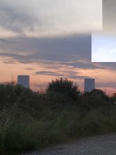
Measurement_70bfd9ba-fbcd-4846-9a53-02ec04a01e1d

Measured radiation

0.123 µSv/h
geolocalisation :

42.6104411, 9.4831754

Ground level
giocante1
Date de la mesure :
Latitude :
42.6104411
Longitude :
9.4831754
Altitude (M) :
60.0
Measurement time :
6 minutes 38 secondes
Distance travelled :
4.19m
Measurement speed :
Measurement Environment :
En campagne countryside
Weather :
Tags :
Description :
Temperature :
28.0°C
Hits number :
126
Mesure UUID :
70bfd9ba-fbcd-4846-9a53-02ec04a01e1d
Manual Reporting :
No
Sensor / ID :
1171483831
Sensor / Firmware version :
RiumGm
Sensor / Type :
Sensor / Tube type :
J305γβ
Smartphone / UUID :
57fcd8dae515e6ed
Smartphone / Platform :
Android
Smartphone / Model :
SM-A105FN
Smartphone / OS Version :
9
Position acurracy :
12.0
Measurement height above the ground (in meters) :
1.00
Altitude accuracy :
12.0
Mean qualification :
Ground level
Software version :
OpenRadiation app 2.3.1
Measured value :
0.123 µSv/h

Measurement_11f3143e-30b3-49d7-92f2-ff3bd9c156ad

Measured radiation

0.111 µSv/h
geolocalisation :

42.5659942, 9.5220143

Ground level
giocante1
Date de la mesure :
Latitude :
42.5659942
Longitude :
9.5220143
Altitude (M) :
53.0
Measurement time :
5 minutes 9 secondes
Distance travelled :
0.74m
Measurement speed :
Measurement Environment :
En campagne countryside
Weather :
Tags :
Description :
Temperature :
27.0°C
Hits number :
90
Mesure UUID :
11f3143e-30b3-49d7-92f2-ff3bd9c156ad
Manual Reporting :
No
Sensor / ID :
1171483831
Sensor / Firmware version :
RiumGm
Sensor / Type :
Sensor / Tube type :
J305γβ
Smartphone / UUID :
57fcd8dae515e6ed
Smartphone / Platform :
Android
Smartphone / Model :
SM-A105FN
Smartphone / OS Version :
9
Position acurracy :
6.5
Measurement height above the ground (in meters) :
Altitude accuracy :
6.5
Mean qualification :
Ground level
Software version :
OpenRadiation app 2.3.1
Measured value :
0.111 µSv/h

Measurement_ffcc5d99-c440-48a7-abd0-aa1496674450

Measured radiation

0.110 µSv/h
geolocalisation :

46.337306666667, 2.574405

Ground level
goldi
Date de la mesure :
Latitude :
46.337306666667
Longitude :
2.574405
Altitude (M) :
216.0
Measurement time :
1 minutes
Distance travelled :
Measurement speed :
Measurement Environment :
En campagne countryside
Weather :
Tags :
Description :
Temperature :
Hits number :
36
Mesure UUID :
ffcc5d99-c440-48a7-abd0-aa1496674450
Manual Reporting :
No
Sensor / ID :
safecast_id 1234
Sensor / Firmware version :
$BNRDD
Sensor / Type :
Sensor / Tube type :
Smartphone / UUID :
Smartphone / Platform :
Smartphone / Model :
Smartphone / OS Version :
Position acurracy :
10.0
Measurement height above the ground (in meters) :
1.00
Altitude accuracy :
10.0
Mean qualification :
Ground level
Software version :
openradiation.net/upload v0.2.0
Measured value :
0.110 µSv/h

Measurement_ff5d5cd2-6f47-4a16-a43b-111442080038

Measured radiation

0.147 µSv/h
geolocalisation :

49.855616666667, 2.8328866666667

Ground level
Fanche
Date de la mesure :
Latitude :
49.855616666667
Longitude :
2.8328866666667
Altitude (M) :
88.0
Measurement time :
1 minutes 1 secondes
Distance travelled :
1743.77m
Measurement speed :
Measurement Environment :
En campagne countryside
Weather :
Tags :
Description :
Temperature :
Hits number :
49
Mesure UUID :
ff5d5cd2-6f47-4a16-a43b-111442080038
Manual Reporting :
No
Sensor / ID :
safecast_id 2344
Sensor / Firmware version :
$BNRDD
Sensor / Type :
Sensor / Tube type :
Smartphone / UUID :
Smartphone / Platform :
Smartphone / Model :
Smartphone / OS Version :
Position acurracy :
10.0
Measurement height above the ground (in meters) :
1.00
Altitude accuracy :
10.0
Mean qualification :
Ground level
Software version :
openradiation.net/upload v0.9
Measured value :
0.147 µSv/h

Measurement_e1e10edc-2815-4843-a11f-188b87270e2e

Measured radiation

0.059 µSv/h
geolocalisation :

44.1027174, 0.8783984

Ground level
Nala
Date de la mesure :
Latitude :
44.1027174
Longitude :
0.8783984
Altitude (M) :
110.0
Measurement time :
2 minutes 51 secondes
Distance travelled :
4.25m
Measurement speed :
Measurement Environment :
En campagne countryside
Weather :
Tags :
Description :
A proximité de la centrale nucléaire de Golfech
measurment image
Temperature :
28.0°C
Hits number :
50
Mesure UUID :
e1e10edc-2815-4843-a11f-188b87270e2e
Manual Reporting :
No
Sensor / ID :
00230
Sensor / Firmware version :
OpengKIT71
Sensor / Type :
Sensor / Tube type :
SBM-20
Smartphone / UUID :
963626a73b573742
Smartphone / Platform :
Android
Smartphone / Model :
Redmi Note 6 Pro
Smartphone / OS Version :
9
Position acurracy :
5.5
Measurement height above the ground (in meters) :
1.00
Altitude accuracy :
5.5
Mean qualification :
Ground level
Software version :
OpenRadiation app 2.3.4
Measured value :
0.059 µSv/h

Measurement_2913a484-3ecc-4370-a26b-be3116eedb81

Measured radiation

2.964 µSv/h
geolocalisation :

47.256680681451, -2.2417624471882

Ground level
RM07
ATYPICAL MEASURE
Date de la mesure :
Latitude :
47.256680681451
Longitude :
-2.2417624471881
Altitude (M) :
4.0
Measurement time :
10 secondes
Distance travelled :
0.19m
Measurement speed :
Measurement Environment :
En campagne countryside
Weather :
Tags :
Description :
crique trebezy
measurment image
Temperature :
15.0°C
Hits number :
61
Mesure UUID :
2913a484-3ecc-4370-a26b-be3116eedb81
Manual Reporting :
No
Sensor / ID :
5c40d10c
Sensor / Firmware version :
RiumGM BLE -b
Sensor / Type :
Sensor / Tube type :
J305γβ
Smartphone / UUID :
DA49CEFC-6BEE-4BDB-ADEB-DD00B53559AD
Smartphone / Platform :
iOS
Smartphone / Model :
iPhone10,3
Smartphone / OS Version :
16.2
Position acurracy :
1414.0
Measurement height above the ground (in meters) :
0.00
Altitude accuracy :
1414.0
Mean qualification :
Ground level
Software version :
OpenRadiation app 2.3.4
Measured value :
2.964 µSv/h

Measurement_dc784bba-3a66-48cb-bbc2-801298db2143

Measured radiation

0.346 µSv/h
geolocalisation :

47.247161208696, -2.260720320048

Ground level
RM07
ATYPICAL MEASURE
Date de la mesure :
Latitude :
47.247161208696
Longitude :
-2.2607203200481
Altitude (M) :
5.0
Measurement time :
1 minutes 10 secondes
Distance travelled :
3.51m
Measurement speed :
Measurement Environment :
En campagne countryside
Weather :
Tags :
Description :
roche locale
measurment image
Temperature :
17.0°C
Hits number :
54
Mesure UUID :
dc784bba-3a66-48cb-bbc2-801298db2143
Manual Reporting :
No
Sensor / ID :
5c40d10c
Sensor / Firmware version :
RiumGM BLE -b
Sensor / Type :
Sensor / Tube type :
J305γβ
Smartphone / UUID :
DA49CEFC-6BEE-4BDB-ADEB-DD00B53559AD
Smartphone / Platform :
iOS
Smartphone / Model :
iPhone10,3
Smartphone / OS Version :
16.2
Position acurracy :
10.0
Measurement height above the ground (in meters) :
1.00
Altitude accuracy :
10.0
Mean qualification :
Ground level
Software version :
OpenRadiation app 2.3.4
Measured value :
0.346 µSv/h

Measurement_84ed0cb5-5325-44eb-98f9-315670e3829b

Measured radiation

0.734 µSv/h
geolocalisation :

47.250580519235, -2.2563161569608

Ground level
RM07
ATYPICAL MEASURE
Date de la mesure :
Latitude :
47.250580519235
Longitude :
-2.2563161569608
Altitude (M) :
10.0
Measurement time :
41 secondes
Distance travelled :
18.19m
Measurement speed :
Measurement Environment :
En campagne countryside
Weather :
Tags :
Description :
crique Trebezy sable mixte
Temperature :
25.0°C
Hits number :
64
Mesure UUID :
84ed0cb5-5325-44eb-98f9-315670e3829b
Manual Reporting :
No
Sensor / ID :
5c40d10c
Sensor / Firmware version :
RiumGM BLE -b
Sensor / Type :
Sensor / Tube type :
J305γβ
Smartphone / UUID :
DA49CEFC-6BEE-4BDB-ADEB-DD00B53559AD
Smartphone / Platform :
iOS
Smartphone / Model :
iPhone10,3
Smartphone / OS Version :
16.2
Position acurracy :
45.6
Measurement height above the ground (in meters) :
1.00
Altitude accuracy :
45.6
Mean qualification :
Ground level
Software version :
OpenRadiation app 2.3.4
Measured value :
0.734 µSv/h

Measurement_ffc5d9ec-43aa-4840-a8ff-641450521482

Measured radiation

0.102 µSv/h
geolocalisation :

46.609728333333, 0.32680833333333

Ground level
Fanche
Date de la mesure :
Latitude :
46.609728333333
Longitude :
0.32680833333333
Altitude (M) :
115.0
Measurement time :
1 minutes
Distance travelled :
1989.41m
Measurement speed :
Measurement Environment :
En campagne countryside
Weather :
Tags :
Description :
Temperature :
Hits number :
34
Mesure UUID :
ffc5d9ec-43aa-4840-a8ff-641450521482
Manual Reporting :
No
Sensor / ID :
safecast_id 2344
Sensor / Firmware version :
$BNRDD
Sensor / Type :
Sensor / Tube type :
Smartphone / UUID :
Smartphone / Platform :
Smartphone / Model :
Smartphone / OS Version :
Position acurracy :
10.0
Measurement height above the ground (in meters) :
1.00
Altitude accuracy :
10.0
Mean qualification :
Ground level
Software version :
openradiation.net/upload v0.9
Measured value :
0.102 µSv/h