


countryside

icone_mesure
slug
countryside

Measurement_25d672cf-4fea-4843-91b0-d7c8bccb353f

Measured radiation

2.630 µSv/h
geolocalisation :

47.250109040243, -2.2574351122779

Ground level
ATYPICAL MEASURE
Date de la mesure :
Latitude :
47.250109040243
Longitude :
-2.2574351122779
Altitude (M) :
6.0
Measurement time :
38 secondes
Distance travelled :
3.78m
Measurement speed :
Measurement Environment :
En campagne countryside
Weather :
Tags :
Description :
Temperature :
19.0°C
Hits number :
218
Mesure UUID :
25d672cf-4fea-4843-91b0-d7c8bccb353f
Manual Reporting :
No
Sensor / ID :
616EF1BC-3224-F367-61E6-057A4DACA310
Sensor / Firmware version :
AtomTag v.1.0.3
Sensor / Type :
Sensor / Tube type :
SBM-20
Smartphone / UUID :
14B67E76-D12D-4011-966B-6476AE1E7EEE
Smartphone / Platform :
iOS
Smartphone / Model :
iPhone9,3
Smartphone / OS Version :
15.7.5
Position acurracy :
16.0
Measurement height above the ground (in meters) :
1.00
Altitude accuracy :
16.0
Mean qualification :
Ground level
Software version :
OpenRadiation app 2.3.4
Measured value :
2.630 µSv/h
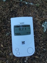
Measurement_3db3e5cb-0ab0-475c-a7c5-9786618a596c

Measured radiation

0.072 µSv/h
geolocalisation :

54.429157215576, -3.4897819518715

Ground level
Colin Wales
Date de la mesure :
Latitude :
54.429157215576
Longitude :
-3.4897819518715
Altitude (M) :
47.0
Measurement time :
3 minutes 59 secondes
Distance travelled :
0.00m
Measurement speed :
Measurement Environment :
En campagne countryside
Weather :
Tags :
Description :
Temperature :
28.0°C
Hits number :
51
Mesure UUID :
3db3e5cb-0ab0-475c-a7c5-9786618a596c
Manual Reporting :
No
Sensor / ID :
6972704c
Sensor / Firmware version :
RiumGM BLE -b
Sensor / Type :
Sensor / Tube type :
J305γβ
Smartphone / UUID :
60A31498-E2AA-4DBD-953F-5582058908F5
Smartphone / Platform :
iOS
Smartphone / Model :
iPhone9,3
Smartphone / OS Version :
14.4.2
Position acurracy :
6.0
Measurement height above the ground (in meters) :
0.00
Altitude accuracy :
6.0
Mean qualification :
Ground level
Software version :
OpenRadiation app 2.3.4
Measured value :
0.072 µSv/h

Measurement_ffd2d8a4-017d-46e1-a157-6c1682682619

Measured radiation

0.120 µSv/h
geolocalisation :

48.071098333333, -4.484905

Ground level
Fanche
Date de la mesure :
Latitude :
48.071098333333
Longitude :
-4.484905
Altitude (M) :
75.0
Measurement time :
1 minutes
Distance travelled :
1288.84m
Measurement speed :
Measurement Environment :
En campagne countryside
Weather :
Tags :
Description :
Temperature :
Hits number :
40
Mesure UUID :
ffd2d8a4-017d-46e1-a157-6c1682682619
Manual Reporting :
No
Sensor / ID :
safecast_id 3220
Sensor / Firmware version :
$BNRDD
Sensor / Type :
Sensor / Tube type :
Smartphone / UUID :
Smartphone / Platform :
Smartphone / Model :
Smartphone / OS Version :
Position acurracy :
10.0
Measurement height above the ground (in meters) :
1.00
Altitude accuracy :
10.0
Mean qualification :
Ground level
Software version :
openradiation.net/upload v0.9
Measured value :
0.120 µSv/h

Measurement_e088cdf8-a905-4975-ae20-bec6a9b1142f

Measured radiation

0.053 µSv/h
geolocalisation :

45.2025601, 6.6772651

Ground level
JCG
Date de la mesure :
Latitude :
45.2025601
Longitude :
6.6772651
Altitude (M) :
1426.0
Measurement time :
3 minutes 2 secondes
Distance travelled :
Measurement speed :
Measurement Environment :
En campagne countryside
Weather :
Tags :
Description :
Temperature :
Hits number :
50
Mesure UUID :
e088cdf8-a905-4975-ae20-bec6a9b1142f
Manual Reporting :
No
Sensor / ID :
00014
Sensor / Firmware version :
OpengKIT71
Sensor / Type :
Sensor / Tube type :
SBM-20
Smartphone / UUID :
0B736886-F086-42D8-BD0B-EC2045D10455
Smartphone / Platform :
iOS
Smartphone / Model :
iPhone6,2
Smartphone / OS Version :
10.0.2
Position acurracy :
1103.9
Measurement height above the ground (in meters) :
1.00
Altitude accuracy :
1103.9
Mean qualification :
Ground level
Software version :
OpenRadiation app 1.0.0
Measured value :
0.053 µSv/h

Measurement_038dda61-6964-4a3c-8b89-895ecd4969bf

Measured radiation

0.210 µSv/h
geolocalisation :

45.170718706255, 6.6492623649599

Ground level
PTFCJB
ATYPICAL MEASURE
Date de la mesure :
Latitude :
45.170718706255
Longitude :
6.6492623649599
Altitude (M) :
1531.0
Measurement time :
4 minutes
Distance travelled :
0.00m
Measurement speed :
Measurement Environment :
En campagne countryside
Weather :
Tags :
Description :
au bord du ruisseau charmaix station val frejus
measurment image
Temperature :
Hits number :
Mesure UUID :
038dda61-6964-4a3c-8b89-895ecd4969bf
Manual Reporting :
Yes
Sensor / ID :
Sensor / Firmware version :
Sensor / Type :
Sensor / Tube type :
Smartphone / UUID :
ACA0F7CE-767E-48DA-AAD9-84C5935EDDE9
Smartphone / Platform :
iOS
Smartphone / Model :
iPhone8,4
Smartphone / OS Version :
12.1.2
Position acurracy :
221.2
Measurement height above the ground (in meters) :
0.00
Altitude accuracy :
221.2
Mean qualification :
Ground level
Software version :
OpenRadiation app 2.3.0
Measured value :
0.210 µSv/h

Measurement_3965541c-7e7b-4979-aa39-e8e0e2f14ac2

Measured radiation

0.126 µSv/h
geolocalisation :

51.875173721844, 0.24509925109184

Ground level
Date de la mesure :
Latitude :
51.875173721844
Longitude :
0.24509925109184
Altitude (M) :
94.0
Measurement time :
2 minutes 51 secondes
Distance travelled :
0.00m
Measurement speed :
Measurement Environment :
En campagne countryside
Weather :
Tags :
Description :
Temperature :
26.0°C
Hits number :
55
Mesure UUID :
3965541c-7e7b-4979-aa39-e8e0e2f14ac2
Manual Reporting :
No
Sensor / ID :
6972704c
Sensor / Firmware version :
RiumGM BLE -b
Sensor / Type :
Sensor / Tube type :
J305γβ
Smartphone / UUID :
60A31498-E2AA-4DBD-953F-5582058908F5
Smartphone / Platform :
iOS
Smartphone / Model :
iPhone9,3
Smartphone / OS Version :
15.5
Position acurracy :
24.0
Measurement height above the ground (in meters) :
1.00
Altitude accuracy :
24.0
Mean qualification :
Ground level
Software version :
OpenRadiation app 2.3.4
Measured value :
0.126 µSv/h

Measurement_1c8a78de-9688-48cf-81b0-b261b7f8fdbd

Measured radiation

0.190 µSv/h
geolocalisation :

45.8779375, 1.3893147

Ground level
CsITl
Date de la mesure :
Latitude :
45.8779375
Longitude :
1.3893147
Altitude (M) :
303.0
Measurement time :
5 minutes 1 secondes
Distance travelled :
550.02m
Measurement speed :
Measurement Environment :
En campagne countryside
Weather :
Tags :
Description :
Temperature :
20.0°C
Hits number :
136
Mesure UUID :
1c8a78de-9688-48cf-81b0-b261b7f8fdbd
Manual Reporting :
No
Sensor / ID :
1708426269
Sensor / Firmware version :
RiumGm
Sensor / Type :
Sensor / Tube type :
J305γβ
Smartphone / UUID :
664b6093fd16bf4b
Smartphone / Platform :
Android
Smartphone / Model :
SM-A202F
Smartphone / OS Version :
9
Position acurracy :
5.1
Measurement height above the ground (in meters) :
1.00
Altitude accuracy :
5.1
Mean qualification :
Ground level
Software version :
OpenRadiation app 2.3.4
Measured value :
0.190 µSv/h

Measurement_362a9311-67ef-4db3-a02b-90c22b943daa

Measured radiation

0.142 µSv/h
geolocalisation :

45.8702013, 1.3851252

Ground level
CsITl
Date de la mesure :
Latitude :
45.8702013
Longitude :
1.3851252
Altitude (M) :
356.0
Measurement time :
5 minutes 2 secondes
Distance travelled :
186.74m
Measurement speed :
Measurement Environment :
En campagne countryside
Weather :
Tags :
Description :
Temperature :
23.0°C
Hits number :
107
Mesure UUID :
362a9311-67ef-4db3-a02b-90c22b943daa
Manual Reporting :
No
Sensor / ID :
1708426269
Sensor / Firmware version :
RiumGm
Sensor / Type :
Sensor / Tube type :
J305γβ
Smartphone / UUID :
664b6093fd16bf4b
Smartphone / Platform :
Android
Smartphone / Model :
SM-A202F
Smartphone / OS Version :
9
Position acurracy :
14.1
Measurement height above the ground (in meters) :
1.00
Altitude accuracy :
14.1
Mean qualification :
Ground level
Software version :
OpenRadiation app 2.3.4
Measured value :
0.142 µSv/h

Measurement_c3dbd1f5-ea94-44d6-a1d6-14f488bd8cf1

Measured radiation

8.463 µSv/h
geolocalisation :

37.413374163584, 140.98563766947

Ground level
sirse31
ATYPICAL MEASURE
Date de la mesure :
Latitude :
37.413374163584
Longitude :
140.98563766947
Altitude (M) :
74.0
Measurement time :
10 secondes
Distance travelled :
2.91m
Measurement speed :
Measurement Environment :
En campagne countryside
Weather :
Tags :
Description :
site G fukushima
Temperature :
31.0°C
Hits number :
198
Mesure UUID :
c3dbd1f5-ea94-44d6-a1d6-14f488bd8cf1
Manual Reporting :
No
Sensor / ID :
00170
Sensor / Firmware version :
OpengKIT71
Sensor / Type :
Sensor / Tube type :
SBM-20
Smartphone / UUID :
383B87B9-BE22-43ED-AEDF-1FAC257116B1
Smartphone / Platform :
iOS
Smartphone / Model :
iPhone10,5
Smartphone / OS Version :
13.1.2
Position acurracy :
8.0
Measurement height above the ground (in meters) :
1.00
Altitude accuracy :
8.0
Mean qualification :
Ground level
Software version :
OpenRadiation app 2.3.1
Measured value :
8.463 µSv/h

Measurement_9dda2ab6-1aaf-4de5-9ff9-e78fbe915c21

Measured radiation

0.066 µSv/h
geolocalisation :

47.2932953, -1.3942791

Ground level
Date de la mesure :
Latitude :
47.2932953
Longitude :
-1.3942791
Altitude (M) :
67.0
Measurement time :
2 minutes 48 secondes
Distance travelled :
0.01m
Measurement speed :
Measurement Environment :
En campagne countryside
Weather :
rainy day Pluie
Tags :
Description :
Temperature :
25.0°C
Hits number :
52
Mesure UUID :
9dda2ab6-1aaf-4de5-9ff9-e78fbe915c21
Manual Reporting :
No
Sensor / ID :
00219
Sensor / Firmware version :
OpengKIT71
Sensor / Type :
Sensor / Tube type :
SBM-20
Smartphone / UUID :
320a84b51f2dea8e
Smartphone / Platform :
Android
Smartphone / Model :
POT-LX1A
Smartphone / OS Version :
9
Position acurracy :
4.8
Measurement height above the ground (in meters) :
1.00
Altitude accuracy :
4.8
Mean qualification :
Ground level
Software version :
OpenRadiation app 2.3.4
Measured value :
0.066 µSv/h