


countryside

icone_mesure
slug
countryside

Measurement_f202ca59-1458-44c3-b255-961ee6753420

Measured radiation

0.330 µSv/h
geolocalisation :

46.748070267877, 8.4643626701089

Ground level
REP-Rouen2023
ATYPICAL MEASURE
Date de la mesure :
Latitude :
46.748070267877
Longitude :
8.4643626701089
Altitude (M) :
1919.0
Measurement time :
1 minutes 24 secondes
Distance travelled :
121.39m
Measurement speed :
Measurement Environment :
En campagne countryside
Weather :
Tags :
Description :
Temperature :
23.0°C
Hits number :
62
Mesure UUID :
f202ca59-1458-44c3-b255-961ee6753420
Manual Reporting :
No
Sensor / ID :
14ecabba
Sensor / Firmware version :
RiumGM BLE -b
Sensor / Type :
Sensor / Tube type :
J305γβ
Smartphone / UUID :
EDE02C1A-1491-4004-92BC-8C006A2CA4D8
Smartphone / Platform :
iOS
Smartphone / Model :
iPhone10,3
Smartphone / OS Version :
16.5.1
Position acurracy :
170.0
Measurement height above the ground (in meters) :
0.00
Altitude accuracy :
170.0
Mean qualification :
Ground level
Software version :
OpenRadiation app 2.3.4
Measured value :
0.330 µSv/h
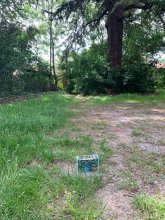
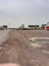
Measurement_f202ca59-1458-44c3-b255-961ee6753420

Measured radiation

0.330 µSv/h
geolocalisation :

46.748070267877, 8.4643626701089

Ground level
REP-Rouen2023
ATYPICAL MEASURE
Date de la mesure :
Latitude :
46.748070267877
Longitude :
8.4643626701089
Altitude (M) :
1919.0
Measurement time :
1 minutes 24 secondes
Distance travelled :
121.39m
Measurement speed :
Measurement Environment :
En campagne countryside
Weather :
Tags :
Description :
Temperature :
23.0°C
Hits number :
62
Mesure UUID :
f202ca59-1458-44c3-b255-961ee6753420
Manual Reporting :
No
Sensor / ID :
14ecabba
Sensor / Firmware version :
RiumGM BLE -b
Sensor / Type :
Sensor / Tube type :
J305γβ
Smartphone / UUID :
EDE02C1A-1491-4004-92BC-8C006A2CA4D8
Smartphone / Platform :
iOS
Smartphone / Model :
iPhone10,3
Smartphone / OS Version :
16.5.1
Position acurracy :
170.0
Measurement height above the ground (in meters) :
0.00
Altitude accuracy :
170.0
Mean qualification :
Ground level
Software version :
OpenRadiation app 2.3.4
Measured value :
0.330 µSv/h
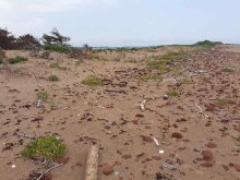
Measurement_2a6bd592-2769-46d3-a50a-b4c7ae9b63ef

Measured radiation

0.132 µSv/h
geolocalisation :

43.551740806639, 1.5222798973609

Ground level
Sopjac
Date de la mesure :
Latitude :
43.551740806639
Longitude :
1.5222798973609
Altitude (M) :
160.0
Measurement time :
1 minutes 49 secondes
Distance travelled :
0.00m
Measurement speed :
Measurement Environment :
En campagne countryside
Weather :
Tags :
Description :
measurment image
Temperature :
29.0°C
Hits number :
52
Mesure UUID :
2a6bd592-2769-46d3-a50a-b4c7ae9b63ef
Manual Reporting :
No
Sensor / ID :
00189
Sensor / Firmware version :
OpengKIT71
Sensor / Type :
Sensor / Tube type :
SBM-20
Smartphone / UUID :
6C64CB32-807E-467B-9FB8-A2E9EFA49625
Smartphone / Platform :
iOS
Smartphone / Model :
iPhone11,2
Smartphone / OS Version :
16.2
Position acurracy :
5.0
Measurement height above the ground (in meters) :
0.00
Altitude accuracy :
5.0
Mean qualification :
Ground level
Software version :
OpenRadiation app 2.3.4
Measured value :
0.132 µSv/h

Measurement_759de39e-ad45-46dc-9e8b-222c85ee4e40

Measured radiation

0.098 µSv/h
geolocalisation :

46.4540566, -63.2917604

Ground level
Fanche
Date de la mesure :
Latitude :
46.4540566
Longitude :
-63.2917604
Altitude (M) :
-21.0
Measurement time :
3 minutes 53 secondes
Distance travelled :
130.65m
Measurement speed :
Measurement Environment :
En campagne countryside
Weather :
Tags :
Description :
measurment image
Temperature :
18.0°C
Hits number :
70
Mesure UUID :
759de39e-ad45-46dc-9e8b-222c85ee4e40
Manual Reporting :
No
Sensor / ID :
0C:1C:57:B5:CA:05
Sensor / Firmware version :
AtomTag v.1.0.3
Sensor / Type :
Sensor / Tube type :
SBM-20
Smartphone / UUID :
2e0896e728021500
Smartphone / Platform :
Android
Smartphone / Model :
SM-A202F
Smartphone / OS Version :
9
Position acurracy :
3.1
Measurement height above the ground (in meters) :
Altitude accuracy :
3.1
Mean qualification :
Ground level
Software version :
OpenRadiation app 2.3.4
Measured value :
0.098 µSv/h

Measurement_0a2bd3fe-79ab-41f1-9877-86af00fb22de

Measured radiation

0.070 µSv/h
geolocalisation :

46.501805, -63.4160931

Ground level
Fanche
Date de la mesure :
Latitude :
46.501805
Longitude :
-63.4160931
Altitude (M) :
-17.0
Measurement time :
3 minutes 55 secondes
Distance travelled :
125.65m
Measurement speed :
Measurement Environment :
En campagne countryside
Weather :
Tags :
Description :
measurment image
Temperature :
15.0°C
Hits number :
56
Mesure UUID :
0a2bd3fe-79ab-41f1-9877-86af00fb22de
Manual Reporting :
No
Sensor / ID :
0C:1C:57:B5:C3:BB
Sensor / Firmware version :
AtomTag v.1.0.3
Sensor / Type :
Sensor / Tube type :
SBM-20
Smartphone / UUID :
2e0896e728021500
Smartphone / Platform :
Android
Smartphone / Model :
SM-A202F
Smartphone / OS Version :
9
Position acurracy :
3.1
Measurement height above the ground (in meters) :
1.00
Altitude accuracy :
3.1
Mean qualification :
Ground level
Software version :
OpenRadiation app 2.3.4
Measured value :
0.070 µSv/h

Measurement_a392dfc7-2422-4eb4-b29e-524433cfb7ff

Measured radiation

0.117 µSv/h
geolocalisation :

46.7035348, -64.2345984

Ground level
Fanche
Date de la mesure :
Latitude :
46.7035348
Longitude :
-64.2345984
Altitude (M) :
16.0
Measurement time :
2 minutes 53 secondes
Distance travelled :
0.18m
Measurement speed :
Measurement Environment :
En campagne countryside
Weather :
Tags :
Description :
measurment image
Temperature :
26.0°C
Hits number :
59
Mesure UUID :
a392dfc7-2422-4eb4-b29e-524433cfb7ff
Manual Reporting :
No
Sensor / ID :
0C:1C:57:B5:C3:BB
Sensor / Firmware version :
AtomTag v.1.0.3
Sensor / Type :
Sensor / Tube type :
SBM-20
Smartphone / UUID :
2e0896e728021500
Smartphone / Platform :
Android
Smartphone / Model :
SM-A202F
Smartphone / OS Version :
9
Position acurracy :
2.4
Measurement height above the ground (in meters) :
1.00
Altitude accuracy :
2.4
Mean qualification :
Ground level
Software version :
OpenRadiation app 2.3.4
Measured value :
0.117 µSv/h

Measurement_ff1e3713-1224-4f42-a3b6-171686725171

Measured radiation

0.099 µSv/h
geolocalisation :

43.329786666667, 5.405695

Ground level
Fanche
Date de la mesure :
Latitude :
43.329786666667
Longitude :
5.405695
Altitude (M) :
95.0
Measurement time :
1 minutes
Distance travelled :
295.44m
Measurement speed :
Measurement Environment :
En campagne countryside
Weather :
rainy day Pluie
Tags :
Description :
Temperature :
Hits number :
33
Mesure UUID :
ff1e3713-1224-4f42-a3b6-171686725171
Manual Reporting :
No
Sensor / ID :
safecast_id 3220
Sensor / Firmware version :
$BNRDD
Sensor / Type :
Sensor / Tube type :
Smartphone / UUID :
Smartphone / Platform :
Smartphone / Model :
Smartphone / OS Version :
Position acurracy :
4.0
Measurement height above the ground (in meters) :
1.00
Altitude accuracy :
4.0
Mean qualification :
Ground level
Software version :
openradiation.net/upload v0.9
Measured value :
0.099 µSv/h

Measurement_53b75166-25b6-495f-9172-af3becd89046

Measured radiation

0.113 µSv/h
geolocalisation :

48.5238587, 7.2925051

Ground level
Brunonix
Date de la mesure :
Latitude :
48.5238587
Longitude :
7.2925051
Altitude (M) :
344.0
Measurement time :
3 minutes 12 secondes
Distance travelled :
0.00m
Measurement speed :
Measurement Environment :
En campagne countryside
Weather :
Tags :
Description :
dans mon bureau
Temperature :
26.0°C
Hits number :
57
Mesure UUID :
53b75166-25b6-495f-9172-af3becd89046
Manual Reporting :
No
Sensor / ID :
3888534334
Sensor / Firmware version :
RiumGm
Sensor / Type :
Sensor / Tube type :
J305γβ
Smartphone / UUID :
75285c33d603835a
Smartphone / Platform :
Android
Smartphone / Model :
SM-P610
Smartphone / OS Version :
11
Position acurracy :
32.1
Measurement height above the ground (in meters) :
Altitude accuracy :
32.1
Mean qualification :
Ground level
Software version :
OpenRadiation app 2.3.4
Measured value :
0.113 µSv/h

Measurement_2a001d4d-d06f-434d-8bda-994d2e3b70ea

Measured radiation

227.000 µSv/h
geolocalisation :

35.7965519, 51.4234344

Ground level
ATYPICAL MEASURE
Date de la mesure :
Latitude :
35.7965519
Longitude :
51.4234344
Altitude (M) :
Measurement time :
12 secondes
Distance travelled :
Measurement speed :
Measurement Environment :
En campagne countryside
Weather :
Tags :
Description :
Temperature :
Hits number :
3
Mesure UUID :
2a001d4d-d06f-434d-8bda-994d2e3b70ea
Manual Reporting :
Yes
Sensor / ID :
Sensor / Firmware version :
Sensor / Type :
Sensor / Tube type :
Smartphone / UUID :
30232f7212338d54
Smartphone / Platform :
Android
Smartphone / Model :
GT-I9300
Smartphone / OS Version :
4.3
Position acurracy :
31.5
Measurement height above the ground (in meters) :
Altitude accuracy :
31.5
Mean qualification :
Ground level
Software version :
OpenRadiation app 1.0.0
Measured value :
227.000 µSv/h

Measurement_63a69b77-9d6f-4fa2-a20f-f8b218cc58cc

Measured radiation

0.772 µSv/h
geolocalisation :

45.8503073, 3.3171939

Ground level
ATYPICAL MEASURE
Date de la mesure :
Latitude :
45.8503073
Longitude :
3.3171939
Altitude (M) :
287.0
Measurement time :
32 secondes
Distance travelled :
Measurement speed :
Measurement Environment :
En campagne countryside
Weather :
Tags :
Description :
Temperature :
Hits number :
67
Mesure UUID :
63a69b77-9d6f-4fa2-a20f-f8b218cc58cc
Manual Reporting :
No
Sensor / ID :
00013
Sensor / Firmware version :
OpengKIT71
Sensor / Type :
Sensor / Tube type :
SBM-20
Smartphone / UUID :
FA3BA3AB-E555-4465-BB7E-7E1502E1586B
Smartphone / Platform :
iOS
Smartphone / Model :
iPhone6,2
Smartphone / OS Version :
10.2.1
Position acurracy :
10.0
Measurement height above the ground (in meters) :
0.00
Altitude accuracy :
10.0
Mean qualification :
Ground level
Software version :
OpenRadiation app 1.0.0
Measured value :
0.772 µSv/h