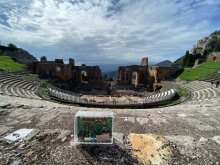
Measurement_4223cb3b-cb0f-46c3-a15a-f8af9cb013b8
Measured radiation
0.088 µSv/h
geolocalisation :
25.207887309444, 55.342737023469
Ground level
Latitude :
25.207887309444
Longitude :
55.342737023469
Altitude (M) :
12.0
Measurement time :
3 minutes 29 secondes
Distance travelled :
0.00m
Measurement speed :
Measurement Environment :
 inside
Weather :
Tags :
Description :
Temperature :
22.0°C
Hits number :
51
Mesure UUID :
4223cb3b-cb0f-46c3-a15a-f8af9cb013b8
Manual Reporting :
No
Sensor / ID :
1a92d550
Sensor / Firmware version :
RiumGM BLE -b
Sensor / Type :
Sensor / Tube type :
J305γβ
Smartphone / UUID :
3F78E981-2DB2-4A9D-AE3B-4A2C233FAF59
Smartphone / Platform :
ios
Smartphone / Model :
iPad13,19
Smartphone / OS Version :
26.1
Position acurracy :
14.6
Measurement height above the ground (in meters) :
1.00
Altitude accuracy :
14.6
Mean qualification :
Ground level
Software version :
OpenRadiation app 3.1.1
Measured value :
0.088 µSv/h


 countryside
 city
city
