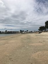
Ground level

slug
groundlevel

Measurement_ff9d670f-1b51-4737-aa0f-7c1750586212

Measured radiation

0.060 µSv/h
geolocalisation :

48.795455, 2.2848116666667

Ground level
Fanche
Measurement date :
Latitude :
48.795455
Longitude :
2.2848116666667
Altitude (M) :
159.0
Measurement time :
1 minutes
Distance travelled :
54.45m
Measurement speed :
Measurement Environment :
En ville city
Weather :
Tags :
Description :
Temperature :
Hits number :
20
Mesure UUID :
ff9d670f-1b51-4737-aa0f-7c1750586212
Manual Reporting :
No
Sensor / ID :
safecast_id 2340
Sensor / Firmware version :
$BNRDD
Sensor / Type :
Sensor / Tube type :
Smartphone / UUID :
Smartphone / Platform :
Smartphone / Model :
Smartphone / OS Version :
Position acurracy :
8.0
Measurement height above the ground (in meters) :
1.00
Altitude accuracy :
8.0
Mean qualification :
Ground level
Software version :
openradiation.net/upload v0.9
Measured value :
0.060 µSv/h

Measurement_cb1346ae-af32-0625-8e87-84574108777b

Measured radiation

0.097 µSv/h
geolocalisation :

50.672861, 3.204542

Ground level
renichuss
Measurement date :
Latitude :
50.672861
Longitude :
3.204542
Altitude (M) :
42.0
Measurement time :
10 minutes
Distance travelled :
0.00m
Measurement speed :
Measurement Environment :
À l'intérieur inside
Weather :
Tags :
Description :
Temperature :
Hits number :
233
Mesure UUID :
cb1346ae-af32-0625-8e87-84574108777b
Manual Reporting :
No
Sensor / ID :
b183cbc2-e56f-4308-862a-3fd17716e5b1
Sensor / Firmware version :
RadMon v1.6
Sensor / Type :
Sensor / Tube type :
SBM-20
Smartphone / UUID :
Smartphone / Platform :
Smartphone / Model :
Smartphone / OS Version :
Position acurracy :
20.0
Measurement height above the ground (in meters) :
1.00
Altitude accuracy :
20.0
Mean qualification :
Ground level
Software version :
RadMon v1.6-backport1.8-2025-a38d
Measured value :
0.097 µSv/h

Measurement_2df557d3-e204-4f69-870a-6d4ef0359c4d

Measured radiation

0.102 µSv/h
geolocalisation :

47.3711602, 5.0248654

Ground level
suzon-21
Measurement date :
Latitude :
47.3711602
Longitude :
5.0248654
Altitude (M) :
337.0
Measurement time :
13 minutes 17 secondes
Distance travelled :
639.91m
Measurement speed :
Measurement Environment :
En ville city
Weather :
Tags :
Description :
Kit OpenRaxiation V 2-2.
Parcours dans le village.
Temperature :
29.0°C
Hits number :
255
Mesure UUID :
2df557d3-e204-4f69-870a-6d4ef0359c4d
Manual Reporting :
No
Sensor / ID :
00153
Sensor / Firmware version :
OpengKIT72
Sensor / Type :
Sensor / Tube type :
Smartphone / UUID :
40f15d6de1d2300e
Smartphone / Platform :
android
Smartphone / Model :
22011119UY
Smartphone / OS Version :
12
Position acurracy :
4.3
Measurement height above the ground (in meters) :
1.00
Altitude accuracy :
4.3
Mean qualification :
Ground level
Software version :
OpenRadiation app 3.1
Measured value :
0.102 µSv/h

Measurement_ffd5bc5b-101d-4012-ac85-1e1717893869

Measured radiation

0.084 µSv/h
geolocalisation :

49.135948333333, -122.845525

Ground level
Fanche
Measurement date :
Latitude :
49.135948333333
Longitude :
-122.845525
Altitude (M) :
65.0
Measurement time :
1 minutes
Distance travelled :
409.85m
Measurement speed :
Measurement Environment :
Sur la route ontheroad
Weather :
Tags :
Description :
Temperature :
Hits number :
28
Mesure UUID :
ffd5bc5b-101d-4012-ac85-1e1717893869
Manual Reporting :
No
Sensor / ID :
safecast_id 3220
Sensor / Firmware version :
$BNRDD
Sensor / Type :
Sensor / Tube type :
Smartphone / UUID :
Smartphone / Platform :
Smartphone / Model :
Smartphone / OS Version :
Position acurracy :
9.0
Measurement height above the ground (in meters) :
1.00
Altitude accuracy :
9.0
Mean qualification :
Ground level
Software version :
openradiation.net/upload v0.9
Measured value :
0.084 µSv/h

Measurement_ba68c459-0af7-4439-ae27-69990f8290ea

Measured radiation

0.124 µSv/h
geolocalisation :

43.8422903, 5.7627371

Ground level
Christelle Adam
Measurement date :
Latitude :
43.8422903
Longitude :
5.7627371
Altitude (M) :
513.0
Measurement time :
18 minutes 33 secondes
Distance travelled :
0.00m
Measurement speed :
Measurement Environment :
En campagne countryside
Weather :
Tags :
Description :
Temperature :
28.0°C
Hits number :
355
Mesure UUID :
ba68c459-0af7-4439-ae27-69990f8290ea
Manual Reporting :
No
Sensor / ID :
d3679d94
Sensor / Firmware version :
RiumGM BLE -b
Sensor / Type :
Sensor / Tube type :
J305γβ
Smartphone / UUID :
bec0e833c8cc0761
Smartphone / Platform :
android
Smartphone / Model :
SM-A137F
Smartphone / OS Version :
14
Position acurracy :
14.7
Measurement height above the ground (in meters) :
Altitude accuracy :
14.7
Mean qualification :
Ground level
Software version :
OpenRadiation app 3.1
Measured value :
0.124 µSv/h

Measurement_aced15ff-593a-467f-92e0-76e5ffa1c039

Measured radiation

0.088 µSv/h
geolocalisation :

48.761991797299, 1.9520730256356

Ground level
Yann29
Measurement date :
Latitude :
48.761991797299
Longitude :
1.9520730256356
Altitude (M) :
174.0
Measurement time :
4 minutes 17 secondes
Distance travelled :
0.00m
Measurement speed :
Measurement Environment :
À l'intérieur inside
Weather :
Tags :
Description :
Temperature :
26.0°C
Hits number :
63
Mesure UUID :
aced15ff-593a-467f-92e0-76e5ffa1c039
Manual Reporting :
No
Sensor / ID :
4e233779
Sensor / Firmware version :
RiumGM BLE -b
Sensor / Type :
Sensor / Tube type :
J305γβ
Smartphone / UUID :
ECD4A24E-D8E9-4EA4-B33D-59F462068F44
Smartphone / Platform :
ios
Smartphone / Model :
iPhone14,4
Smartphone / OS Version :
18.5
Position acurracy :
8.9
Measurement height above the ground (in meters) :
1.00
Altitude accuracy :
8.9
Mean qualification :
Ground level
Software version :
OpenRadiation app 3.1
Measured value :
0.088 µSv/h

Measurement_ed4dc25b-d21e-40df-8030-d5a4f66ea2ec

Measured radiation

0.080 µSv/h
geolocalisation :

47.3227105, 5.0271701

Ground level
Fanche
Measurement date :
Latitude :
47.3227105
Longitude :
5.0271701
Altitude (M) :
248.0
Measurement time :
3 minutes 15 secondes
Distance travelled :
656.95m
Measurement speed :
Measurement Environment :
Sur la route ontheroad
Weather :
Tags :
Description :
TGV Paris Lausanne
Temperature :
24.0°C
Hits number :
51
Mesure UUID :
ed4dc25b-d21e-40df-8030-d5a4f66ea2ec
Manual Reporting :
No
Sensor / ID :
0C:1C:57:B5:CA:67
Sensor / Firmware version :
AtomTag v.1.0.3
Sensor / Type :
Sensor / Tube type :
SBM-20
Smartphone / UUID :
450af21a32183632
Smartphone / Platform :
Android
Smartphone / Model :
SM-J600FN
Smartphone / OS Version :
8.0.0
Position acurracy :
96.0
Measurement height above the ground (in meters) :
0.00
Altitude accuracy :
96.0
Mean qualification :
Ground level
Software version :
OpenRadiation app 2.3.1
Measured value :
0.080 µSv/h

Measurement_0f47df24-025a-45ff-9ad8-87f5439b7cf1

Measured radiation

0.098 µSv/h
geolocalisation :

47.90208381, 3.35014551

Ground level
Serpent
Measurement date :
Latitude :
47.90208381
Longitude :
3.35014551
Altitude (M) :
166.0
Measurement time :
5 minutes
Distance travelled :
9328.31m
Measurement speed :
Measurement Environment :
Sur la route ontheroad
Weather :
Tags :
Description :
Temperature :
25.0°C
Hits number :
93
Mesure UUID :
0f47df24-025a-45ff-9ad8-87f5439b7cf1
Manual Reporting :
No
Sensor / ID :
00053
Sensor / Firmware version :
OpengKIT72
Sensor / Type :
Sensor / Tube type :
Smartphone / UUID :
96d273508b44d194
Smartphone / Platform :
android
Smartphone / Model :
FP4
Smartphone / OS Version :
14
Position acurracy :
9.9
Measurement height above the ground (in meters) :
1.00
Altitude accuracy :
9.9
Mean qualification :
Ground level
Software version :
OpenRadiation app 3.0
Measured value :
0.098 µSv/h

Measurement_680edd16-8a40-4386-b11e-3d8aef2c5cb8

Measured radiation

0.533 µSv/h
geolocalisation :

47.250160196138, -2.2572213503932

Ground level
Yann29
ATYPICAL MEASURE
Measurement date :
Latitude :
47.250160196138
Longitude :
-2.2572213503932
Altitude (M) :
6.0
Measurement time :
46 secondes
Distance travelled :
0.00m
Measurement speed :
Measurement Environment :
En campagne countryside
Weather :
Tags :
Description :
measurment image
Temperature :
43.0°C
Hits number :
53
Mesure UUID :
680edd16-8a40-4386-b11e-3d8aef2c5cb8
Manual Reporting :
No
Sensor / ID :
4e233779
Sensor / Firmware version :
RiumGM BLE -b
Sensor / Type :
Sensor / Tube type :
J305γβ
Smartphone / UUID :
ECD4A24E-D8E9-4EA4-B33D-59F462068F44
Smartphone / Platform :
ios
Smartphone / Model :
iPhone14,4
Smartphone / OS Version :
18.5
Position acurracy :
10.2
Measurement height above the ground (in meters) :
0.00
Altitude accuracy :
10.2
Mean qualification :
Ground level
Software version :
OpenRadiation app 3.1
Measured value :
0.533 µSv/h

Measurement_ff0415d6-b8d0-4d4b-a480-d51745160836

Measured radiation

0.132 µSv/h
geolocalisation :

47.77336, -3.3714033333333

Ground level
Fanche
Measurement date :
Latitude :
47.77336
Longitude :
-3.3714033333333
Altitude (M) :
-3.0
Measurement time :
1 minutes
Distance travelled :
1324.60m
Measurement speed :
Measurement Environment :
Sur la route ontheroad
Weather :
Tags :
Description :
Temperature :
Hits number :
44
Mesure UUID :
ff0415d6-b8d0-4d4b-a480-d51745160836
Manual Reporting :
No
Sensor / ID :
safecast_id 3220
Sensor / Firmware version :
$BNRDD
Sensor / Type :
Sensor / Tube type :
Smartphone / UUID :
Smartphone / Platform :
Smartphone / Model :
Smartphone / OS Version :
Position acurracy :
9.0
Measurement height above the ground (in meters) :
1.00
Altitude accuracy :
9.0
Mean qualification :
Ground level
Software version :
openradiation.net/upload v0.9
Measured value :
0.132 µSv/h