


countryside

icone_mesure
slug
countryside

Measurement_ffb394b8-3855-41e3-a7d3-2e1725286757

Measured radiation

0.527 µSv/h
geolocalisation :

52.297306666667, 10.46909

Ground level
Fanche
ATYPICAL MEASURE
Date de la mesure :
Latitude :
52.297306666667
Longitude :
10.46909
Altitude (M) :
62.0
Measurement time :
1 minutes
Distance travelled :
2.81m
Measurement speed :
Measurement Environment :
En campagne countryside
Weather :
Tags :
Description :
Temperature :
Hits number :
176
Mesure UUID :
ffb394b8-3855-41e3-a7d3-2e1725286757
Manual Reporting :
No
Sensor / ID :
safecast_id 1225
Sensor / Firmware version :
$BNRDD
Sensor / Type :
Sensor / Tube type :
Smartphone / UUID :
Smartphone / Platform :
Smartphone / Model :
Smartphone / OS Version :
Position acurracy :
8.0
Measurement height above the ground (in meters) :
1.00
Altitude accuracy :
8.0
Mean qualification :
Ground level
Software version :
openradiation.net/upload v0.9
Measured value :
0.527 µSv/h
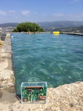
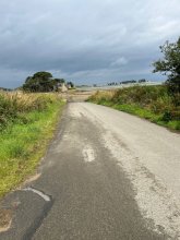
Measurement_ffb394b8-3855-41e3-a7d3-2e1725286817

Measured radiation

0.437 µSv/h
geolocalisation :

52.297318333333, 10.469126666667

Ground level
Fanche
ATYPICAL MEASURE
Date de la mesure :
Latitude :
52.297318333333
Longitude :
10.469126666667
Altitude (M) :
62.0
Measurement time :
1 minutes
Distance travelled :
2.02m
Measurement speed :
Measurement Environment :
En campagne countryside
Weather :
Tags :
Description :
Temperature :
Hits number :
146
Mesure UUID :
ffb394b8-3855-41e3-a7d3-2e1725286817
Manual Reporting :
No
Sensor / ID :
safecast_id 1225
Sensor / Firmware version :
$BNRDD
Sensor / Type :
Sensor / Tube type :
Smartphone / UUID :
Smartphone / Platform :
Smartphone / Model :
Smartphone / OS Version :
Position acurracy :
8.0
Measurement height above the ground (in meters) :
1.00
Altitude accuracy :
8.0
Mean qualification :
Ground level
Software version :
openradiation.net/upload v0.9
Measured value :
0.437 µSv/h

Measurement_ffcc5d99-c440-48a7-abd0-aa1496669905

Measured radiation

0.130 µSv/h
geolocalisation :

46.348073333333, 2.217605

Ground level
goldi
Date de la mesure :
Latitude :
46.348073333333
Longitude :
2.217605
Altitude (M) :
378.0
Measurement time :
1 minutes
Distance travelled :
Measurement speed :
Measurement Environment :
En campagne countryside
Weather :
Tags :
Description :
Temperature :
Hits number :
42
Mesure UUID :
ffcc5d99-c440-48a7-abd0-aa1496669905
Manual Reporting :
No
Sensor / ID :
safecast_id 1234
Sensor / Firmware version :
$BNRDD
Sensor / Type :
Sensor / Tube type :
Smartphone / UUID :
Smartphone / Platform :
Smartphone / Model :
Smartphone / OS Version :
Position acurracy :
9.0
Measurement height above the ground (in meters) :
1.00
Altitude accuracy :
9.0
Mean qualification :
Ground level
Software version :
openradiation.net/upload v0.2.0
Measured value :
0.130 µSv/h

Measurement_ffcc5d99-c440-48a7-abd0-aa1496669435

Measured radiation

0.100 µSv/h
geolocalisation :

46.347011666667, 2.21097

Ground level
goldi
Date de la mesure :
Latitude :
46.347011666667
Longitude :
2.21097
Altitude (M) :
371.0
Measurement time :
1 minutes
Distance travelled :
Measurement speed :
Measurement Environment :
En campagne countryside
Weather :
Tags :
Description :
Temperature :
Hits number :
33
Mesure UUID :
ffcc5d99-c440-48a7-abd0-aa1496669435
Manual Reporting :
No
Sensor / ID :
safecast_id 1234
Sensor / Firmware version :
$BNRDD
Sensor / Type :
Sensor / Tube type :
Smartphone / UUID :
Smartphone / Platform :
Smartphone / Model :
Smartphone / OS Version :
Position acurracy :
10.0
Measurement height above the ground (in meters) :
1.00
Altitude accuracy :
10.0
Mean qualification :
Ground level
Software version :
openradiation.net/upload v0.2.0
Measured value :
0.100 µSv/h

Measurement_43942894-e8c7-46e7-85dd-2e45495667c0

Measured radiation

0.226 µSv/h
geolocalisation :

41.05602070762, -8.2699215605999

Ground level
domlo
ATYPICAL MEASURE
Date de la mesure :
Latitude :
41.05602070762
Longitude :
-8.2699215605999
Altitude (M) :
226.0
Measurement time :
1 minutes 12 secondes
Distance travelled :
0.00m
Measurement speed :
Measurement Environment :
En campagne countryside
Weather :
Tags :
Description :
measurment image
Temperature :
44.0°C
Hits number :
52
Mesure UUID :
43942894-e8c7-46e7-85dd-2e45495667c0
Manual Reporting :
No
Sensor / ID :
00164
Sensor / Firmware version :
OpengKIT71
Sensor / Type :
Sensor / Tube type :
SBM-20
Smartphone / UUID :
37C525FD-5749-4F9D-AC22-87318DD67A00
Smartphone / Platform :
iOS
Smartphone / Model :
iPhone8,1
Smartphone / OS Version :
13.5.1
Position acurracy :
165.0
Measurement height above the ground (in meters) :
0.00
Altitude accuracy :
165.0
Mean qualification :
Ground level
Software version :
OpenRadiation app 2.3.1
Measured value :
0.226 µSv/h

Measurement_b5edc00e-ef20-4ed0-8871-74fb3fc0a9d8

Measured radiation

0.071 µSv/h
geolocalisation :

45.196888, -4.2985849

Ground level
Date de la mesure :
Latitude :
45.196888
Longitude :
-4.2985849
Altitude (M) :
57.0
Measurement time :
3 minutes 25 secondes
Distance travelled :
596.19m
Measurement speed :
Measurement Environment :
En campagne countryside
Weather :
Tags :
Description :
Temperature :
23.0°C
Hits number :
66
Mesure UUID :
b5edc00e-ef20-4ed0-8871-74fb3fc0a9d8
Manual Reporting :
No
Sensor / ID :
00161
Sensor / Firmware version :
OpengKIT71
Sensor / Type :
Sensor / Tube type :
SBM-20
Smartphone / UUID :
2bcc4be4017ecce5
Smartphone / Platform :
Android
Smartphone / Model :
DUB-LX1
Smartphone / OS Version :
8.1.0
Position acurracy :
3.4
Measurement height above the ground (in meters) :
0.00
Altitude accuracy :
3.4
Mean qualification :
Ground level
Software version :
OpenRadiation app 2.3.4
Measured value :
0.071 µSv/h

Measurement_e2f40efa-e836-4e25-b742-1200b7b12bf5

Measured radiation

0.154 µSv/h
geolocalisation :

40.636966955614, -6.6147343051852

Ground level
Date de la mesure :
Latitude :
40.636966955615
Longitude :
-6.6147343051852
Altitude (M) :
664.0
Measurement time :
2 minutes 17 secondes
Distance travelled :
2.24m
Measurement speed :
Measurement Environment :
En campagne countryside
Weather :
Tags :
Description :
Temperature :
23.0°C
Hits number :
52
Mesure UUID :
e2f40efa-e836-4e25-b742-1200b7b12bf5
Manual Reporting :
No
Sensor / ID :
f38d62a9
Sensor / Firmware version :
RiumGM BLE -b
Sensor / Type :
Sensor / Tube type :
J305γβ
Smartphone / UUID :
C6E8FAD9-3142-4F62-B613-8339D08A3547
Smartphone / Platform :
iOS
Smartphone / Model :
iPhone12,8
Smartphone / OS Version :
16.3.1
Position acurracy :
9.4
Measurement height above the ground (in meters) :
1.00
Altitude accuracy :
9.4
Mean qualification :
Ground level
Software version :
OpenRadiation app 2.3.4
Measured value :
0.154 µSv/h

Measurement_99d33fbf-56e0-43f6-9efb-66b69a90a9e3

Measured radiation

0.092 µSv/h
geolocalisation :

48.83725111164, -3.2815297260688

Ground level
raton74
Date de la mesure :
Latitude :
48.83725111164
Longitude :
-3.2815297260688
Altitude (M) :
11.0
Measurement time :
13 minutes 14 secondes
Distance travelled :
258.30m
Measurement speed :
Measurement Environment :
En campagne countryside
Weather :
Tags :
Description :
measurment image
Temperature :
24.0°C
Hits number :
202
Mesure UUID :
99d33fbf-56e0-43f6-9efb-66b69a90a9e3
Manual Reporting :
No
Sensor / ID :
b4cda69c
Sensor / Firmware version :
RiumGM BLE -b
Sensor / Type :
Sensor / Tube type :
J305γβ
Smartphone / UUID :
288C2239-61F2-4006-94D4-D309C357D469
Smartphone / Platform :
iOS
Smartphone / Model :
iPhone14,7
Smartphone / OS Version :
17.5.1
Position acurracy :
4.7
Measurement height above the ground (in meters) :
1.00
Altitude accuracy :
4.7
Mean qualification :
Ground level
Software version :
OpenRadiation app 2.3.4
Measured value :
0.092 µSv/h

Measurement_07c611ac-8b26-4ae4-8552-cabe63bd80fe

Measured radiation

0.058 µSv/h
geolocalisation :

47.5875448, 1.3383232

Ground level
Astangul
Date de la mesure :
Latitude :
47.5875448
Longitude :
1.3383232
Altitude (M) :
119.0
Measurement time :
4 minutes 6 secondes
Distance travelled :
81.35m
Measurement speed :
Measurement Environment :
En campagne countryside
Weather :
Tags :
Description :
Temperature :
19.0°C
Hits number :
52
Mesure UUID :
07c611ac-8b26-4ae4-8552-cabe63bd80fe
Manual Reporting :
No
Sensor / ID :
0C:1C:57:B5:B6:AA
Sensor / Firmware version :
AtomTag v.1.0.3
Sensor / Type :
Sensor / Tube type :
SBM-20
Smartphone / UUID :
21572b726cc59c67
Smartphone / Platform :
Android
Smartphone / Model :
LE2115
Smartphone / OS Version :
12
Position acurracy :
11.1
Measurement height above the ground (in meters) :
1.00
Altitude accuracy :
11.1
Mean qualification :
Ground level
Software version :
OpenRadiation app 2.3.4
Measured value :
0.058 µSv/h