


countryside

icone_mesure
slug
countryside

Measurement_3f7ee25f-f6d5-4ab4-a05b-85d389268971

Measured radiation

0.049 µSv/h
geolocalisation :

45.2144106, 5.668146

Ground level
ghis
Date de la mesure :
Latitude :
45.2144106
Longitude :
5.668146
Altitude (M) :
256.0
Measurement time :
3 minutes 12 secondes
Distance travelled :
0.25m
Measurement speed :
Measurement Environment :
En campagne countryside
Weather :
rainy day Pluie
Tags :
Description :
Temperature :
26.0°C
Hits number :
51
Mesure UUID :
3f7ee25f-f6d5-4ab4-a05b-85d389268971
Manual Reporting :
No
Sensor / ID :
00169
Sensor / Firmware version :
OpengKIT71
Sensor / Type :
Sensor / Tube type :
SBM-20
Smartphone / UUID :
2c849fe673cd8d81
Smartphone / Platform :
Android
Smartphone / Model :
SM-J600FN
Smartphone / OS Version :
10
Position acurracy :
20.9
Measurement height above the ground (in meters) :
1.00
Altitude accuracy :
20.9
Mean qualification :
Ground level
Software version :
OpenRadiation app 2.3.5
Measured value :
0.049 µSv/h

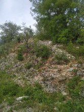
Measurement_5b02558e-f830-47aa-8c78-3bce3b6f6380

Measured radiation

7.711 µSv/h
geolocalisation :

37.413330080713, 140.98542605894

Ground level
sirse31
ATYPICAL MEASURE
Date de la mesure :
Latitude :
37.413330080713
Longitude :
140.98542605894
Altitude (M) :
61.0
Measurement time :
11 secondes
Distance travelled :
9.38m
Measurement speed :
Measurement Environment :
En campagne countryside
Weather :
Tags :
Description :
site G fukushima
Temperature :
31.0°C
Hits number :
182
Mesure UUID :
5b02558e-f830-47aa-8c78-3bce3b6f6380
Manual Reporting :
No
Sensor / ID :
00170
Sensor / Firmware version :
OpengKIT71
Sensor / Type :
Sensor / Tube type :
SBM-20
Smartphone / UUID :
383B87B9-BE22-43ED-AEDF-1FAC257116B1
Smartphone / Platform :
iOS
Smartphone / Model :
iPhone10,5
Smartphone / OS Version :
13.1.2
Position acurracy :
12.0
Measurement height above the ground (in meters) :
1.00
Altitude accuracy :
12.0
Mean qualification :
Ground level
Software version :
OpenRadiation app 2.3.1
Measured value :
7.711 µSv/h

Measurement_7f892d0a-c489-48b7-95e8-cd5ac74357e7

Measured radiation

7.573 µSv/h
geolocalisation :

37.413604276324, 140.98571892127

Ground level
sirse31
ATYPICAL MEASURE
Date de la mesure :
Latitude :
37.413604276324
Longitude :
140.98571892127
Altitude (M) :
71.0
Measurement time :
10 secondes
Distance travelled :
0.00m
Measurement speed :
Measurement Environment :
En campagne countryside
Weather :
Tags :
Description :
site G fukushima
Temperature :
30.0°C
Hits number :
179
Mesure UUID :
7f892d0a-c489-48b7-95e8-cd5ac74357e7
Manual Reporting :
No
Sensor / ID :
00170
Sensor / Firmware version :
OpengKIT71
Sensor / Type :
Sensor / Tube type :
SBM-20
Smartphone / UUID :
383B87B9-BE22-43ED-AEDF-1FAC257116B1
Smartphone / Platform :
iOS
Smartphone / Model :
iPhone10,5
Smartphone / OS Version :
13.1.2
Position acurracy :
6.0
Measurement height above the ground (in meters) :
1.00
Altitude accuracy :
6.0
Mean qualification :
Ground level
Software version :
OpenRadiation app 2.3.1
Measured value :
7.573 µSv/h

Measurement_9ccc2bcf-07e1-4d75-942c-92bcf571a6eb

Measured radiation

0.102 µSv/h
geolocalisation :

54.508474961562, -2.6485719427779

Ground level
Date de la mesure :
Latitude :
54.508474961562
Longitude :
-2.6485719427779
Altitude (M) :
310.0
Measurement time :
3 minutes 6 secondes
Distance travelled :
5.10m
Measurement speed :
Measurement Environment :
En campagne countryside
Weather :
Tags :
Description :
Temperature :
25.0°C
Hits number :
51
Mesure UUID :
9ccc2bcf-07e1-4d75-942c-92bcf571a6eb
Manual Reporting :
No
Sensor / ID :
6972704c
Sensor / Firmware version :
RiumGM BLE -b
Sensor / Type :
Sensor / Tube type :
J305γβ
Smartphone / UUID :
60A31498-E2AA-4DBD-953F-5582058908F5
Smartphone / Platform :
iOS
Smartphone / Model :
iPhone9,3
Smartphone / OS Version :
15.5
Position acurracy :
8.0
Measurement height above the ground (in meters) :
1.00
Altitude accuracy :
8.0
Mean qualification :
Ground level
Software version :
OpenRadiation app 2.3.4
Measured value :
0.102 µSv/h

Measurement_c3ac6360-2c81-4216-833a-c64cced1a16e

Measured radiation

0.104 µSv/h
geolocalisation :

43.724733791608, 5.5574803088862

Ground level
Date de la mesure :
Latitude :
43.724733791608
Longitude :
5.5574803088863
Altitude (M) :
274.0
Measurement time :
3 minutes 25 secondes
Distance travelled :
6.19m
Measurement speed :
Measurement Environment :
En campagne countryside
Weather :
Tags :
Description :
Temperature :
24.0°C
Hits number :
57
Mesure UUID :
c3ac6360-2c81-4216-833a-c64cced1a16e
Manual Reporting :
No
Sensor / ID :
cadfbee1
Sensor / Firmware version :
RiumGM BLE -b
Sensor / Type :
Sensor / Tube type :
J305γβ
Smartphone / UUID :
5F70489C-9E72-4F23-8555-C6776E9A46B7
Smartphone / Platform :
iOS
Smartphone / Model :
iPhone11,2
Smartphone / OS Version :
15.4.1
Position acurracy :
15.1
Measurement height above the ground (in meters) :
1.00
Altitude accuracy :
15.1
Mean qualification :
Ground level
Software version :
OpenRadiation app 2.3.4
Measured value :
0.104 µSv/h

Measurement_da241c5d-f21b-4fed-ad62-2267c140b6cb

Measured radiation

0.135 µSv/h
geolocalisation :

45.7356398, 1.3126696

Ground level
Fanche
Date de la mesure :
Latitude :
45.7356398
Longitude :
1.3126696
Altitude (M) :
279.0
Measurement time :
18 minutes 45 secondes
Distance travelled :
314.88m
Measurement speed :
Measurement Environment :
En campagne countryside
Weather :
Tags :
Description :
Temperature :
15.0°C
Hits number :
427
Mesure UUID :
da241c5d-f21b-4fed-ad62-2267c140b6cb
Manual Reporting :
No
Sensor / ID :
80:30:DC:4A:B7:65
Sensor / Firmware version :
AtomTag v.1.0.3
Sensor / Type :
Sensor / Tube type :
SBM-20
Smartphone / UUID :
d404f9b3128dc3f5
Smartphone / Platform :
Android
Smartphone / Model :
SM-J330FN
Smartphone / OS Version :
9
Position acurracy :
7.5
Measurement height above the ground (in meters) :
1.00
Altitude accuracy :
7.5
Mean qualification :
Ground level
Software version :
OpenRadiation app 2.3.4
Measured value :
0.135 µSv/h

Measurement_6f4a513e-ecd1-4528-85db-6db8fd4e025f

Measured radiation

0.195 µSv/h
geolocalisation :

44.945800257583, 1.6659729309127

Ground level
sylvain
Date de la mesure :
Latitude :
44.945800257583
Longitude :
1.6659729309127
Altitude (M) :
141.0
Measurement time :
1 minutes 50 secondes
Distance travelled :
4.12m
Measurement speed :
Measurement Environment :
En campagne countryside
Weather :
Tags :
Description :
Temperature :
20.0°C
Hits number :
51
Mesure UUID :
6f4a513e-ecd1-4528-85db-6db8fd4e025f
Manual Reporting :
No
Sensor / ID :
e6b88c42
Sensor / Firmware version :
RiumGM BLE -b
Sensor / Type :
Sensor / Tube type :
J305γβ
Smartphone / UUID :
7CF4DEAB-7112-4ED7-ACBA-A77FBD13B555
Smartphone / Platform :
iOS
Smartphone / Model :
iPhone15,2
Smartphone / OS Version :
17.1
Position acurracy :
4.3
Measurement height above the ground (in meters) :
1.00
Altitude accuracy :
4.3
Mean qualification :
Ground level
Software version :
OpenRadiation app 2.3.4
Measured value :
0.195 µSv/h

Measurement_4f144f01-b264-4a24-855f-b200b943b37c

Measured radiation

0.043 µSv/h
geolocalisation :

43.601932372007, 3.8585662096775

Ground level
RM07
Date de la mesure :
Latitude :
43.601932372007
Longitude :
3.8585662096775
Altitude (M) :
43.0
Measurement time :
17 minutes 48 secondes
Distance travelled :
0.00m
Measurement speed :
Measurement Environment :
En campagne countryside
Weather :
Tags :
Description :
halle tropisme
measurment image
Temperature :
22.0°C
Hits number :
267
Mesure UUID :
4f144f01-b264-4a24-855f-b200b943b37c
Manual Reporting :
No
Sensor / ID :
00269
Sensor / Firmware version :
OpengKIT71
Sensor / Type :
Sensor / Tube type :
SBM-20
Smartphone / UUID :
DA49CEFC-6BEE-4BDB-ADEB-DD00B53559AD
Smartphone / Platform :
iOS
Smartphone / Model :
iPhone10,3
Smartphone / OS Version :
16.2
Position acurracy :
10.0
Measurement height above the ground (in meters) :
1.00
Altitude accuracy :
10.0
Mean qualification :
Ground level
Software version :
OpenRadiation app 2.3.4
Measured value :
0.043 µSv/h

Measurement_7721995b-3f06-43fd-8827-7b4b80e35e19

Measured radiation

20.254 µSv/h
geolocalisation :

51.4084392, 30.0651524

Ground level
ATYPICAL MEASURE
Date de la mesure :
Latitude :
51.4084392
Longitude :
30.0651524
Altitude (M) :
154.0
Measurement time :
1 minutes 12 secondes
Distance travelled :
5.13m
Measurement speed :
Measurement Environment :
En campagne countryside
Weather :
Tags :
Description :
Temperature :
29.0°C
Hits number :
2963
Mesure UUID :
7721995b-3f06-43fd-8827-7b4b80e35e19
Manual Reporting :
No
Sensor / ID :
00200
Sensor / Firmware version :
OpengKIT71
Sensor / Type :
Sensor / Tube type :
SBM-20
Smartphone / UUID :
d11d21ab0d9f9f08
Smartphone / Platform :
Android
Smartphone / Model :
SM-G955F
Smartphone / OS Version :
9
Position acurracy :
5.4
Measurement height above the ground (in meters) :
0.00
Altitude accuracy :
5.4
Mean qualification :
Ground level
Software version :
OpenRadiation app 2.3.1
Measured value :
20.254 µSv/h

Measurement_1397576b-9ed1-48d4-906b-de1df4e0af13

Measured radiation

0.044 µSv/h
geolocalisation :

44.5044672, 1.8541245

Ground level
Nala
Date de la mesure :
Latitude :
44.5044672
Longitude :
1.8541245
Altitude (M) :
293.0
Measurement time :
3 minutes 26 secondes
Distance travelled :
2.83m
Measurement speed :
Measurement Environment :
En campagne countryside
Weather :
Tags :
Description :
measurment image
Temperature :
33.0°C
Hits number :
52
Mesure UUID :
1397576b-9ed1-48d4-906b-de1df4e0af13
Manual Reporting :
No
Sensor / ID :
00230
Sensor / Firmware version :
OpengKIT71
Sensor / Type :
Sensor / Tube type :
SBM-20
Smartphone / UUID :
963626a73b573742
Smartphone / Platform :
Android
Smartphone / Model :
Redmi Note 6 Pro
Smartphone / OS Version :
9
Position acurracy :
7.2
Measurement height above the ground (in meters) :
1.00
Altitude accuracy :
7.2
Mean qualification :
Ground level
Software version :
OpenRadiation app 2.3.4
Measured value :
0.044 µSv/h