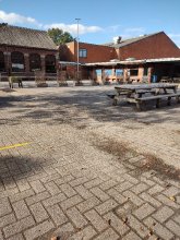
Ground level

slug
groundlevel

Measurement_0f937391-4b8d-42f6-9ecd-d43ed0b67082

Measured radiation

0.081 µSv/h
geolocalisation :

49.145299424463, -0.40770985186138

Ground level
BuChan
Measurement date :
Latitude :
49.145299424463
Longitude :
-0.40770985186138
Altitude (M) :
37.0
Measurement time :
5 minutes 2 secondes
Distance travelled :
3741.09m
Measurement speed :
Measurement Environment :
Sur la route ontheroad
Weather :
Tags :
Description :
FLA VES
om 361470
Temperature :
17.0°C
Hits number :
79
Mesure UUID :
0f937391-4b8d-42f6-9ecd-d43ed0b67082
Manual Reporting :
No
Sensor / ID :
36B9B274-1314-A7EB-B432-9C1BE1DE22BB
Sensor / Firmware version :
AtomTag v.1.0.3
Sensor / Type :
Sensor / Tube type :
SBM-20
Smartphone / UUID :
544BD275-F000-4D02-8084-1786ABC41AA1
Smartphone / Platform :
iOS
Smartphone / Model :
iPhone8,1
Smartphone / OS Version :
13.6.1
Position acurracy :
10.0
Measurement height above the ground (in meters) :
1.00
Altitude accuracy :
10.0
Mean qualification :
Ground level
Software version :
OpenRadiation app 2.3.3
Measured value :
0.081 µSv/h

Measurement_81d65c89-0b21-4d1d-9d28-f13afc4d6645

Measured radiation

0.081 µSv/h
geolocalisation :

45.7239979, 6.0624042

Ground level
ghis
Measurement date :
Latitude :
45.7239979
Longitude :
6.0624042
Altitude (M) :
808.0
Measurement time :
3 minutes 41 secondes
Distance travelled :
109.45m
Measurement speed :
Measurement Environment :
En campagne countryside
Weather :
Tags :
Description :
Temperature :
21.0°C
Hits number :
51
Mesure UUID :
81d65c89-0b21-4d1d-9d28-f13afc4d6645
Manual Reporting :
No
Sensor / ID :
3772bf4e
Sensor / Firmware version :
RiumGM BLE -b
Sensor / Type :
Sensor / Tube type :
J305γβ
Smartphone / UUID :
bae2f0ab6269bbe2
Smartphone / Platform :
Android
Smartphone / Model :
DIG-L21HN
Smartphone / OS Version :
6.0
Position acurracy :
34.0
Measurement height above the ground (in meters) :
1.00
Altitude accuracy :
34.0
Mean qualification :
Ground level
Software version :
OpenRadiation app 2.3.4
Measured value :
0.081 µSv/h

Measurement_76bab5fc-aaa5-459d-886d-2c6325c4a7c4

Measured radiation

0.115 µSv/h
geolocalisation :

48.139046656225, 7.261760070985

Ground level
domlo
Measurement date :
Latitude :
48.139046656225
Longitude :
7.261760070985
Altitude (M) :
250.0
Measurement time :
2 minutes 30 secondes
Distance travelled :
130.30m
Measurement speed :
Measurement Environment :
En campagne countryside
Weather :
Tags :
Description :
measurment image
Temperature :
22.0°C
Hits number :
65
Mesure UUID :
76bab5fc-aaa5-459d-886d-2c6325c4a7c4
Manual Reporting :
No
Sensor / ID :
00164
Sensor / Firmware version :
OpengKIT71
Sensor / Type :
Sensor / Tube type :
SBM-20
Smartphone / UUID :
37C525FD-5749-4F9D-AC22-87318DD67A00
Smartphone / Platform :
iOS
Smartphone / Model :
iPhone8,1
Smartphone / OS Version :
13.3
Position acurracy :
65.0
Measurement height above the ground (in meters) :
1.00
Altitude accuracy :
65.0
Mean qualification :
Ground level
Software version :
OpenRadiation app 2.3.1
Measured value :
0.115 µSv/h

Measurement_38c15d06-c3cd-4b24-9fff-62630f9283d4

Measured radiation

0.182 µSv/h
geolocalisation :

45.4176393, 6.6085888

Ground level
SHREK
Measurement date :
Latitude :
45.4176393
Longitude :
6.6085888
Altitude (M) :
1934.0
Measurement time :
2 minutes 1 secondes
Distance travelled :
7.05m
Measurement speed :
Measurement Environment :
En campagne countryside
Weather :
Tags :
Description :
measurment image
Temperature :
16.0°C
Hits number :
53
Mesure UUID :
38c15d06-c3cd-4b24-9fff-62630f9283d4
Manual Reporting :
No
Sensor / ID :
7284f884
Sensor / Firmware version :
RiumGM BLE -b
Sensor / Type :
Sensor / Tube type :
J305γβ
Smartphone / UUID :
936a7b1982cfeab4
Smartphone / Platform :
android
Smartphone / Model :
SM-G781B
Smartphone / OS Version :
13
Position acurracy :
11.9
Measurement height above the ground (in meters) :
1.00
Altitude accuracy :
11.9
Mean qualification :
Ground level
Software version :
OpenRadiation app 3.0
Measured value :
0.182 µSv/h

Measurement_ff3ccceb-5f4c-4c94-a36a-f91475164617

Measured radiation

0.108 µSv/h
geolocalisation :

49.843468333333, 3.1893333333333

Ground level
Fanche
Measurement date :
Latitude :
49.843468333333
Longitude :
3.1893333333333
Altitude (M) :
96.0
Measurement time :
1 minutes 1 secondes
Distance travelled :
1958.75m
Measurement speed :
Measurement Environment :
Sur la route ontheroad
Weather :
Tags :
Description :
Temperature :
Hits number :
36
Mesure UUID :
ff3ccceb-5f4c-4c94-a36a-f91475164617
Manual Reporting :
No
Sensor / ID :
safecast_id 2340
Sensor / Firmware version :
$BNRDD
Sensor / Type :
Sensor / Tube type :
Smartphone / UUID :
Smartphone / Platform :
Smartphone / Model :
Smartphone / OS Version :
Position acurracy :
11.0
Measurement height above the ground (in meters) :
1.00
Altitude accuracy :
11.0
Mean qualification :
Ground level
Software version :
openradiation.net/upload v0.9
Measured value :
0.108 µSv/h

Measurement_ff3ccceb-5f4c-4c94-a36a-f91475167208

Measured radiation

0.099 µSv/h
geolocalisation :

49.851965, 2.2289733333333

Ground level
Fanche
Measurement date :
Latitude :
49.851965
Longitude :
2.2289733333333
Altitude (M) :
27.0
Measurement time :
1 minutes
Distance travelled :
1777.68m
Measurement speed :
Measurement Environment :
Sur la route ontheroad
Weather :
Tags :
Description :
Temperature :
Hits number :
33
Mesure UUID :
ff3ccceb-5f4c-4c94-a36a-f91475167208
Manual Reporting :
No
Sensor / ID :
safecast_id 2340
Sensor / Firmware version :
$BNRDD
Sensor / Type :
Sensor / Tube type :
Smartphone / UUID :
Smartphone / Platform :
Smartphone / Model :
Smartphone / OS Version :
Position acurracy :
10.0
Measurement height above the ground (in meters) :
1.00
Altitude accuracy :
10.0
Mean qualification :
Ground level
Software version :
openradiation.net/upload v0.9
Measured value :
0.099 µSv/h

Measurement_afeac3e7-576b-47ed-a434-3cb33a823198

Measured radiation

0.060 µSv/h
geolocalisation :

48.61999387, 2.13176645

Ground level
Germanium
Measurement date :
Latitude :
48.61999387
Longitude :
2.13176645
Altitude (M) :
157.0
Measurement time :
5 minutes
Distance travelled :
7670.84m
Measurement speed :
Measurement Environment :
Sur la route ontheroad
Weather :
Tags :
Description :
Temperature :
16.0°C
Hits number :
69
Mesure UUID :
afeac3e7-576b-47ed-a434-3cb33a823198
Manual Reporting :
No
Sensor / ID :
00053
Sensor / Firmware version :
OpengKIT72
Sensor / Type :
Sensor / Tube type :
Smartphone / UUID :
96d273508b44d194
Smartphone / Platform :
android
Smartphone / Model :
FP4
Smartphone / OS Version :
14
Position acurracy :
9.9
Measurement height above the ground (in meters) :
1.00
Altitude accuracy :
9.9
Mean qualification :
Ground level
Software version :
OpenRadiation app 3.0
Measured value :
0.060 µSv/h

Measurement_4def48db-2fc4-4460-90ec-2fbc16f1b4fe

Measured radiation

0.115 µSv/h
geolocalisation :

43.683892850611, 3.5885055913742

Ground level
domlo
Measurement date :
Latitude :
43.683892850611
Longitude :
3.5885055913742
Altitude (M) :
71.0
Measurement time :
3 minutes 3 secondes
Distance travelled :
0.00m
Measurement speed :
Measurement Environment :
En ville city
Weather :
Tags :
Description :
measurment image
Temperature :
19.0°C
Hits number :
55
Mesure UUID :
4def48db-2fc4-4460-90ec-2fbc16f1b4fe
Manual Reporting :
No
Sensor / ID :
41007bbe
Sensor / Firmware version :
RiumGM BLE -b
Sensor / Type :
Sensor / Tube type :
J305γβ
Smartphone / UUID :
F2F0E7EB-7961-450A-A274-5E99CBD951C1
Smartphone / Platform :
ios
Smartphone / Model :
iPhone12,1
Smartphone / OS Version :
18.1.1
Position acurracy :
16.1
Measurement height above the ground (in meters) :
1.00
Altitude accuracy :
16.1
Mean qualification :
Ground level
Software version :
OpenRadiation app 3.0
Measured value :
0.115 µSv/h

Measurement_ffa81558-7f67-4699-a042-541683826227

Measured radiation

47.275 µSv/h
geolocalisation :

46.260313333333, 6.0562716666667

Ground level
Fanche
ATYPICAL MEASURE
Measurement date :
Latitude :
46.260313333333
Longitude :
6.0562716666667
Altitude (M) :
436.0
Measurement time :
1 minutes 1 secondes
Distance travelled :
38.62m
Measurement speed :
Measurement Environment :
À l'intérieur inside
Weather :
Tags :
Description :
Etalonnage au CERN/CERF
Temperature :
Hits number :
15790
Mesure UUID :
ffa81558-7f67-4699-a042-541683826227
Manual Reporting :
No
Sensor / ID :
safecast_id 3289
Sensor / Firmware version :
$BNRDD
Sensor / Type :
Sensor / Tube type :
Smartphone / UUID :
Smartphone / Platform :
Smartphone / Model :
Smartphone / OS Version :
Position acurracy :
9.0
Measurement height above the ground (in meters) :
1.00
Altitude accuracy :
9.0
Mean qualification :
Ground level
Software version :
openradiation.net/upload v0.9
Measured value :
47.275 µSv/h

Measurement_fd5cc4e0-6086-4361-9b7d-574ac14a8286

Measured radiation

13.351 µSv/h
geolocalisation :

49.0045983, 2.5849529

Ground level
Fanche
ATYPICAL MEASURE
Measurement date :
Latitude :
49.0045983
Longitude :
2.5849529
Altitude (M) :
147.0
Measurement time :
12 secondes
Distance travelled :
18.61m
Measurement speed :
Measurement Environment :
À l'intérieur inside
Weather :
Tags :
Description :
Temperature :
15.0°C
Hits number :
348
Mesure UUID :
fd5cc4e0-6086-4361-9b7d-574ac14a8286
Manual Reporting :
No
Sensor / ID :
0C:1C:57:B5:CA:67
Sensor / Firmware version :
AtomTag v.1.0.3
Sensor / Type :
Sensor / Tube type :
SBM-20
Smartphone / UUID :
d404f9b3128dc3f5
Smartphone / Platform :
Android
Smartphone / Model :
SM-J330FN
Smartphone / OS Version :
8.0.0
Position acurracy :
14.6
Measurement height above the ground (in meters) :
1.00
Altitude accuracy :
14.6
Mean qualification :
Ground level
Software version :
OpenRadiation app 2.3.1
Measured value :
13.351 µSv/h