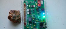


city

icone_mesure
slug
city

Measurement_fe5a1606-3154-4555-8202-2579ec0fbfca

Measured radiation

0.397 µSv/h
geolocalisation :

41.899277855824, 12.471381205801

Ground level
domlo
ATYPICAL MEASURE
Date de la mesure :
Latitude :
41.899277855824
Longitude :
12.471381205801
Altitude (M) :
24.0
Measurement time :
2 minutes 43 secondes
Distance travelled :
0.00m
Measurement speed :
Measurement Environment :
En ville city
Weather :
Tags :
Description :
Temperature :
30.0°C
Hits number :
188
Mesure UUID :
fe5a1606-3154-4555-8202-2579ec0fbfca
Manual Reporting :
No
Sensor / ID :
00164
Sensor / Firmware version :
OpengKIT71
Sensor / Type :
Sensor / Tube type :
SBM-20
Smartphone / UUID :
37C525FD-5749-4F9D-AC22-87318DD67A00
Smartphone / Platform :
iOS
Smartphone / Model :
iPhone12,1
Smartphone / OS Version :
15.6.1
Position acurracy :
35.0
Measurement height above the ground (in meters) :
0.00
Altitude accuracy :
35.0
Mean qualification :
Ground level
Software version :
OpenRadiation app 2.3.4
Measured value :
0.397 µSv/h
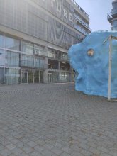

Measurement_fff5ad71-f036-4082-abec-701700727772

Measured radiation

0.114 µSv/h
geolocalisation :

43.613125, 1.4290033333333

Ground level
Fanche
Date de la mesure :
Latitude :
43.613125
Longitude :
1.4290033333333
Altitude (M) :
126.0
Measurement time :
1 minutes
Distance travelled :
86.17m
Measurement speed :
Measurement Environment :
En ville city
Weather :
Tags :
Description :
Temperature :
Hits number :
38
Mesure UUID :
fff5ad71-f036-4082-abec-701700727772
Manual Reporting :
No
Sensor / ID :
safecast_id 1225
Sensor / Firmware version :
$BNRDD
Sensor / Type :
Sensor / Tube type :
Smartphone / UUID :
Smartphone / Platform :
Smartphone / Model :
Smartphone / OS Version :
Position acurracy :
7.0
Measurement height above the ground (in meters) :
1.00
Altitude accuracy :
7.0
Mean qualification :
Ground level
Software version :
openradiation.net/upload v0.9
Measured value :
0.114 µSv/h

Measurement_ffdecf18-4694-4d3a-acf9-a21657873571

Measured radiation

0.225 µSv/h
geolocalisation :

48.853386666667, 2.34379

Ground level
Fanche
ATYPICAL MEASURE
Date de la mesure :
Latitude :
48.853386666667
Longitude :
2.34379
Altitude (M) :
47.0
Measurement time :
1 minutes
Distance travelled :
23.43m
Measurement speed :
Measurement Environment :
En ville city
Weather :
Tags :
Description :
Temperature :
Hits number :
75
Mesure UUID :
ffdecf18-4694-4d3a-acf9-a21657873571
Manual Reporting :
No
Sensor / ID :
safecast_id 3289
Sensor / Firmware version :
$BNRDD
Sensor / Type :
Sensor / Tube type :
Smartphone / UUID :
Smartphone / Platform :
Smartphone / Model :
Smartphone / OS Version :
Position acurracy :
6.0
Measurement height above the ground (in meters) :
1.00
Altitude accuracy :
6.0
Mean qualification :
Ground level
Software version :
openradiation.net/upload v0.9
Measured value :
0.225 µSv/h

Measurement_4e693bd7-2fbf-4c4d-a1f5-8e35dab6b357

Measured radiation

0.206 µSv/h
geolocalisation :

47.2074455, -1.5565385

Ground level
labsciren
ATYPICAL MEASURE
Date de la mesure :
Latitude :
47.2074455
Longitude :
-1.5565385
Altitude (M) :
70.0
Measurement time :
2 minutes
Distance travelled :
47.80m
Measurement speed :
Measurement Environment :
En ville city
Weather :
Tags :
Description :
esplanade devant l'école d'architecture
measurment image
Temperature :
25.0°C
Hits number :
58
Mesure UUID :
4e693bd7-2fbf-4c4d-a1f5-8e35dab6b357
Manual Reporting :
No
Sensor / ID :
7c805ac0
Sensor / Firmware version :
RiumGM BLE -b
Sensor / Type :
Sensor / Tube type :
J305γβ
Smartphone / UUID :
20735809be10aad8
Smartphone / Platform :
Android
Smartphone / Model :
M2007J20CG
Smartphone / OS Version :
12
Position acurracy :
17.7
Measurement height above the ground (in meters) :
1.00
Altitude accuracy :
17.7
Mean qualification :
Ground level
Software version :
OpenRadiation app 2.3.4
Measured value :
0.206 µSv/h

Measurement_ff54f45d-bad3-4970-ac53-aa1704576461

Measured radiation

0.090 µSv/h
geolocalisation :

48.795353333333, 2.3111183333333

Ground level
Fanche
Date de la mesure :
Latitude :
48.795353333333
Longitude :
2.3111183333333
Altitude (M) :
98.0
Measurement time :
1 minutes
Distance travelled :
418.78m
Measurement speed :
Measurement Environment :
En ville city
Weather :
Tags :
Description :
Temperature :
Hits number :
30
Mesure UUID :
ff54f45d-bad3-4970-ac53-aa1704576461
Manual Reporting :
No
Sensor / ID :
safecast_id 1223
Sensor / Firmware version :
$BNRDD
Sensor / Type :
Sensor / Tube type :
Smartphone / UUID :
Smartphone / Platform :
Smartphone / Model :
Smartphone / OS Version :
Position acurracy :
5.0
Measurement height above the ground (in meters) :
1.00
Altitude accuracy :
5.0
Mean qualification :
Ground level
Software version :
openradiation.net/upload v0.9
Measured value :
0.090 µSv/h

Measurement_4caba9fb-c348-40cc-b0d0-20af0838bc81

Measured radiation

0.122 µSv/h
geolocalisation :

44.9431576, -0.2407403

Ground level
Nala
Date de la mesure :
Latitude :
44.9431576
Longitude :
-0.2407403
Altitude (M) :
55.0
Measurement time :
2 minutes 49 secondes
Distance travelled :
155.34m
Measurement speed :
Measurement Environment :
En ville city
Weather :
Tags :
Description :
Autour du lac des Dageys.
measurment image
Temperature :
28.0°C
Hits number :
53
Mesure UUID :
4caba9fb-c348-40cc-b0d0-20af0838bc81
Manual Reporting :
No
Sensor / ID :
238193284
Sensor / Firmware version :
RiumGm
Sensor / Type :
Sensor / Tube type :
J305γβ
Smartphone / UUID :
963626a73b573742
Smartphone / Platform :
Android
Smartphone / Model :
Redmi Note 6 Pro
Smartphone / OS Version :
9
Position acurracy :
29.9
Measurement height above the ground (in meters) :
0.00
Altitude accuracy :
29.9
Mean qualification :
Ground level
Software version :
OpenRadiation app 2.3.4
Measured value :
0.122 µSv/h

Measurement_371e6e66-3a38-4bd8-aa08-e8d232d06c07

Measured radiation

0.063 µSv/h
geolocalisation :

47.3082203, -1.4896344

Ground level
Date de la mesure :
Latitude :
47.3082203
Longitude :
-1.4896344
Altitude (M) :
67.0
Measurement time :
3 minutes 5 secondes
Distance travelled :
5.90m
Measurement speed :
Measurement Environment :
En ville city
Weather :
Tags :
Description :
Temperature :
26.0°C
Hits number :
56
Mesure UUID :
371e6e66-3a38-4bd8-aa08-e8d232d06c07
Manual Reporting :
No
Sensor / ID :
00252
Sensor / Firmware version :
OpengKIT71
Sensor / Type :
Sensor / Tube type :
SBM-20
Smartphone / UUID :
b1627c5cd9b151b7
Smartphone / Platform :
Android
Smartphone / Model :
SM-G7810
Smartphone / OS Version :
10
Position acurracy :
89.8
Measurement height above the ground (in meters) :
1.00
Altitude accuracy :
89.8
Mean qualification :
Ground level
Software version :
OpenRadiation app 2.3.4
Measured value :
0.063 µSv/h

Measurement_dbdb5d57-18ca-41a9-9de0-80c67b944fcb

Measured radiation

0.093 µSv/h
geolocalisation :

43.05643241, 141.35291631

Ground level
Date de la mesure :
Latitude :
43.05643241
Longitude :
141.35291631
Altitude (M) :
60.0
Measurement time :
7 minutes 19 secondes
Distance travelled :
583.52m
Measurement speed :
Measurement Environment :
En ville city
Weather :
rainy day Pluie
Tags :
Description :
Temperature :
17.0°C
Hits number :
112
Mesure UUID :
dbdb5d57-18ca-41a9-9de0-80c67b944fcb
Manual Reporting :
No
Sensor / ID :
ef63cd2a
Sensor / Firmware version :
RiumGM BLE -b
Sensor / Type :
Sensor / Tube type :
J305γβ
Smartphone / UUID :
0ce08088d2f2f7fe
Smartphone / Platform :
Android
Smartphone / Model :
Redmi 8
Smartphone / OS Version :
10
Position acurracy :
18.2
Measurement height above the ground (in meters) :
0.00
Altitude accuracy :
18.2
Mean qualification :
Ground level
Software version :
OpenRadiation app 2.3.4
Measured value :
0.093 µSv/h

Measurement_ff5366d7-c4fc-42dd-a3db-e71693061767

Measured radiation

2.548 µSv/h
geolocalisation :

43.32521, -76.176748333333

Ground level
Fanche
ATYPICAL MEASURE
Date de la mesure :
Latitude :
43.32521
Longitude :
-76.176748333333
Altitude (M) :
11678.0
Measurement time :
1 minutes
Distance travelled :
14135.06m
Measurement speed :
Measurement Environment :
En ville city
Weather :
Tags :
Description :
Temperature :
Hits number :
851
Mesure UUID :
ff5366d7-c4fc-42dd-a3db-e71693061767
Manual Reporting :
No
Sensor / ID :
safecast_id 3220
Sensor / Firmware version :
$BNRDD
Sensor / Type :
Sensor / Tube type :
Smartphone / UUID :
Smartphone / Platform :
Smartphone / Model :
Smartphone / OS Version :
Position acurracy :
7.0
Measurement height above the ground (in meters) :
1.00
Altitude accuracy :
7.0
Mean qualification :
Ground level
Software version :
openradiation.net/upload v0.9
Measured value :
2.548 µSv/h

Measurement_3fdc4b82-6aeb-4a96-8ecd-132e435a828b

Measured radiation

5.570 µSv/h
geolocalisation :

41.4989904, 2.1052031

Ground level
PaK
ATYPICAL MEASURE
Date de la mesure :
Latitude :
41.4989904
Longitude :
2.1052031
Altitude (M) :
198.0
Measurement time :
46 secondes
Distance travelled :
0.00m
Measurement speed :
Measurement Environment :
En ville city
Weather :
Tags :
Description :
measuring Torbernita
measurment image
Temperature :
22.0°C
Hits number :
606
Mesure UUID :
3fdc4b82-6aeb-4a96-8ecd-132e435a828b
Manual Reporting :
No
Sensor / ID :
00214
Sensor / Firmware version :
OpengKIT71
Sensor / Type :
Sensor / Tube type :
SBM-20
Smartphone / UUID :
00fd9e6faf79acc4
Smartphone / Platform :
Android
Smartphone / Model :
SM-M022F
Smartphone / OS Version :
11
Position acurracy :
13.2
Measurement height above the ground (in meters) :
0.00
Altitude accuracy :
13.2
Mean qualification :
Ground level
Software version :
OpenRadiation app 2.3.5
Measured value :
5.570 µSv/h