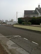
Ground level

slug
groundlevel

Measurement_8b4a4b16-75cf-48b2-9e33-a951e5d87d51

Measured radiation

0.133 µSv/h
geolocalisation :

48.113204122876, -1.6824048257523

Ground level
Hobert
Measurement date :
Latitude :
48.113204122876
Longitude :
-1.6824048257523
Altitude (M) :
37.0
Measurement time :
4 minutes 47 secondes
Distance travelled :
5.39m
Measurement speed :
Measurement Environment :
À l'intérieur inside
Weather :
Tags :
Description :
Temperature :
24.0°C
Hits number :
97
Mesure UUID :
8b4a4b16-75cf-48b2-9e33-a951e5d87d51
Manual Reporting :
No
Sensor / ID :
0a36fd4c
Sensor / Firmware version :
RiumGM BLE -b
Sensor / Type :
Sensor / Tube type :
J305γβ
Smartphone / UUID :
099DFCB7-1478-4415-9D8B-B22AC1148A94
Smartphone / Platform :
iOS
Smartphone / Model :
iPhone9,3
Smartphone / OS Version :
15.7
Position acurracy :
35.0
Measurement height above the ground (in meters) :
1.00
Altitude accuracy :
35.0
Mean qualification :
Ground level
Software version :
OpenRadiation app 2.3.4
Measured value :
0.133 µSv/h

Measurement_ebed0b22-6a12-4f9f-a881-2a4b5c2f5a5d

Measured radiation

0.285 µSv/h
geolocalisation :

46.1131983, 3.6829338

Ground level
lauryne
ATYPICAL MEASURE
Measurement date :
Latitude :
46.1131983
Longitude :
3.6829338
Altitude (M) :
616.0
Measurement time :
1 minutes
Distance travelled :
Measurement speed :
Measurement Environment :
En campagne countryside
Weather :
Tags :
Description :
Temperature :
Hits number :
52
Mesure UUID :
ebed0b22-6a12-4f9f-a881-2a4b5c2f5a5d
Manual Reporting :
No
Sensor / ID :
000119
Sensor / Firmware version :
OG-KIT1
Sensor / Type :
Sensor / Tube type :
SBM-20
Smartphone / UUID :
68c5b97c636dcd21
Smartphone / Platform :
Android
Smartphone / Model :
SM-A500FU
Smartphone / OS Version :
6.0.1
Position acurracy :
17.0
Measurement height above the ground (in meters) :
1.00
Altitude accuracy :
17.0
Mean qualification :
Ground level
Software version :
OpenRadiation app 1.0.0
Measured value :
0.285 µSv/h

Measurement_5dfb5b14-7c82-45a2-a9b7-f18dfc0b4806

Measured radiation

0.149 µSv/h
geolocalisation :

46.1076996, 3.5583798

Ground level
Measurement date :
Latitude :
46.1076996
Longitude :
3.5583798
Altitude (M) :
461.0
Measurement time :
2 minutes 1 secondes
Distance travelled :
Measurement speed :
Measurement Environment :
En campagne countryside
Weather :
Tags :
Description :
Temperature :
Hits number :
63
Mesure UUID :
5dfb5b14-7c82-45a2-a9b7-f18dfc0b4806
Manual Reporting :
No
Sensor / ID :
00013
Sensor / Firmware version :
OpengKIT71
Sensor / Type :
Sensor / Tube type :
SBM-20
Smartphone / UUID :
5EA6CA15-5925-439B-A492-F2AC6E77A278
Smartphone / Platform :
iOS
Smartphone / Model :
iPhone6,2
Smartphone / OS Version :
11.2.2
Position acurracy :
5.0
Measurement height above the ground (in meters) :
1.00
Altitude accuracy :
5.0
Mean qualification :
Ground level
Software version :
OpenRadiation app 1.0.0
Measured value :
0.149 µSv/h

Measurement_8beaf4dc-deef-4c5d-8227-d06d33dc1285

Measured radiation

0.217 µSv/h
geolocalisation :

41.927423835732, 8.7337568588555

Ground level
giocante1
ATYPICAL MEASURE
Measurement date :
Latitude :
41.927423835732
Longitude :
8.7337568588555
Altitude (M) :
129.0
Measurement time :
1 minutes 47 secondes
Distance travelled :
0.00m
Measurement speed :
Measurement Environment :
À l'intérieur inside
Weather :
Tags :
Description :
Temperature :
27.0°C
Hits number :
54
Mesure UUID :
8beaf4dc-deef-4c5d-8227-d06d33dc1285
Manual Reporting :
No
Sensor / ID :
3021143173
Sensor / Firmware version :
RiumGm
Sensor / Type :
Sensor / Tube type :
J305γβ
Smartphone / UUID :
57fcd8dae515e6ed
Smartphone / Platform :
Android
Smartphone / Model :
SM-A105FN
Smartphone / OS Version :
9
Position acurracy :
41.5
Measurement height above the ground (in meters) :
1.00
Altitude accuracy :
41.5
Mean qualification :
Ground level
Software version :
OpenRadiation app 2.3.1
Measured value :
0.217 µSv/h

Measurement_b152ff4e-d4c7-4482-9ee5-cc9b2216c3e0

Measured radiation

0.129 µSv/h
geolocalisation :

42.3191065, 9.4080875

Ground level
madouc
Measurement date :
Latitude :
42.3191065
Longitude :
9.4080875
Altitude (M) :
545.0
Measurement time :
2 minutes 41 secondes
Distance travelled :
0.00m
Measurement speed :
Measurement Environment :
En campagne countryside
Weather :
Tags :
Description :
Temperature :
20.0°C
Hits number :
53
Mesure UUID :
b152ff4e-d4c7-4482-9ee5-cc9b2216c3e0
Manual Reporting :
No
Sensor / ID :
0065cca9
Sensor / Firmware version :
RiumGM BLE -b
Sensor / Type :
Sensor / Tube type :
J305γβ
Smartphone / UUID :
3f290efb92fc097e
Smartphone / Platform :
android
Smartphone / Model :
SM-G781B
Smartphone / OS Version :
13
Position acurracy :
56.1
Measurement height above the ground (in meters) :
1.00
Altitude accuracy :
56.1
Mean qualification :
Ground level
Software version :
OpenRadiation app 3.0
Measured value :
0.129 µSv/h

Measurement_19df2fe8-d947-4557-9692-56aebe67e234

Measured radiation

0.114 µSv/h
geolocalisation :

46.9669993, -2.0007601

Ground level
Measurement date :
Latitude :
46.9669993
Longitude :
-2.0007601
Altitude (M) :
53.0
Measurement time :
2 minutes 17 secondes
Distance travelled :
479.54m
Measurement speed :
Measurement Environment :
À l'intérieur inside
Weather :
Tags :
Description :
Temperature :
25.0°C
Hits number :
59
Mesure UUID :
19df2fe8-d947-4557-9692-56aebe67e234
Manual Reporting :
No
Sensor / ID :
00219
Sensor / Firmware version :
OpengKIT71
Sensor / Type :
Sensor / Tube type :
SBM-20
Smartphone / UUID :
320a84b51f2dea8e
Smartphone / Platform :
Android
Smartphone / Model :
POT-LX1A
Smartphone / OS Version :
9
Position acurracy :
2429.0
Measurement height above the ground (in meters) :
1.00
Altitude accuracy :
2429.0
Mean qualification :
Ground level
Software version :
OpenRadiation app 2.3.4
Measured value :
0.114 µSv/h

Measurement_ff70ba0d-b372-4249-a070-691436553523

Measured radiation

0.069 µSv/h
geolocalisation :

48.674706666667, 2.2815333333333

Ground level
Fanche
Measurement date :
Latitude :
48.674706666667
Longitude :
2.2815333333333
Altitude (M) :
85.0
Measurement time :
1 minutes
Distance travelled :
1002.80m
Measurement speed :
Measurement Environment :
En campagne countryside
Weather :
Tags :
Description :
Temperature :
Hits number :
23
Mesure UUID :
ff70ba0d-b372-4249-a070-691436553523
Manual Reporting :
No
Sensor / ID :
safecast_id 2344
Sensor / Firmware version :
$BNRDD
Sensor / Type :
Sensor / Tube type :
Smartphone / UUID :
Smartphone / Platform :
Smartphone / Model :
Smartphone / OS Version :
Position acurracy :
9.0
Measurement height above the ground (in meters) :
1.00
Altitude accuracy :
9.0
Mean qualification :
Ground level
Software version :
openradiation.net/upload v0.9
Measured value :
0.069 µSv/h

Measurement_11538da1-7e0e-4942-b40d-c93f90ac5478

Measured radiation

0.161 µSv/h
geolocalisation :

43.0673811, 0.1549455

Ground level
Nala
Measurement date :
Latitude :
43.0673811
Longitude :
0.1549455
Altitude (M) :
601.0
Measurement time :
2 minutes 10 secondes
Distance travelled :
13.38m
Measurement speed :
Measurement Environment :
En ville city
Weather :
Tags :
Description :
A proximité du Pic du Midi.
measurment image
Temperature :
20.0°C
Hits number :
51
Mesure UUID :
11538da1-7e0e-4942-b40d-c93f90ac5478
Manual Reporting :
No
Sensor / ID :
238193284
Sensor / Firmware version :
RiumGm
Sensor / Type :
Sensor / Tube type :
J305γβ
Smartphone / UUID :
963626a73b573742
Smartphone / Platform :
Android
Smartphone / Model :
Redmi Note 6 Pro
Smartphone / OS Version :
9
Position acurracy :
22.3
Measurement height above the ground (in meters) :
1.00
Altitude accuracy :
22.3
Mean qualification :
Ground level
Software version :
OpenRadiation app 2.3.1
Measured value :
0.161 µSv/h

Measurement_0b27aeb2-4239-4a45-abce-169f9bfa519a

Measured radiation

0.068 µSv/h
geolocalisation :

47.587865204595, -2.8562972880927

Ground level
domlo
Measurement date :
Latitude :
47.587865204595
Longitude :
-2.8562972880927
Altitude (M) :
4.0
Measurement time :
2 minutes 45 secondes
Distance travelled :
50.88m
Measurement speed :
Measurement Environment :
En campagne countryside
Weather :
Tags :
Description :
sentier ile aux moines
measurment image
Temperature :
35.0°C
Hits number :
52
Mesure UUID :
0b27aeb2-4239-4a45-abce-169f9bfa519a
Manual Reporting :
No
Sensor / ID :
00164
Sensor / Firmware version :
OpengKIT71
Sensor / Type :
Sensor / Tube type :
SBM-20
Smartphone / UUID :
37C525FD-5749-4F9D-AC22-87318DD67A00
Smartphone / Platform :
iOS
Smartphone / Model :
iPhone8,1
Smartphone / OS Version :
13.5.1
Position acurracy :
5.0
Measurement height above the ground (in meters) :
1.00
Altitude accuracy :
5.0
Mean qualification :
Ground level
Software version :
OpenRadiation app 2.3.1
Measured value :
0.068 µSv/h

Measurement_24d60846-ff18-45b8-baf4-e34fa24515b0

Measured radiation

0.106 µSv/h
geolocalisation :

47.0763766, 4.3622348

Ground level
ValH
Measurement date :
Latitude :
47.0763766
Longitude :
4.3622348
Altitude (M) :
94.0
Measurement time :
3 minutes
Distance travelled :
13868.15m
Measurement speed :
Measurement Environment :
Sur la route ontheroad
Weather :
Tags :
Description :
Temperature :
27.0°C
Hits number :
51
Mesure UUID :
24d60846-ff18-45b8-baf4-e34fa24515b0
Manual Reporting :
No
Sensor / ID :
1075035709
Sensor / Firmware version :
RiumGm
Sensor / Type :
Sensor / Tube type :
J305γβ
Smartphone / UUID :
d7571fed5fdd5938
Smartphone / Platform :
Android
Smartphone / Model :
SM-N950F
Smartphone / OS Version :
9
Position acurracy :
2758.0
Measurement height above the ground (in meters) :
1.00
Altitude accuracy :
2758.0
Mean qualification :
Ground level
Software version :
OpenRadiation app 2.3.4
Measured value :
0.106 µSv/h