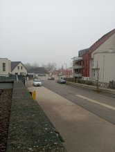
Ground level

slug
groundlevel

Measurement_d35ba07a-d40c-4374-ad55-105f4168bed3

Measured radiation

0.096 µSv/h
geolocalisation :

44.040878391866, 1.1124529782693

Ground level
Measurement date :
Latitude :
44.040878391866
Longitude :
1.1124529782693
Altitude (M) :
86.0
Measurement time :
7 minutes 47 secondes
Distance travelled :
19.22m
Measurement speed :
Measurement Environment :
À l'intérieur inside
Weather :
Tags :
Description :
Temperature :
25.0°C
Hits number :
180
Mesure UUID :
d35ba07a-d40c-4374-ad55-105f4168bed3
Manual Reporting :
No
Sensor / ID :
00194
Sensor / Firmware version :
OpengKIT71
Sensor / Type :
Sensor / Tube type :
SBM-20
Smartphone / UUID :
E3681A6C-2D53-43FE-9B61-627EA46529C7
Smartphone / Platform :
ios
Smartphone / Model :
iPhone10,3
Smartphone / OS Version :
16.7.10
Position acurracy :
50.0
Measurement height above the ground (in meters) :
1.00
Altitude accuracy :
50.0
Mean qualification :
Ground level
Software version :
OpenRadiation app 3.0
Measured value :
0.096 µSv/h

Measurement_0a9c884f-7cd9-433a-b182-731f69008a8d

Measured radiation

0.122 µSv/h
geolocalisation :

45.227142333984, -0.57264315

Ground level
Hobert
Measurement date :
Latitude :
45.227142333984
Longitude :
-0.57264315
Altitude (M) :
9.0
Measurement time :
9 minutes 25 secondes
Distance travelled :
254.01m
Measurement speed :
Measurement Environment :
En ville city
Weather :
Tags :
Description :
Temperature :
27.0°C
Hits number :
178
Mesure UUID :
0a9c884f-7cd9-433a-b182-731f69008a8d
Manual Reporting :
No
Sensor / ID :
0a36fd4c
Sensor / Firmware version :
RiumGM BLE -b
Sensor / Type :
Sensor / Tube type :
J305γβ
Smartphone / UUID :
099DFCB7-1478-4415-9D8B-B22AC1148A94
Smartphone / Platform :
iOS
Smartphone / Model :
iPhone9,3
Smartphone / OS Version :
15.5
Position acurracy :
5.0
Measurement height above the ground (in meters) :
1.00
Altitude accuracy :
5.0
Mean qualification :
Ground level
Software version :
OpenRadiation app 2.3.4
Measured value :
0.122 µSv/h

Measurement_9bec755a-ad28-4689-bd78-8c9a8e7664b5

Measured radiation

0.076 µSv/h
geolocalisation :

45.012226131216, -0.43666114150706

Ground level
Measurement date :
Latitude :
45.012226131216
Longitude :
-0.43666114150706
Altitude (M) :
52.0
Measurement time :
4 minutes 40 secondes
Distance travelled :
0.00m
Measurement speed :
Measurement Environment :
À l'intérieur inside
Weather :
Tags :
Description :
Temperature :
24.0°C
Hits number :
62
Mesure UUID :
9bec755a-ad28-4689-bd78-8c9a8e7664b5
Manual Reporting :
No
Sensor / ID :
b8cfaadf
Sensor / Firmware version :
RiumGM BLE -b
Sensor / Type :
Sensor / Tube type :
J305γβ
Smartphone / UUID :
E0E54D9E-88DC-47E3-88C9-5D26780EF8F6
Smartphone / Platform :
iOS
Smartphone / Model :
iPhone14,7
Smartphone / OS Version :
17.3.1
Position acurracy :
35.0
Measurement height above the ground (in meters) :
1.00
Altitude accuracy :
35.0
Mean qualification :
Ground level
Software version :
OpenRadiation app 2.3.4
Measured value :
0.076 µSv/h

Measurement_280fcd6b-89bb-4df0-969a-d13e080bca42

Measured radiation

0.058 µSv/h
geolocalisation :

48.827265980887, 2.2127408855205

Ground level
Measurement date :
Latitude :
48.827265980887
Longitude :
2.2127408855205
Altitude (M) :
99.0
Measurement time :
2 minutes 57 secondes
Distance travelled :
0.00m
Measurement speed :
Measurement Environment :
À l'intérieur inside
Weather :
rainy day Pluie
Tags :
Description :
Temperature :
25.0°C
Hits number :
51
Mesure UUID :
280fcd6b-89bb-4df0-969a-d13e080bca42
Manual Reporting :
No
Sensor / ID :
00013
Sensor / Firmware version :
OpengKIT71
Sensor / Type :
Sensor / Tube type :
SBM-20
Smartphone / UUID :
C4A7B755-90C2-452C-A101-7C40CFE607F4
Smartphone / Platform :
ios
Smartphone / Model :
iPhone12,1
Smartphone / OS Version :
18.4
Position acurracy :
9.9
Measurement height above the ground (in meters) :
1.00
Altitude accuracy :
9.9
Mean qualification :
Ground level
Software version :
OpenRadiation app 3.0
Measured value :
0.058 µSv/h

Measurement_de1f3d57-2c6d-4ac8-ac61-cf684c2f01b7

Measured radiation

21.153 µSv/h
geolocalisation :

31.2385213, 121.4785491

Ground level
Fanche
ATYPICAL MEASURE
Measurement date :
Latitude :
31.2385213
Longitude :
121.4785491
Altitude (M) :
5.0
Measurement time :
5 secondes
Distance travelled :
0.00m
Measurement speed :
Measurement Environment :
Sur la route ontheroad
Weather :
Tags :
Description :
Temperature :
22.0°C
Hits number :
272
Mesure UUID :
de1f3d57-2c6d-4ac8-ac61-cf684c2f01b7
Manual Reporting :
No
Sensor / ID :
88:4A:EA:7C:0A:69
Sensor / Firmware version :
AtomTag v.1.0.3
Sensor / Type :
Sensor / Tube type :
SBM-20
Smartphone / UUID :
450af21a32183632
Smartphone / Platform :
Android
Smartphone / Model :
SM-J600FN
Smartphone / OS Version :
8.0.0
Position acurracy :
8.3
Measurement height above the ground (in meters) :
1.00
Altitude accuracy :
8.3
Mean qualification :
Ground level
Software version :
OpenRadiation app 2.2.0
Measured value :
21.153 µSv/h

Measurement_ffcf0a81-8970-43ed-a50b-cf1728582893

Measured radiation

0.129 µSv/h
geolocalisation :

49.336188333333, 0.35658666666667

Ground level
Fanche
Measurement date :
Latitude :
49.336188333333
Longitude :
0.35658666666667
Altitude (M) :
115.0
Measurement time :
1 minutes 1 secondes
Distance travelled :
2082.40m
Measurement speed :
Measurement Environment :
En campagne countryside
Weather :
rainy day Pluie
Tags :
Description :
Temperature :
Hits number :
43
Mesure UUID :
ffcf0a81-8970-43ed-a50b-cf1728582893
Manual Reporting :
No
Sensor / ID :
safecast_id 1223
Sensor / Firmware version :
$BNRDD
Sensor / Type :
Sensor / Tube type :
Smartphone / UUID :
Smartphone / Platform :
Smartphone / Model :
Smartphone / OS Version :
Position acurracy :
8.0
Measurement height above the ground (in meters) :
1.00
Altitude accuracy :
8.0
Mean qualification :
Ground level
Software version :
openradiation.net/upload v0.9
Measured value :
0.129 µSv/h

Measurement_ff3ccceb-5f4c-4c94-a36a-f91475174859

Measured radiation

0.072 µSv/h
geolocalisation :

49.415176666667, 0.272295

Ground level
Fanche
Measurement date :
Latitude :
49.415176666667
Longitude :
0.272295
Altitude (M) :
5.0
Measurement time :
1 minutes
Distance travelled :
1563.66m
Measurement speed :
Measurement Environment :
Sur la route ontheroad
Weather :
Tags :
Description :
Temperature :
Hits number :
24
Mesure UUID :
ff3ccceb-5f4c-4c94-a36a-f91475174859
Manual Reporting :
No
Sensor / ID :
safecast_id 2340
Sensor / Firmware version :
$BNRDD
Sensor / Type :
Sensor / Tube type :
Smartphone / UUID :
Smartphone / Platform :
Smartphone / Model :
Smartphone / OS Version :
Position acurracy :
10.0
Measurement height above the ground (in meters) :
1.00
Altitude accuracy :
10.0
Mean qualification :
Ground level
Software version :
openradiation.net/upload v0.9
Measured value :
0.072 µSv/h

Measurement_ffbf5dfd-771b-42dd-a75a-da1725614128

Measured radiation

0.123 µSv/h
geolocalisation :

45.941538333333, 1.3925933333333

Ground level
Fanche
Measurement date :
Latitude :
45.941538333333
Longitude :
1.3925933333333
Altitude (M) :
535.0
Measurement time :
1 minutes
Distance travelled :
2363.72m
Measurement speed :
Measurement Environment :
Sur la route ontheroad
Weather :
Tags :
Description :
Temperature :
Hits number :
41
Mesure UUID :
ffbf5dfd-771b-42dd-a75a-da1725614128
Manual Reporting :
No
Sensor / ID :
safecast_id 3228
Sensor / Firmware version :
$BNRDD
Sensor / Type :
Sensor / Tube type :
Smartphone / UUID :
Smartphone / Platform :
Smartphone / Model :
Smartphone / OS Version :
Position acurracy :
7.0
Measurement height above the ground (in meters) :
1.00
Altitude accuracy :
7.0
Mean qualification :
Ground level
Software version :
openradiation.net/upload v0.9
Measured value :
0.123 µSv/h

Measurement_ff3c164a-d543-4851-a848-8f1683729695

Measured radiation

0.114 µSv/h
geolocalisation :

46.86686, 4.82002

Ground level
Fanche
Measurement date :
Latitude :
46.86686
Longitude :
4.82002
Altitude (M) :
201.0
Measurement time :
1 minutes
Distance travelled :
2102.76m
Measurement speed :
Measurement Environment :
Sur la route ontheroad
Weather :
Tags :
Description :
Temperature :
Hits number :
38
Mesure UUID :
ff3c164a-d543-4851-a848-8f1683729695
Manual Reporting :
No
Sensor / ID :
safecast_id 3289
Sensor / Firmware version :
$BNRDD
Sensor / Type :
Sensor / Tube type :
Smartphone / UUID :
Smartphone / Platform :
Smartphone / Model :
Smartphone / OS Version :
Position acurracy :
9.0
Measurement height above the ground (in meters) :
1.00
Altitude accuracy :
9.0
Mean qualification :
Ground level
Software version :
openradiation.net/upload v0.9
Measured value :
0.114 µSv/h

Measurement_ff5366d7-c4fc-42dd-a3db-e71693061887

Measured radiation

2.398 µSv/h
geolocalisation :

43.576171666667, -76.13237

Ground level
Fanche
ATYPICAL MEASURE
Measurement date :
Latitude :
43.576171666667
Longitude :
-76.13237
Altitude (M) :
11563.0
Measurement time :
1 minutes
Distance travelled :
13706.75m
Measurement speed :
Measurement Environment :
En ville city
Weather :
Tags :
Description :
Temperature :
Hits number :
801
Mesure UUID :
ff5366d7-c4fc-42dd-a3db-e71693061887
Manual Reporting :
No
Sensor / ID :
safecast_id 3220
Sensor / Firmware version :
$BNRDD
Sensor / Type :
Sensor / Tube type :
Smartphone / UUID :
Smartphone / Platform :
Smartphone / Model :
Smartphone / OS Version :
Position acurracy :
9.0
Measurement height above the ground (in meters) :
1.00
Altitude accuracy :
9.0
Mean qualification :
Ground level
Software version :
openradiation.net/upload v0.9
Measured value :
2.398 µSv/h