Ground level

slug
groundlevel

Measurement_62aa8c8b-cd74-4b9e-ab63-bb480781a114

Measured radiation

0.117 µSv/h
geolocalisation :

45.943868650618, 3.0839391508454

Ground level
Olivier VOLTZ
Measurement date :
Latitude :
45.943868650618
Longitude :
3.0839391508454
Altitude (M) :
426.0
Measurement time :
2 minutes 47 secondes
Distance travelled :
143.62m
Measurement speed :
Measurement Environment :
En campagne countryside
Weather :
Tags :
Description :
Temperature :
26.0°C
Hits number :
51
Mesure UUID :
62aa8c8b-cd74-4b9e-ab63-bb480781a114
Manual Reporting :
No
Sensor / ID :
7339a980
Sensor / Firmware version :
RiumGM BLE -b
Sensor / Type :
Sensor / Tube type :
J305γβ
Smartphone / UUID :
6A2BCC37-D2A9-4CB6-924B-95846E4FE1D6
Smartphone / Platform :
ios
Smartphone / Model :
iPhone17,3
Smartphone / OS Version :
18.4.1
Position acurracy :
2.6
Measurement height above the ground (in meters) :
1.00
Altitude accuracy :
2.6
Mean qualification :
Ground level
Software version :
OpenRadiation app 3.0
Measured value :
0.117 µSv/h

Measurement_b01179ca-807e-4383-80a4-d102989927ef

Measured radiation

0.081 µSv/h
geolocalisation :

49.8975939, 2.2647186

Ground level
CLI gravelines 2
Measurement date :
Latitude :
49.8975939
Longitude :
2.2647186
Altitude (M) :
70.0
Measurement time :
3 minutes 14 secondes
Distance travelled :
537.45m
Measurement speed :
Measurement Environment :
Weather :
Tags :
Description :
Temperature :
20.0°C
Hits number :
51
Mesure UUID :
b01179ca-807e-4383-80a4-d102989927ef
Manual Reporting :
No
Sensor / ID :
80:30:DC:4A:B7:7A
Sensor / Firmware version :
AtomTag v.1.0.3
Sensor / Type :
Sensor / Tube type :
SBM-20
Smartphone / UUID :
4a8e20637900eef5
Smartphone / Platform :
Android
Smartphone / Model :
SM-G9730
Smartphone / OS Version :
9
Position acurracy :
95.7
Measurement height above the ground (in meters) :
Altitude accuracy :
95.7
Mean qualification :
Ground level
Software version :
OpenRadiation app 2.3.4
Measured value :
0.081 µSv/h

Measurement_ff77f60f-6c48-4ac5-ac87-8f1532182210

Measured radiation

0.150 µSv/h
geolocalisation :

34.1485, -118.06517666667

Ground level
Fanche
Measurement date :
Latitude :
34.1485
Longitude :
-118.06517666667
Altitude (M) :
200.0
Measurement time :
1 minutes
Distance travelled :
1729.55m
Measurement speed :
Measurement Environment :
En campagne countryside
Weather :
Tags :
Description :
Temperature :
Hits number :
50
Mesure UUID :
ff77f60f-6c48-4ac5-ac87-8f1532182210
Manual Reporting :
No
Sensor / ID :
safecast_id 1225
Sensor / Firmware version :
$BNRDD
Sensor / Type :
Sensor / Tube type :
Smartphone / UUID :
Smartphone / Platform :
Smartphone / Model :
Smartphone / OS Version :
Position acurracy :
10.0
Measurement height above the ground (in meters) :
1000.00
Altitude accuracy :
10.0
Mean qualification :
Ground level
Software version :
openradiation.net/upload v0.5
Measured value :
0.150 µSv/h

Measurement_ff77f60f-6c48-4ac5-ac87-8f1532182150

Measured radiation

0.190 µSv/h
geolocalisation :

34.147503333333, -118.08386333333

Ground level
Fanche
Measurement date :
Latitude :
34.147503333333
Longitude :
-118.08386333333
Altitude (M) :
229.0
Measurement time :
1 minutes
Distance travelled :
1725.12m
Measurement speed :
Measurement Environment :
En campagne countryside
Weather :
Tags :
Description :
Temperature :
Hits number :
64
Mesure UUID :
ff77f60f-6c48-4ac5-ac87-8f1532182150
Manual Reporting :
No
Sensor / ID :
safecast_id 1225
Sensor / Firmware version :
$BNRDD
Sensor / Type :
Sensor / Tube type :
Smartphone / UUID :
Smartphone / Platform :
Smartphone / Model :
Smartphone / OS Version :
Position acurracy :
9.0
Measurement height above the ground (in meters) :
1000.00
Altitude accuracy :
9.0
Mean qualification :
Ground level
Software version :
openradiation.net/upload v0.5
Measured value :
0.190 µSv/h

Measurement_2c0a7717-5085-46aa-9350-008496f158f4

Measured radiation

1.572 µSv/h
geolocalisation :

50.974798453728, 2.1328105482022

Ground level
Yann29
ATYPICAL MEASURE
Measurement date :
Latitude :
50.974798453728
Longitude :
2.1328105482022
Altitude (M) :
2.0
Measurement time :
23 secondes
Distance travelled :
0.00m
Measurement speed :
Measurement Environment :
À l'intérieur inside
Weather :
Tags :
Description :
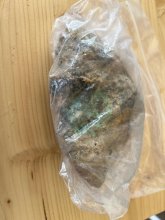
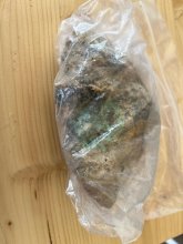
mesure à côté d'un caillou radoactif
measurment image
Temperature :
20.0°C
Hits number :
75
Mesure UUID :
2c0a7717-5085-46aa-9350-008496f158f4
Manual Reporting :
No
Sensor / ID :
93677545
Sensor / Firmware version :
RiumGM BLE -b
Sensor / Type :
Sensor / Tube type :
J305γβ
Smartphone / UUID :
BD2C896C-CF53-4C23-B10A-A484AFB22EE2
Smartphone / Platform :
ios
Smartphone / Model :
iPhone14,4
Smartphone / OS Version :
18.4.1
Position acurracy :
3.5
Measurement height above the ground (in meters) :
1.00
Altitude accuracy :
3.5
Mean qualification :
Ground level
Software version :
OpenRadiation app 3.0
Measured value :
1.572 µSv/h

Measurement_80657c9f-20ca-4cef-9017-2e4a29c135ab

Measured radiation

0.309 µSv/h
geolocalisation :

48.8290433, -3.4862718

Ground level
ghis
ATYPICAL MEASURE
Measurement date :
Latitude :
48.8290433
Longitude :
-3.4862718
Altitude (M) :
60.0
Measurement time :
1 minutes 6 secondes
Distance travelled :
32.02m
Measurement speed :
Measurement Environment :
En ville city
Weather :
Tags :
Description :
Temperature :
4.0°C
Hits number :
50
Mesure UUID :
80657c9f-20ca-4cef-9017-2e4a29c135ab
Manual Reporting :
No
Sensor / ID :
20:C3:8F:D1:EE:70
Sensor / Firmware version :
AtomTag v.1.0.3
Sensor / Type :
Sensor / Tube type :
SBM-20
Smartphone / UUID :
87e7ea330f6a93b0
Smartphone / Platform :
Android
Smartphone / Model :
DIG-L21HN
Smartphone / OS Version :
6.0
Position acurracy :
6.7
Measurement height above the ground (in meters) :
1.00
Altitude accuracy :
6.7
Mean qualification :
Ground level
Software version :
OpenRadiation app 2.3.1
Measured value :
0.309 µSv/h

Measurement_b17b0b42-f55f-4ee1-bfaf-8e7a5d0845c6

Measured radiation

4.985 µSv/h
geolocalisation :

50.9748762, 2.1328112

Ground level
ATYPICAL MEASURE
Measurement date :
Latitude :
50.9748762
Longitude :
2.1328112
Altitude (M) :
47.0
Measurement time :
9 secondes
Distance travelled :
0.00m
Measurement speed :
Measurement Environment :
En ville city
Weather :
rainy day Pluie
Tags :
Description :
Temperature :
25.0°C
Hits number :
98
Mesure UUID :
b17b0b42-f55f-4ee1-bfaf-8e7a5d0845c6
Manual Reporting :
No
Sensor / ID :
00001
Sensor / Firmware version :
OpengKIT72
Sensor / Type :
Sensor / Tube type :
Smartphone / UUID :
8ec1468f96db9cda
Smartphone / Platform :
android
Smartphone / Model :
SM-G986U1
Smartphone / OS Version :
13
Position acurracy :
9.8
Measurement height above the ground (in meters) :
1.00
Altitude accuracy :
9.8
Mean qualification :
Ground level
Software version :
OpenRadiation app 3.0
Measured value :
4.985 µSv/h

Measurement_fbf47bf2-10b7-4199-94a0-72cd3595ff27

Measured radiation

0.751 µSv/h
geolocalisation :

50.9748006, 2.1328829

Ground level
ATYPICAL MEASURE
Measurement date :
Latitude :
50.9748006
Longitude :
2.1328829
Altitude (M) :
47.0
Measurement time :
42 secondes
Distance travelled :
0.00m
Measurement speed :
Measurement Environment :
En ville city
Weather :
rainy day Pluie
Tags :
Description :
Temperature :
25.0°C
Hits number :
72
Mesure UUID :
fbf47bf2-10b7-4199-94a0-72cd3595ff27
Manual Reporting :
No
Sensor / ID :
00001
Sensor / Firmware version :
OpengKIT72
Sensor / Type :
Sensor / Tube type :
Smartphone / UUID :
8ec1468f96db9cda
Smartphone / Platform :
android
Smartphone / Model :
SM-G986U1
Smartphone / OS Version :
13
Position acurracy :
10.5
Measurement height above the ground (in meters) :
1.00
Altitude accuracy :
10.5
Mean qualification :
Ground level
Software version :
OpenRadiation app 3.0
Measured value :
0.751 µSv/h

Measurement_ce44d47e-93b1-4ba7-a5d1-1cdd466bfba9

Measured radiation

9.600 µSv/h
geolocalisation :

48.7951375, 2.2850697

Ground level
Fanche
ATYPICAL MEASURE
Measurement date :
Latitude :
48.7951375
Longitude :
2.2850697
Altitude (M) :
Measurement time :
10 secondes
Distance travelled :
0.00m
Measurement speed :
Measurement Environment :
À l'intérieur inside
Weather :
Tags :
Description :
Temperature :
75.0°C
Hits number :
222
Mesure UUID :
ce44d47e-93b1-4ba7-a5d1-1cdd466bfba9
Manual Reporting :
No
Sensor / ID :
00131
Sensor / Firmware version :
OpengKIT71
Sensor / Type :
Sensor / Tube type :
SBM-20
Smartphone / UUID :
7fbd831feba6c773
Smartphone / Platform :
Android
Smartphone / Model :
SM-J600FN
Smartphone / OS Version :
9
Position acurracy :
14.6
Measurement height above the ground (in meters) :
1.00
Altitude accuracy :
14.6
Mean qualification :
Ground level
Software version :
OpenRadiation app 2.3.1
Measured value :
9.600 µSv/h