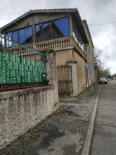


city

icone_mesure
slug
city

Measurement_e47dde66-bf36-41a3-a9b9-e2965c48c13f

Measured radiation

0.148 µSv/h
geolocalisation :

45.7442762, 4.8350502

Ground level
Date de la mesure :
Latitude :
45.7442762
Longitude :
4.8350502
Altitude (M) :
222.0
Measurement time :
2 minutes 38 secondes
Distance travelled :
290.26m
Measurement speed :
Measurement Environment :
En ville city
Weather :
Tags :
Description :
Temperature :
13.0°C
Hits number :
58
Mesure UUID :
e47dde66-bf36-41a3-a9b9-e2965c48c13f
Manual Reporting :
No
Sensor / ID :
5213de31
Sensor / Firmware version :
RiumGM BLE -b
Sensor / Type :
Sensor / Tube type :
J305γβ
Smartphone / UUID :
cf6ec3d3e81aee71
Smartphone / Platform :
android
Smartphone / Model :
Core-X4
Smartphone / OS Version :
10
Position acurracy :
6.0
Measurement height above the ground (in meters) :
1.00
Altitude accuracy :
6.0
Mean qualification :
Ground level
Software version :
OpenRadiation app 3.0
Measured value :
0.148 µSv/h


Measurement_c827d2bd-aa91-438a-9941-3ab000f48347

Measured radiation

0.107 µSv/h
geolocalisation :

46.27429667911, 7.063456865387

Ground level
Thierry Dudok de Wit
Date de la mesure :
Latitude :
46.27429667911
Longitude :
7.063456865387
Altitude (M) :
1134.0
Measurement time :
6 minutes 31 secondes
Distance travelled :
0.00m
Measurement speed :
Measurement Environment :
En ville city
Weather :
Tags :
Description :
Temperature :
Hits number :
232
Mesure UUID :
c827d2bd-aa91-438a-9941-3ab000f48347
Manual Reporting :
No
Sensor / ID :
82771564-BA51-2E60-36DB-0D14B0995FAB
Sensor / Firmware version :
BLEBee
Sensor / Type :
Sensor / Tube type :
LND 7317 pancake
Smartphone / UUID :
551AF55B-F447-41B1-9D6B-E136A052587A
Smartphone / Platform :
ios
Smartphone / Model :
iPhone14,4
Smartphone / OS Version :
18.3.2
Position acurracy :
8.5
Measurement height above the ground (in meters) :
1.00
Altitude accuracy :
8.5
Mean qualification :
Ground level
Software version :
OpenRadiation app 3.0
Measured value :
0.107 µSv/h

Measurement_28b1271a-8822-4c5c-a9da-5bf000d37ccf

Measured radiation

0.143 µSv/h
geolocalisation :

43.2326066, 0.0693178

Ground level
Nala
Date de la mesure :
Latitude :
43.2326066
Longitude :
0.0693178
Altitude (M) :
365.0
Measurement time :
2 minutes 34 secondes
Distance travelled :
35.31m
Measurement speed :
Measurement Environment :
En ville city
Weather :
Tags :
Description :
Devant un ancien bâtiment militaire rénové pour le conseil départemental.
measurment image
Temperature :
20.0°C
Hits number :
55
Mesure UUID :
28b1271a-8822-4c5c-a9da-5bf000d37ccf
Manual Reporting :
No
Sensor / ID :
238193284
Sensor / Firmware version :
RiumGm
Sensor / Type :
Sensor / Tube type :
J305γβ
Smartphone / UUID :
963626a73b573742
Smartphone / Platform :
Android
Smartphone / Model :
Redmi Note 6 Pro
Smartphone / OS Version :
9
Position acurracy :
111.0
Measurement height above the ground (in meters) :
1.00
Altitude accuracy :
111.0
Mean qualification :
Ground level
Software version :
OpenRadiation app 2.3.1
Measured value :
0.143 µSv/h

Measurement_b69f2085-ea1d-4477-8635-e549c2d65389

Measured radiation

0.115 µSv/h
geolocalisation :

43.2371986, 0.0747666

Ground level
Nala
Date de la mesure :
Latitude :
43.2371986
Longitude :
0.0747666
Altitude (M) :
358.0
Measurement time :
2 minutes 46 secondes
Distance travelled :
80.58m
Measurement speed :
Measurement Environment :
En ville city
Weather :
Tags :
Description :
jardin municipal.
Temperature :
19.0°C
Hits number :
50
Mesure UUID :
b69f2085-ea1d-4477-8635-e549c2d65389
Manual Reporting :
No
Sensor / ID :
238193284
Sensor / Firmware version :
RiumGm
Sensor / Type :
Sensor / Tube type :
J305γβ
Smartphone / UUID :
963626a73b573742
Smartphone / Platform :
Android
Smartphone / Model :
Redmi Note 6 Pro
Smartphone / OS Version :
9
Position acurracy :
24.9
Measurement height above the ground (in meters) :
1.00
Altitude accuracy :
24.9
Mean qualification :
Ground level
Software version :
OpenRadiation app 2.3.1
Measured value :
0.115 µSv/h

Measurement_ff90e210-6903-4253-ab57-091679400993

Measured radiation

0.114 µSv/h
geolocalisation :

48.891966666667, 2.4966066666667

Ground level
Fanche
Date de la mesure :
Latitude :
48.891966666667
Longitude :
2.4966066666667
Altitude (M) :
112.0
Measurement time :
1 minutes
Distance travelled :
1987.33m
Measurement speed :
Measurement Environment :
En ville city
Weather :
Tags :
Description :
Temperature :
Hits number :
38
Mesure UUID :
ff90e210-6903-4253-ab57-091679400993
Manual Reporting :
No
Sensor / ID :
safecast_id 1223
Sensor / Firmware version :
$BNRDD
Sensor / Type :
Sensor / Tube type :
Smartphone / UUID :
Smartphone / Platform :
Smartphone / Model :
Smartphone / OS Version :
Position acurracy :
5.0
Measurement height above the ground (in meters) :
-1.00
Altitude accuracy :
5.0
Mean qualification :
Ground level
Software version :
openradiation.net/upload v0.9
Measured value :
0.114 µSv/h

Measurement_8dbdede0-f0bf-435c-aafa-3330a9e168ff

Measured radiation

0.040 µSv/h
geolocalisation :

49.8596631, 3.3018214

Ground level
Date de la mesure :
Latitude :
49.8596631
Longitude :
3.3018214
Altitude (M) :
91.0
Measurement time :
4 minutes
Distance travelled :
Measurement speed :
Measurement Environment :
En ville city
Weather :
Tags :
Description :
Temperature :
Hits number :
58
Mesure UUID :
8dbdede0-f0bf-435c-aafa-3330a9e168ff
Manual Reporting :
No
Sensor / ID :
00143
Sensor / Firmware version :
OpengKIT71
Sensor / Type :
Sensor / Tube type :
SBM-20
Smartphone / UUID :
D07CAC0B-67A1-4F10-A993-F65D0B35EB60
Smartphone / Platform :
iOS
Smartphone / Model :
iPhone9,4
Smartphone / OS Version :
12.1
Position acurracy :
65.0
Measurement height above the ground (in meters) :
1.00
Altitude accuracy :
65.0
Mean qualification :
Ground level
Software version :
OpenRadiation app 1.0.0
Measured value :
0.040 µSv/h

Measurement_4d29dc6c-0aec-47ad-a290-8886262a8976

Measured radiation

0.131 µSv/h
geolocalisation :

43.2442167, 0.0788668

Ground level
Nala
Date de la mesure :
Latitude :
43.2442167
Longitude :
0.0788668
Altitude (M) :
354.0
Measurement time :
1 minutes 47 secondes
Distance travelled :
20.87m
Measurement speed :
Measurement Environment :
En ville city
Weather :
Tags :
Description :
ancienne zone militaire. Lieu de fabrication de minutio s pour l'armée
measurment image
Temperature :
26.0°C
Hits number :
51
Mesure UUID :
4d29dc6c-0aec-47ad-a290-8886262a8976
Manual Reporting :
No
Sensor / ID :
00230
Sensor / Firmware version :
OpengKIT71
Sensor / Type :
Sensor / Tube type :
SBM-20
Smartphone / UUID :
963626a73b573742
Smartphone / Platform :
Android
Smartphone / Model :
Redmi Note 6 Pro
Smartphone / OS Version :
9
Position acurracy :
20.4
Measurement height above the ground (in meters) :
0.00
Altitude accuracy :
20.4
Mean qualification :
Ground level
Software version :
OpenRadiation app 2.3.4
Measured value :
0.131 µSv/h

Measurement_43fc2699-5ad9-4f10-b096-ad48f475a223

Measured radiation

0.119 µSv/h
geolocalisation :

42.7632951, 1.7634809

Ground level
MSKMPO
Date de la mesure :
Latitude :
42.7632951
Longitude :
1.7634809
Altitude (M) :
660.0
Measurement time :
1 minutes 55 secondes
Distance travelled :
5.75m
Measurement speed :
Measurement Environment :
En ville city
Weather :
Tags :
Description :
Luzenac (09) Ecole
Temperature :
19.0°C
Hits number :
51
Mesure UUID :
43fc2699-5ad9-4f10-b096-ad48f475a223
Manual Reporting :
No
Sensor / ID :
000116
Sensor / Firmware version :
OG-KIT1
Sensor / Type :
Sensor / Tube type :
SBM-20
Smartphone / UUID :
a4ae3dc5297b42e4
Smartphone / Platform :
Android
Smartphone / Model :
Redmi Note 6 Pro
Smartphone / OS Version :
9
Position acurracy :
114.2
Measurement height above the ground (in meters) :
1.00
Altitude accuracy :
114.2
Mean qualification :
Ground level
Software version :
OpenRadiation app 2.3.1
Measured value :
0.119 µSv/h

Measurement_8e95851b-1da9-494b-a663-82038bd08e90

Measured radiation

0.084 µSv/h
geolocalisation :

43.5101181, 0.4030472

Ground level
Nala
Date de la mesure :
Latitude :
43.5101181
Longitude :
0.4030472
Altitude (M) :
221.0
Measurement time :
2 minutes 29 secondes
Distance travelled :
3.10m
Measurement speed :
Measurement Environment :
En ville city
Weather :
Tags :
Description :
measurment image
Temperature :
25.0°C
Hits number :
53
Mesure UUID :
8e95851b-1da9-494b-a663-82038bd08e90
Manual Reporting :
No
Sensor / ID :
00230
Sensor / Firmware version :
OpengKIT71
Sensor / Type :
Sensor / Tube type :
SBM-20
Smartphone / UUID :
963626a73b573742
Smartphone / Platform :
Android
Smartphone / Model :
Redmi Note 6 Pro
Smartphone / OS Version :
9
Position acurracy :
5.4
Measurement height above the ground (in meters) :
1.00
Altitude accuracy :
5.4
Mean qualification :
Ground level
Software version :
OpenRadiation app 2.3.4
Measured value :
0.084 µSv/h

Measurement_084e5844-d3e2-4b37-a5bd-47f1ea3a2afc

Measured radiation

0.132 µSv/h
geolocalisation :

48.52402882555, 7.7198480631301

Ground level
Date de la mesure :
Latitude :
48.52402882555
Longitude :
7.7198480631301
Altitude (M) :
144.0
Measurement time :
8 minutes 25 secondes
Distance travelled :
605.52m
Measurement speed :
Measurement Environment :
En ville city
Weather :
Tags :
Description :
Temperature :
25.0°C
Hits number :
169
Mesure UUID :
084e5844-d3e2-4b37-a5bd-47f1ea3a2afc
Manual Reporting :
No
Sensor / ID :
25e224b9
Sensor / Firmware version :
RiumGM BLE -b
Sensor / Type :
Sensor / Tube type :
J305γβ
Smartphone / UUID :
63D2E086-B1B7-489E-BB89-3D96C19FA4AD
Smartphone / Platform :
iOS
Smartphone / Model :
iPhone10,4
Smartphone / OS Version :
14.6
Position acurracy :
1527.4
Measurement height above the ground (in meters) :
1.00
Altitude accuracy :
1527.4
Mean qualification :
Ground level
Software version :
OpenRadiation app 2.3.4
Measured value :
0.132 µSv/h