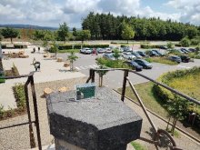
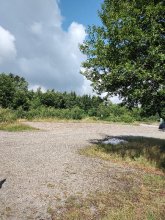
Ground level

slug
groundlevel

Measurement_857538c9-646f-43ac-bee1-095f0c8b75dd

Measured radiation

0.071 µSv/h
geolocalisation :

45.4566631, 5.8814301

Ground level
SRTE
Measurement date :
Latitude :
45.4566631
Longitude :
5.8814301
Altitude (M) :
876.0
Measurement time :
2 minutes 41 secondes
Distance travelled :
Measurement speed :
Measurement Environment :
En campagne countryside
Weather :
Tags :
Description :
Temperature :
Hits number :
52
Mesure UUID :
857538c9-646f-43ac-bee1-095f0c8b75dd
Manual Reporting :
No
Sensor / ID :
00013
Sensor / Firmware version :
OpengKIT71
Sensor / Type :
Sensor / Tube type :
SBM-20
Smartphone / UUID :
040E98E1-1366-45B2-BEEA-3940DC11997E
Smartphone / Platform :
iOS
Smartphone / Model :
iPhone5,3
Smartphone / OS Version :
10.3.3
Position acurracy :
165.0
Measurement height above the ground (in meters) :
0.00
Altitude accuracy :
165.0
Mean qualification :
Ground level
Software version :
OpenRadiation app 1.0.0
Measured value :
0.071 µSv/h

Measurement_d12f0d4a-9914-4938-a7df-084d98f4b9f4

Measured radiation

0.213 µSv/h
geolocalisation :

49.5345156, -1.8838468

Ground level
Hub50
ATYPICAL MEASURE
Measurement date :
Latitude :
49.5345156
Longitude :
-1.8838468
Altitude (M) :
63.0
Measurement time :
5 minutes 1 secondes
Distance travelled :
0.00m
Measurement speed :
Measurement Environment :
À l'intérieur inside
Weather :
Tags :
Description :
bord de falaise Flamanville
Temperature :
23.0°C
Hits number :
150
Mesure UUID :
d12f0d4a-9914-4938-a7df-084d98f4b9f4
Manual Reporting :
No
Sensor / ID :
21c8bdc2
Sensor / Firmware version :
RiumGM BLE -b
Sensor / Type :
Sensor / Tube type :
J305γβ
Smartphone / UUID :
441276ce7058c0e9
Smartphone / Platform :
android
Smartphone / Model :
SM-A325F
Smartphone / OS Version :
13
Position acurracy :
23.3
Measurement height above the ground (in meters) :
0.00
Altitude accuracy :
23.3
Mean qualification :
Ground level
Software version :
OpenRadiation app 3.0
Measured value :
0.213 µSv/h

Measurement_ffd8fd54-c4fc-4c33-a521-fb1747150299

Measured radiation

0.311 µSv/h
geolocalisation :

47.09592, -1.1800266666667

Ground level
Fanche
ATYPICAL MEASURE
Measurement date :
Latitude :
47.09592
Longitude :
-1.1800266666667
Altitude (M) :
38.0
Measurement time :
2 minutes 5 secondes
Distance travelled :
11.58m
Measurement speed :
Measurement Environment :
Sur la route ontheroad
Weather :
Tags :
Description :
Temperature :
Hits number :
104
Mesure UUID :
ffd8fd54-c4fc-4c33-a521-fb1747150299
Manual Reporting :
No
Sensor / ID :
safecast_id 3220
Sensor / Firmware version :
$BNRDD
Sensor / Type :
Sensor / Tube type :
Smartphone / UUID :
Smartphone / Platform :
Smartphone / Model :
Smartphone / OS Version :
Position acurracy :
11.0
Measurement height above the ground (in meters) :
1.00
Altitude accuracy :
11.0
Mean qualification :
Ground level
Software version :
openradiation.net/upload v0.9
Measured value :
0.311 µSv/h

Measurement_ff56e616-3875-424c-aa64-6d1478257060

Measured radiation

0.090 µSv/h
geolocalisation :

43.696953333333, 5.7300566666667

Ground level
Fanche
Measurement date :
Latitude :
43.696953333333
Longitude :
5.7300566666667
Altitude (M) :
258.0
Measurement time :
1 minutes
Distance travelled :
186.23m
Measurement speed :
Measurement Environment :
Sur la route ontheroad
Weather :
Tags :
Description :
Temperature :
Hits number :
30
Mesure UUID :
ff56e616-3875-424c-aa64-6d1478257060
Manual Reporting :
No
Sensor / ID :
safecast_id 2340
Sensor / Firmware version :
$BNRDD
Sensor / Type :
Sensor / Tube type :
Smartphone / UUID :
Smartphone / Platform :
Smartphone / Model :
Smartphone / OS Version :
Position acurracy :
10.0
Measurement height above the ground (in meters) :
1.00
Altitude accuracy :
10.0
Mean qualification :
Ground level
Software version :
openradiation.net/upload v0.9
Measured value :
0.090 µSv/h

Measurement_cbb9ca6e-6313-4835-900b-2e55fcffbc45

Measured radiation

0.042 µSv/h
geolocalisation :

24.4677984, 54.340331

Ground level
DanieleGiuffrida
Measurement date :
Latitude :
24.4677984
Longitude :
54.340331
Altitude (M) :
41.0
Measurement time :
20 minutes 43 secondes
Distance travelled :
37.50m
Measurement speed :
Measurement Environment :
À l'intérieur inside
Weather :
Tags :
Description :
High rise Abu Dhabi
Temperature :
27.0°C
Hits number :
236
Mesure UUID :
cbb9ca6e-6313-4835-900b-2e55fcffbc45
Manual Reporting :
No
Sensor / ID :
00109
Sensor / Firmware version :
OpengKIT72
Sensor / Type :
Sensor / Tube type :
Smartphone / UUID :
c980e1a3489b12d8
Smartphone / Platform :
android
Smartphone / Model :
SM-S918B
Smartphone / OS Version :
15
Position acurracy :
48.8
Measurement height above the ground (in meters) :
1.00
Altitude accuracy :
48.8
Mean qualification :
Ground level
Software version :
OpenRadiation app 3.0
Measured value :
0.042 µSv/h

Measurement_e1ab727b-684b-46c6-a918-8aa8dc72e2d6

Measured radiation

0.091 µSv/h
geolocalisation :

47.05772059974, 4.824651042004

Ground level
BuChan
Measurement date :
Latitude :
47.05772059974
Longitude :
4.824651042004
Altitude (M) :
306.0
Measurement time :
5 minutes 2 secondes
Distance travelled :
7755.32m
Measurement speed :
Measurement Environment :
Sur la route ontheroad
Weather :
Tags :
Description :
om363198
Temperature :
21.0°C
Hits number :
86
Mesure UUID :
e1ab727b-684b-46c6-a918-8aa8dc72e2d6
Manual Reporting :
No
Sensor / ID :
C5128AA5-0B89-FDCF-B85D-35B8C5D3D9E5
Sensor / Firmware version :
AtomTag v.1.0.3
Sensor / Type :
Sensor / Tube type :
SBM-20
Smartphone / UUID :
544BD275-F000-4D02-8084-1786ABC41AA1
Smartphone / Platform :
iOS
Smartphone / Model :
iPhone8,1
Smartphone / OS Version :
13.7
Position acurracy :
10.0
Measurement height above the ground (in meters) :
1.00
Altitude accuracy :
10.0
Mean qualification :
Ground level
Software version :
OpenRadiation app 2.3.4
Measured value :
0.091 µSv/h

Measurement_ffcecb70-1cb6-421d-a3ed-4f1683805147

Measured radiation

0.174 µSv/h
geolocalisation :

47.048001666667, 4.8327916666667

Ground level
Fanche
Measurement date :
Latitude :
47.048001666667
Longitude :
4.8327916666667
Altitude (M) :
254.0
Measurement time :
1 minutes
Distance travelled :
1518.18m
Measurement speed :
Measurement Environment :
Sur la route ontheroad
Weather :
rainy day Pluie
Tags :
Description :
Temperature :
Hits number :
58
Mesure UUID :
ffcecb70-1cb6-421d-a3ed-4f1683805147
Manual Reporting :
No
Sensor / ID :
safecast_id 3220
Sensor / Firmware version :
$BNRDD
Sensor / Type :
Sensor / Tube type :
Smartphone / UUID :
Smartphone / Platform :
Smartphone / Model :
Smartphone / OS Version :
Position acurracy :
11.0
Measurement height above the ground (in meters) :
1.00
Altitude accuracy :
11.0
Mean qualification :
Ground level
Software version :
openradiation.net/upload v0.9
Measured value :
0.174 µSv/h

Measurement_c7abf3ba-1838-49ef-9921-1df08c33426f

Measured radiation

0.199 µSv/h
geolocalisation :

45.929333687918, 3.1090413762913

Ground level
Olivier VOLTZ
Measurement date :
Latitude :
45.929333687918
Longitude :
3.1090413762913
Altitude (M) :
375.0
Measurement time :
1 minutes 50 secondes
Distance travelled :
0.00m
Measurement speed :
Measurement Environment :
À l'intérieur inside
Weather :
Tags :
Description :
Initialisation et premier essai
Temperature :
23.0°C
Hits number :
52
Mesure UUID :
c7abf3ba-1838-49ef-9921-1df08c33426f
Manual Reporting :
No
Sensor / ID :
7339a980
Sensor / Firmware version :
RiumGM BLE -b
Sensor / Type :
Sensor / Tube type :
J305γβ
Smartphone / UUID :
6A2BCC37-D2A9-4CB6-924B-95846E4FE1D6
Smartphone / Platform :
ios
Smartphone / Model :
iPhone17,3
Smartphone / OS Version :
18.4.1
Position acurracy :
15.8
Measurement height above the ground (in meters) :
Altitude accuracy :
15.8
Mean qualification :
Ground level
Software version :
OpenRadiation app 3.0
Measured value :
0.199 µSv/h

Measurement_c4643118-3f0d-4c33-b487-2ef51df77d96

Measured radiation

0.160 µSv/h
geolocalisation :

1.3036642, 103.7738424

Ground level
Measurement date :
Latitude :
1.3036642
Longitude :
103.7738424
Altitude (M) :
42.0
Measurement time :
2 minutes 27 secondes
Distance travelled :
0.00m
Measurement speed :
Measurement Environment :
À l'intérieur inside
Weather :
Tags :
Description :
Temperature :
33.0°C
Hits number :
81
Mesure UUID :
c4643118-3f0d-4c33-b487-2ef51df77d96
Manual Reporting :
No
Sensor / ID :
000106
Sensor / Firmware version :
OG-KIT1
Sensor / Type :
Sensor / Tube type :
SBM-20
Smartphone / UUID :
f298b0358850be76
Smartphone / Platform :
Android
Smartphone / Model :
SM-N950F
Smartphone / OS Version :
8.0.0
Position acurracy :
17.6
Measurement height above the ground (in meters) :
1.00
Altitude accuracy :
17.6
Mean qualification :
Ground level
Software version :
OpenRadiation app 2.1.0
Measured value :
0.160 µSv/h

Measurement_64ad9635-00b6-4caa-a9d2-edc880a0e9e0

Measured radiation

0.071 µSv/h
geolocalisation :

28.9191592, -13.6688086

Ground level
Hocine
Measurement date :
Latitude :
28.9191592
Longitude :
-13.6688086
Altitude (M) :
39.0
Measurement time :
3 minutes 57 secondes
Distance travelled :
0.00m
Measurement speed :
Measurement Environment :
En campagne countryside
Weather :
Tags :
Description :
Bord de mer
Temperature :
24.0°C
Hits number :
50
Mesure UUID :
64ad9635-00b6-4caa-a9d2-edc880a0e9e0
Manual Reporting :
No
Sensor / ID :
173e8e91
Sensor / Firmware version :
RiumGM BLE -b
Sensor / Type :
Sensor / Tube type :
J305γβ
Smartphone / UUID :
83f258ac8501a83c
Smartphone / Platform :
android
Smartphone / Model :
RMO-NX1
Smartphone / OS Version :
13
Position acurracy :
3.8
Measurement height above the ground (in meters) :
1.00
Altitude accuracy :
3.8
Mean qualification :
Ground level
Software version :
OpenRadiation app 3.0
Measured value :
0.071 µSv/h